
California Water Resources Development
$275.00
Visualizing the master plan to supply a thirsty California with sufficient water.
1 in stock
Description
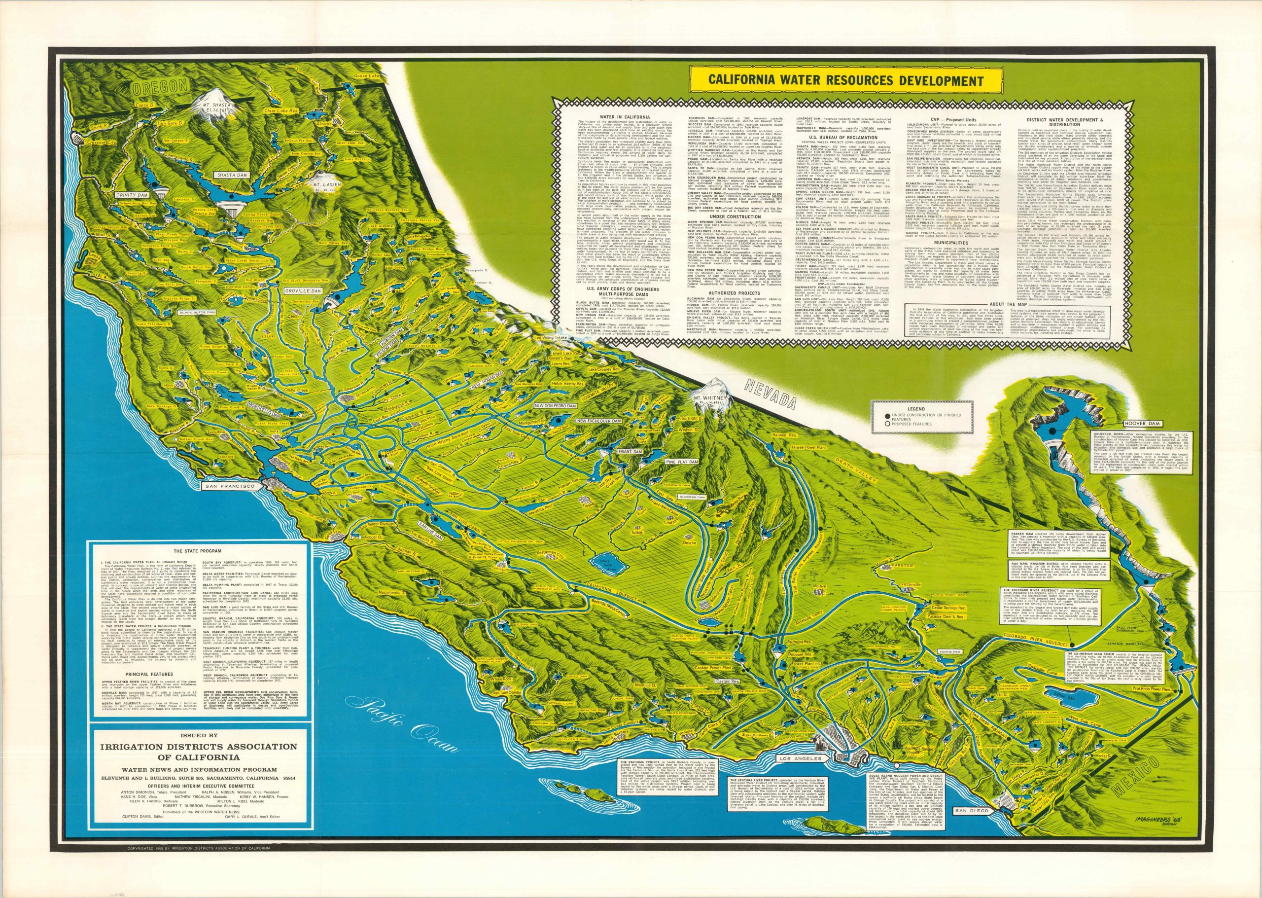
This carefully illustrated relief map of California was published in the late 1960s to present the major features of the statewide water plan. Dozens of elements, proposed, under construction, and completed, are labeled throughout the detailed image. Snow-capped mountain peaks, numerous dams, artificial waterways, and reservoirs all play an important role in the complex system of water capture, preservation, and delivery. Boxes of text provide further details about the various projects and the overall program. An extract from the upper center follows:
“Revised editions of this educational tool have been printed in a continuing effort to present a comprehensive picture of water resources development in California…The map is a topographical effort to show major water development systems and their general relationship to the geographic features of the State.”
The image is signed Imagineers ’68’ – Burton in the lower right – perhaps reflecting an illustrator associated with Disney? Copyrighted and published in 1968 by the Irrigation Districts Association of California Water News and Information Program.
Map Details
Publication Date: 1968
Author: Imagineers - Burton
Sheet Width (in): 40
Sheet Height (in): 28.25
Condition: A
Condition Description: Large color map printed on a folded sheet, single-sided. Wrinkling at fold joints, but overall in near fine condition.
$275.00
1 in stock