California State Park System
$95.00
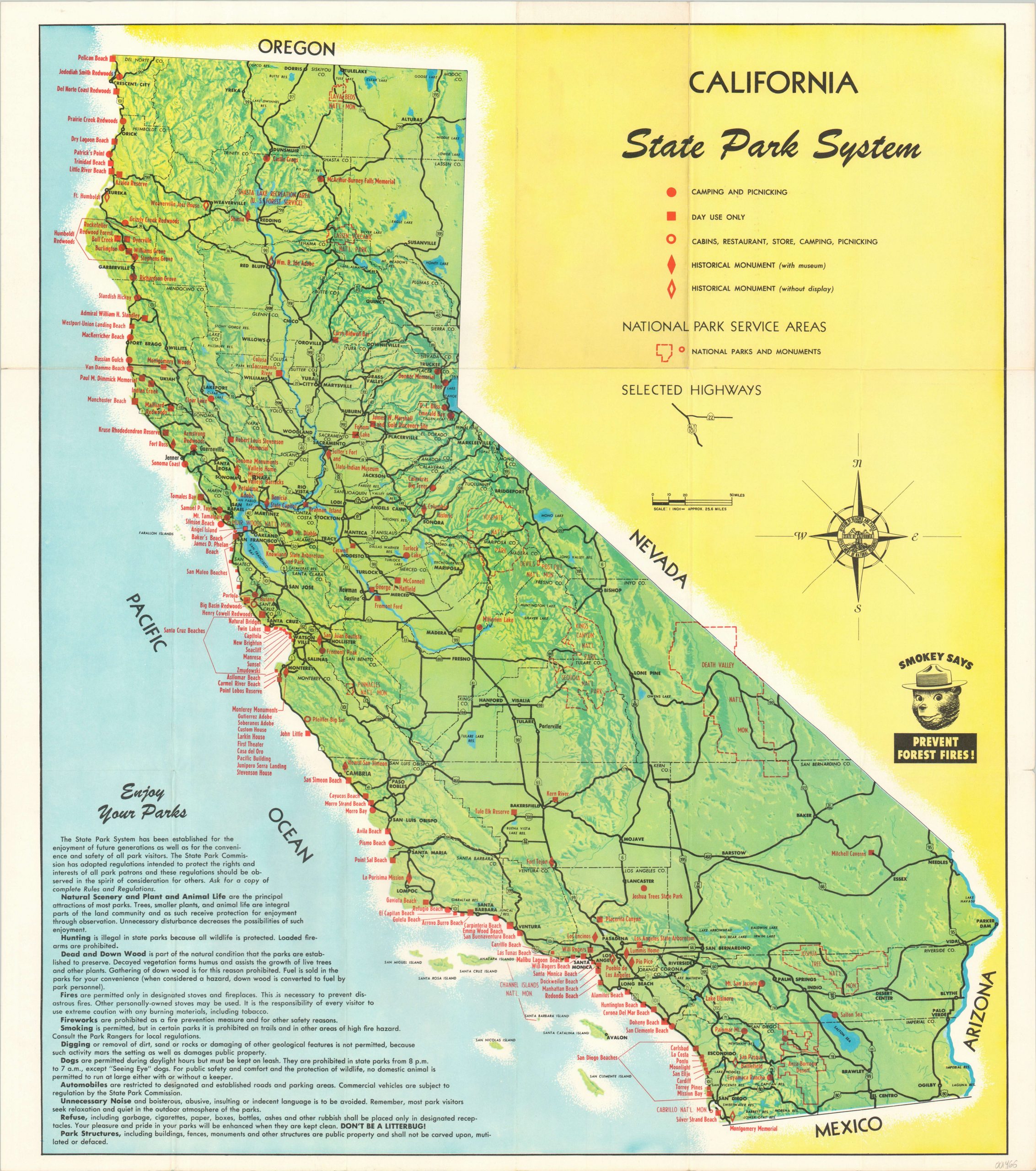
Vibrant map of California emphasizing the state’s robust park system.
1 in stock
Description
This brightly colored map of California was issued by the state’s Department of Natural Resources in 1956 and highlights the recent expansion resulting in the addition of more than 600,000 acres of parkland that same year. A green base map showing pictorial topography is overlaid with thick black lines representing the growing highway network throughout the state. Red symbols explained within the key identify the locations of campsites, picnic areas, historical monuments, National Parks, and more.
A charming illustration of Smokey the Bear, along with an annotated list of best practices in the lower left, encourages safe and responsible use of park facilities – “Don’t be a litterbug!” The verso features a large chart outlining the various amenities available within each location. Services were apparently rudimentary, as only three parks offered both a camp store and cabin facilities.
Map Details
Publication Date: 1956
Author: California Department of Natural Resources
Sheet Width (in): 24.50
Sheet Height (in): 27.40
Condition: A
Condition Description: Originally issued folded into 18 panels. Faint wear along fold lines and a few small tears along the outer edges. Not quite fine condition, but close.
$95.00
1 in stock

