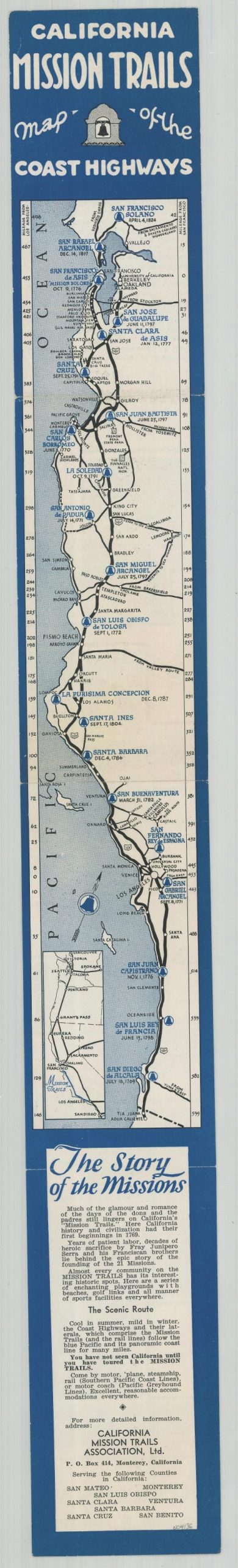
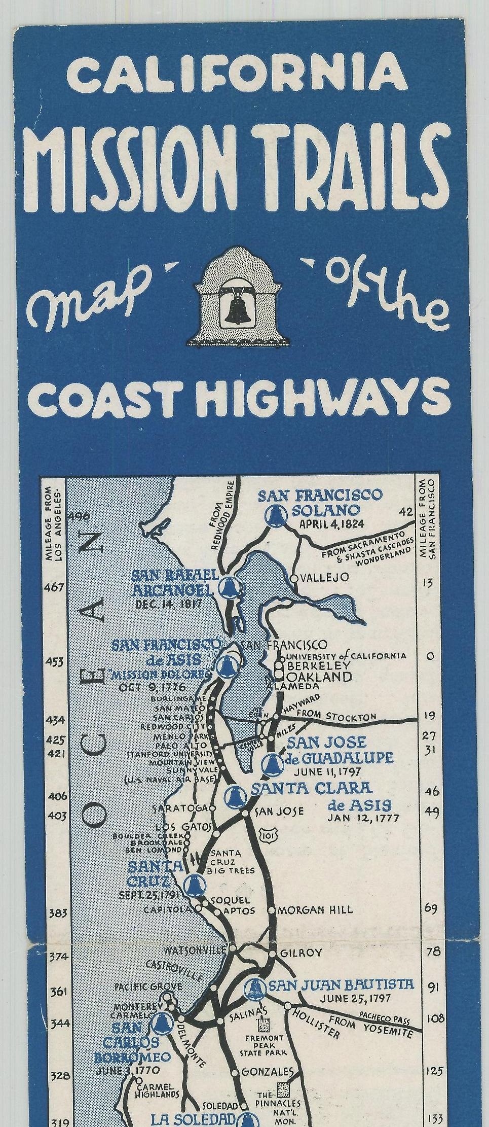
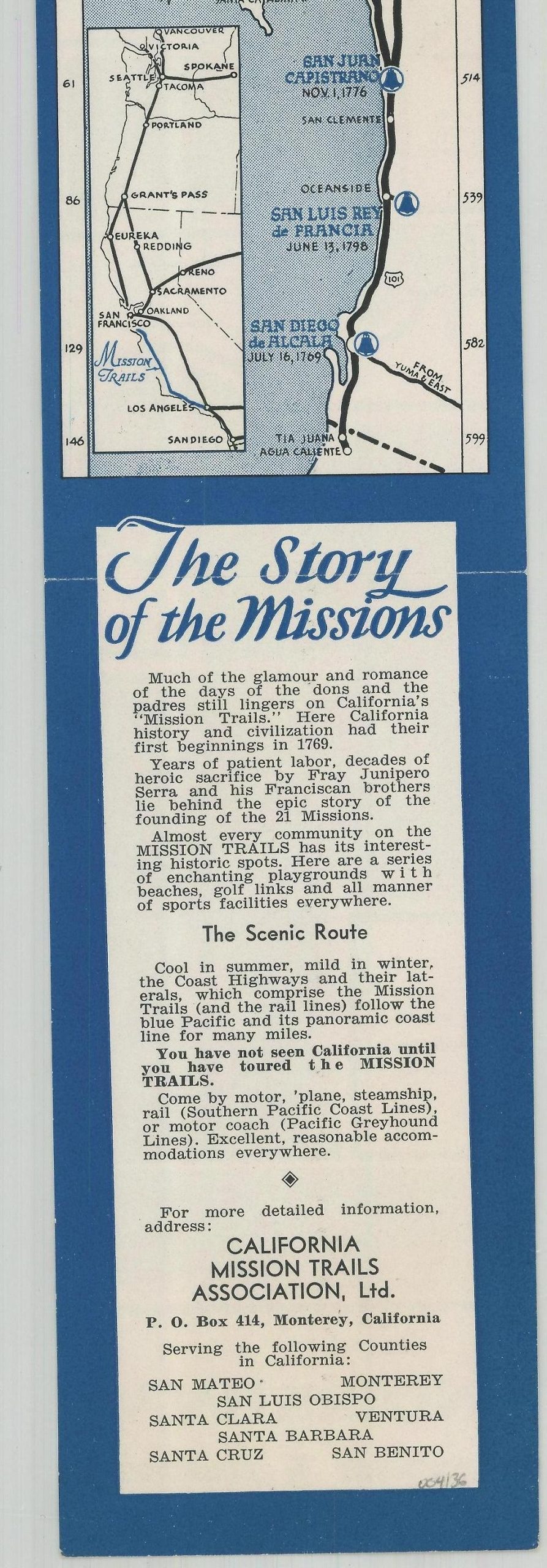
California Mission Trails Map of the Coast Highways
$55.00
Visit the historic missions along California’s Pacific Coast!
1 in stock
Description
This fun little strip map shows the most prominent highways along California’s west coast between San Francisco and San Diego. The numerous Spanish missions established during the 18th and 19th centuries are noted throughout, with photographs of thirteen examples presented on the verso.
Text at the bottom encourages tourism along the route – a difficult prospect for many in the midst of the Great Depression:
“Almost every community on the MISSION TRAILS has its interesting historic spots. Here are a series of enchanting playgrounds with beaches, golf links, and all manner of sports facilities everywhere.”
Created and distributed by the California Mission Trail Association, Ltd. of Monterrey around 1932, based on the date of the California Rodeo on the verso. Printed in San Jose by Rosicrucian Press, Ltd.
Map Details
Publication Date: c. 1932
Author: California Mission Trails Association, Ltd.
Sheet Width (in): 3
Sheet Height (in): 23.75
Condition: A
Condition Description: Light creasing along former fold lines, but otherwise in near fine condition.
$55.00
1 in stock