
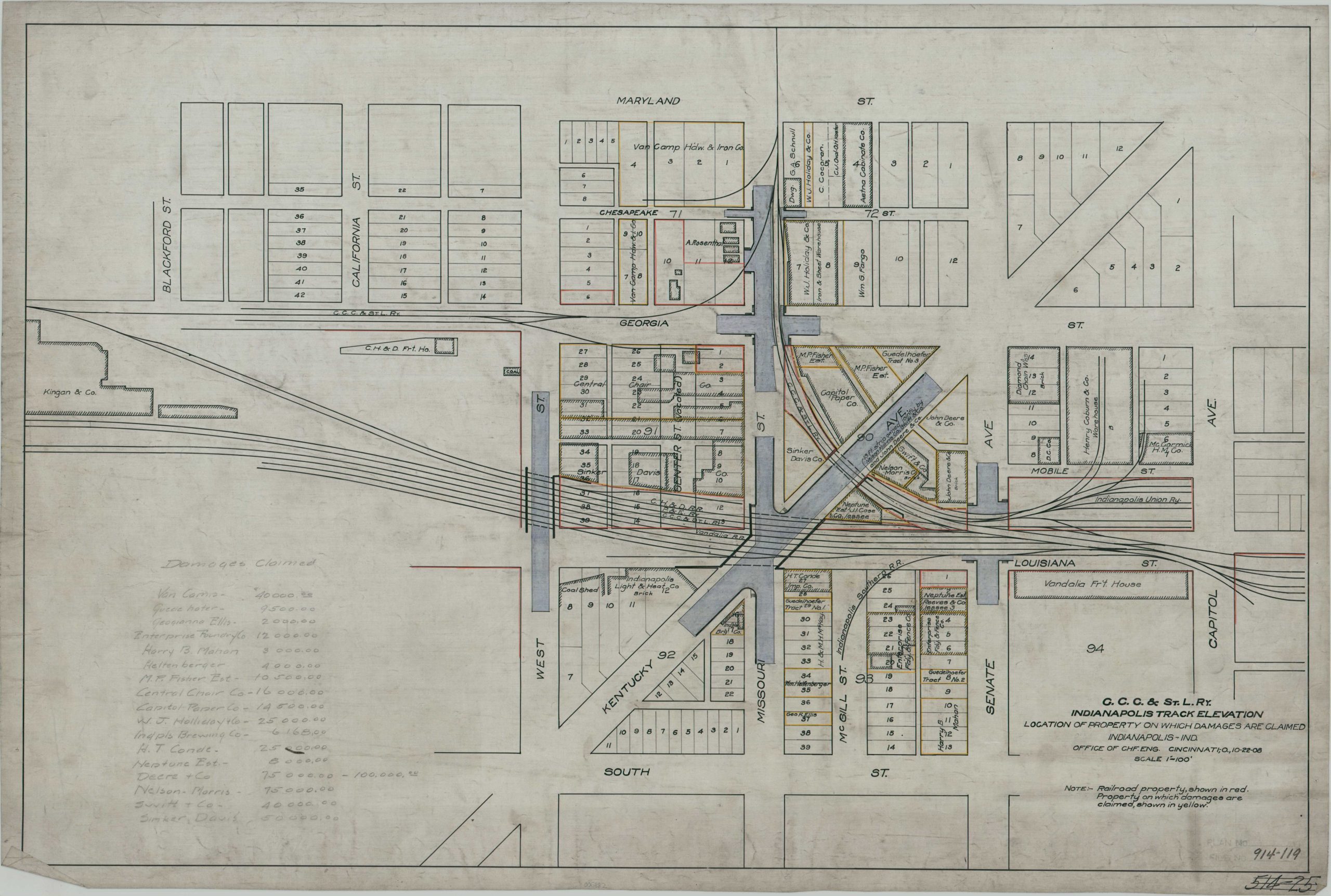
C.C.C. & St.L. Ry. Indianapolis Track Elevation Location of Property on Which Damages are Claimed Indianapolis – IND
Original price was: $450.00.$325.00Current price is: $325.00.
A detailed plan of the area that would ultimately become the Indiana Convention Center.
1 in stock
Description
This incredibly detailed blueprint plan covers a large area in downtown Indianapolis, bordered by Maryland St., Capitol Ave., South St., and West St. It was created by the Cleveland, Cincinnati, Chicago, and St. Louis Railway (‘Big Four’) Office of Chief Engineer in 1921 to highlight (in yellow) damages claimed from extensive local excavation and construction needed for the railroad to elevate its tracks. The concentration of surface lines was previously prohibitive to local traffic and the rails were raised from the ground to facilitate better accessibility. The work was costly and disruptive, and the manuscript annotations indicate damages claimed in excess of $415,000!
Issued at a scale of 1″ = 100′, the image presents a wealth of information about the area in question. Numerous local businesses are outlined and named, including the Capital Paper Company, John Deere & Co., Enterprise Foundry & Fence Company, and Swift & Co. Almost the entire space shown on the map is now occupied by the massive Indiana Convention Center and adjacent parking lots.
Map Details
Publication Date: 1908
Author: Cleveland, Cincinnati, Chicago and St. Louis Railway Office of Chief Engineer
Sheet Width (in): 30
Sheet Height (in): 20.1
Condition: A-
Condition Description: Blueprint map written in black, red, and blue ink, with penciled annotations in several areas. Moderate surface soiling visible throughout, concentrated most heavily along the outer edges of the sheet. Soft creasing from where previously rolled and some wear along the outer edges, including creased corners and small tears. Good to very good condition overall, for a well-used document over a century old.
Original price was: $450.00.$325.00Current price is: $325.00.
1 in stock