
Bushnell’s Map of Fairmount Park Philadelphia
Pocket map of the (then) largest urban park in the United States.
Out of stock
Description
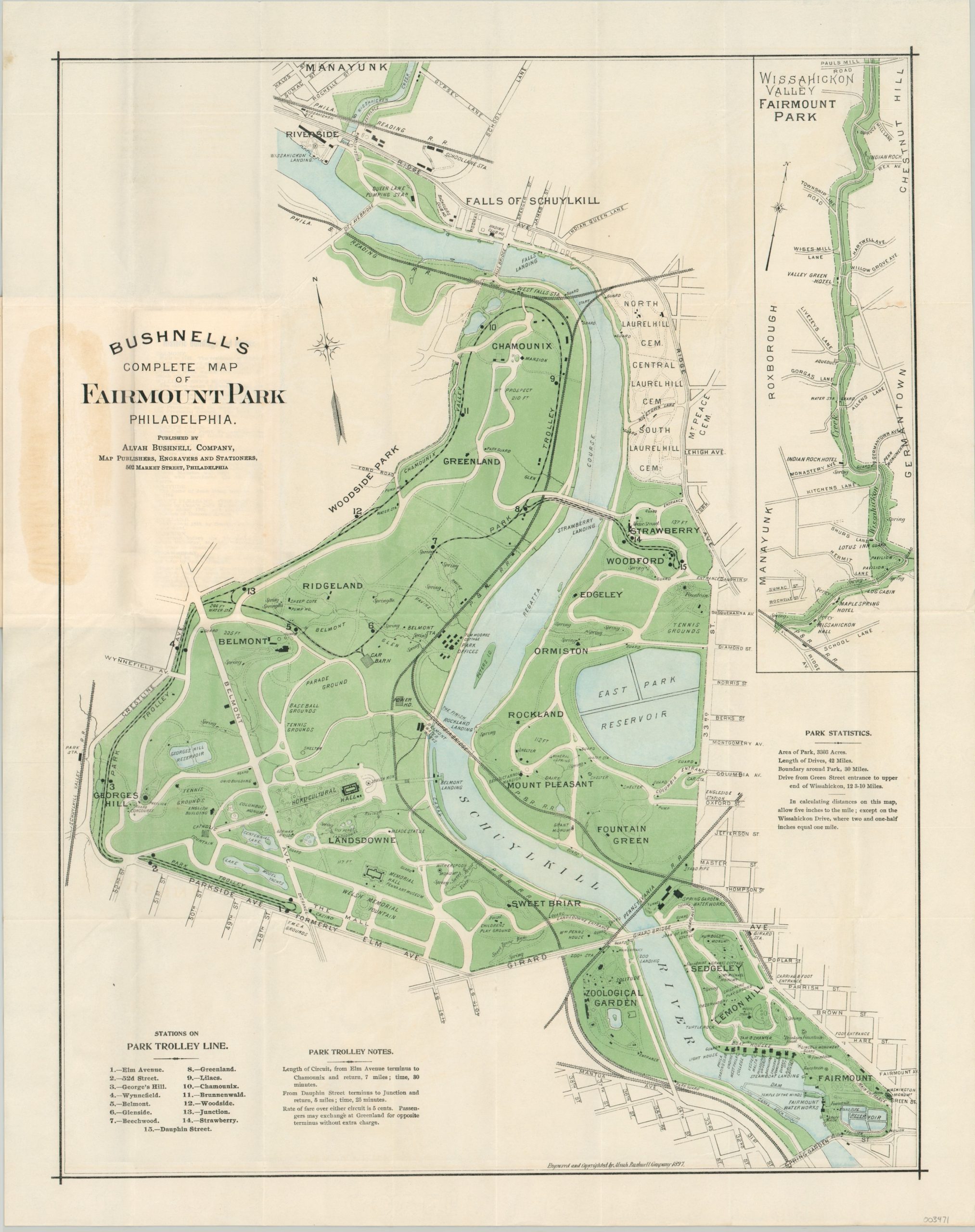
This detailed map of Philadelphia’s Fairmount Park was published locally in 1897 by the Alvah Bushnell Company. At the time of production, the park encompassed over 3,300 acres and was the largest urban greenspace of its era in the United States.
Attractions like the Zoological Garden, Horticultural Hall, and Pennsylvania Art Museum are individually outlined and labeled within the image, in addition to monuments, fountains, sports fields, and other locations of interest. The route of the trolley line is shown, with a list of stations and notes provided in the lower-left corner.
The upper right shows an inset map of Wissahickon Drive – today part of Wissahickon Valley Park. In 1920, the use of automobiles was prohibited and the route became known as Forbidden Drive.
Map Details
Publication Date: 1897
Author: Alvah Bushnell Company
Sheet Width (in): 18.50
Sheet Height (in): 23.75
Condition: A
Condition Description: Pocket map folded into 32 segments and affixed to original green cloth wraps. Creasing along fold lines and a spot of discoloration where the map adheres to the covers, but otherwise in near fine condition overall.
Out of stock