Buolh’s Illustrated Map and Guide to Tour the Gettysburg Battlefield
$75.00
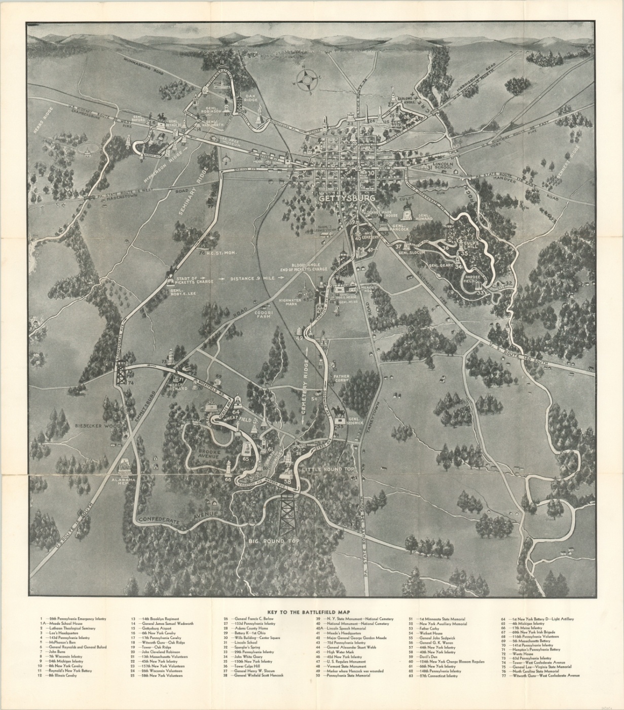
Illustrated overview of the battlefield at Gettysburg, issued shortly before the 75th anniversary.
1 in stock
Description
This map, devoid of color but not absent of charm, presents a bird’s eye view of the area immediately surrounding the small town of Gettysburg, Pennsylvania. On two sunny July days in 1863, the area was awash in smoke and the blood of thousands of Americans fighting one of the bloodiest battles of the Civil War.
Images of the battle are conspicuously absent – only small illustrations of prominent memorials, stylized natural features, and a simplified plan of the town are shown; connected by boldly drawn transportation routes. This information would have been critical to the swarms of battlefield tourists that descended to the site every year, especially in 1938, two years after the map’s dated publication.
That year saw the battle’s 75th anniversary, and 25 veterans of the fight were on hand to witness the celebration. Nearly 2,000 former Confederate and Union troops attended in all, with an average age of 94.
The verso includes photographs and text outlining the history of the battle, Lincoln’s Gettysburg Address, and facts about the most famous engagement of the American Civil War.
Map Details
Publication Date: 1936
Author: George Buohl
Sheet Width (in): 23.75
Sheet Height (in): 27.00
Condition: B
Condition Description: Moderate wear and creasing along originally issued fold lines. About 7" of separation in the lower right has been repaired on the verso with archival tape, but a bit of curling along the seam remains.
$75.00
1 in stock