Buckeye Region Detour Chart
$500.00
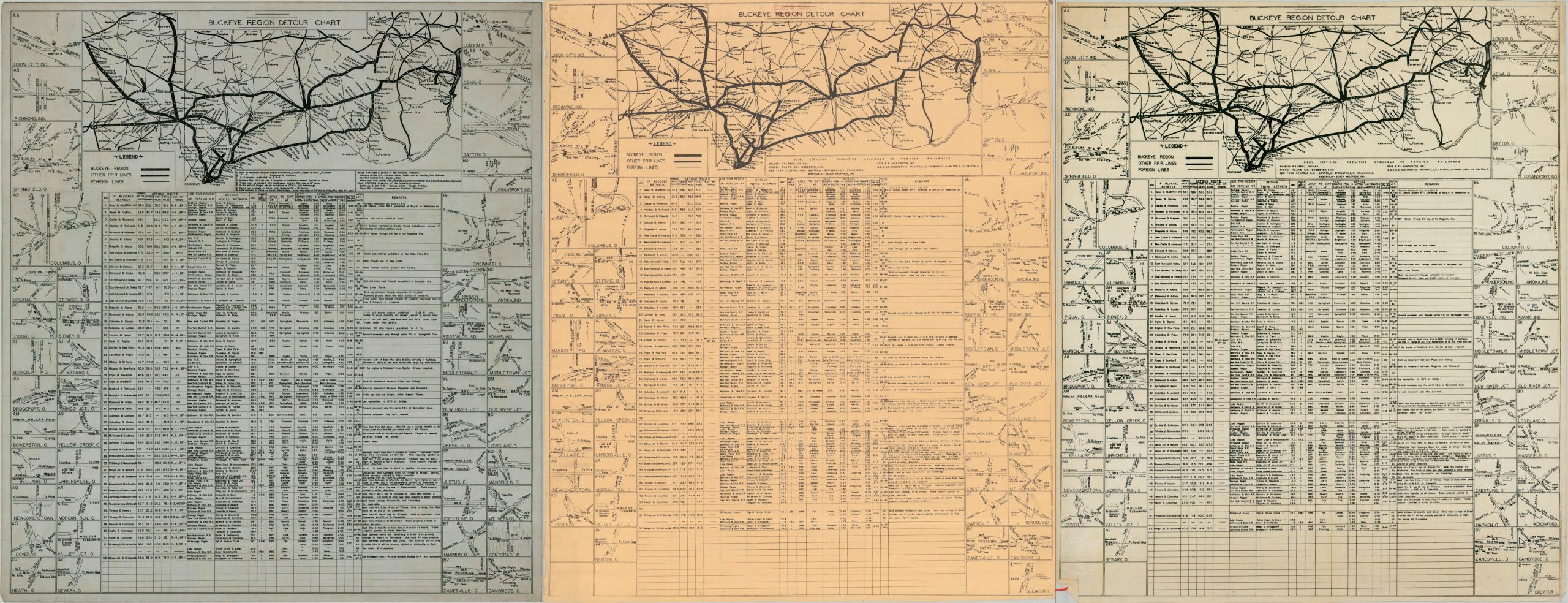
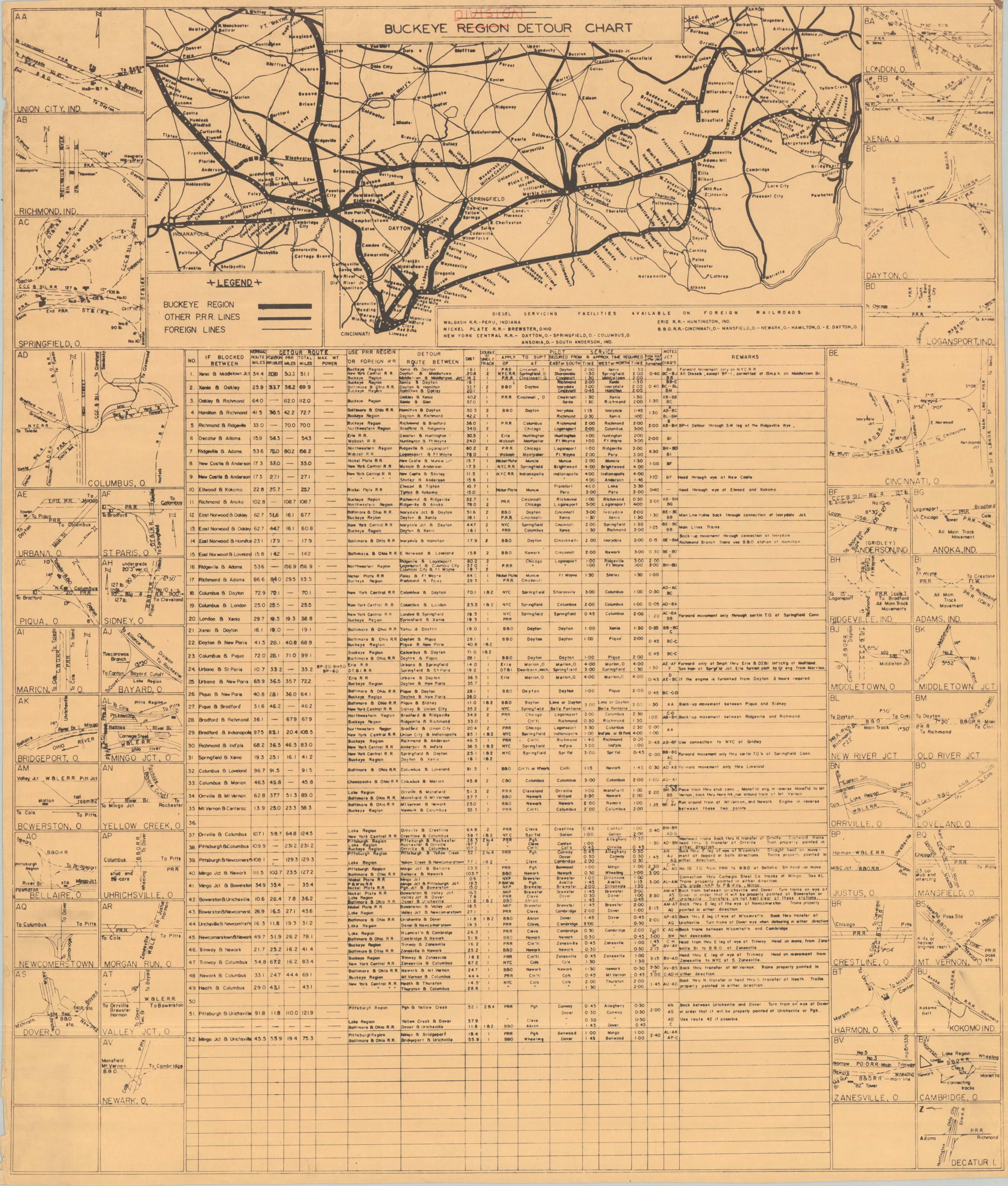
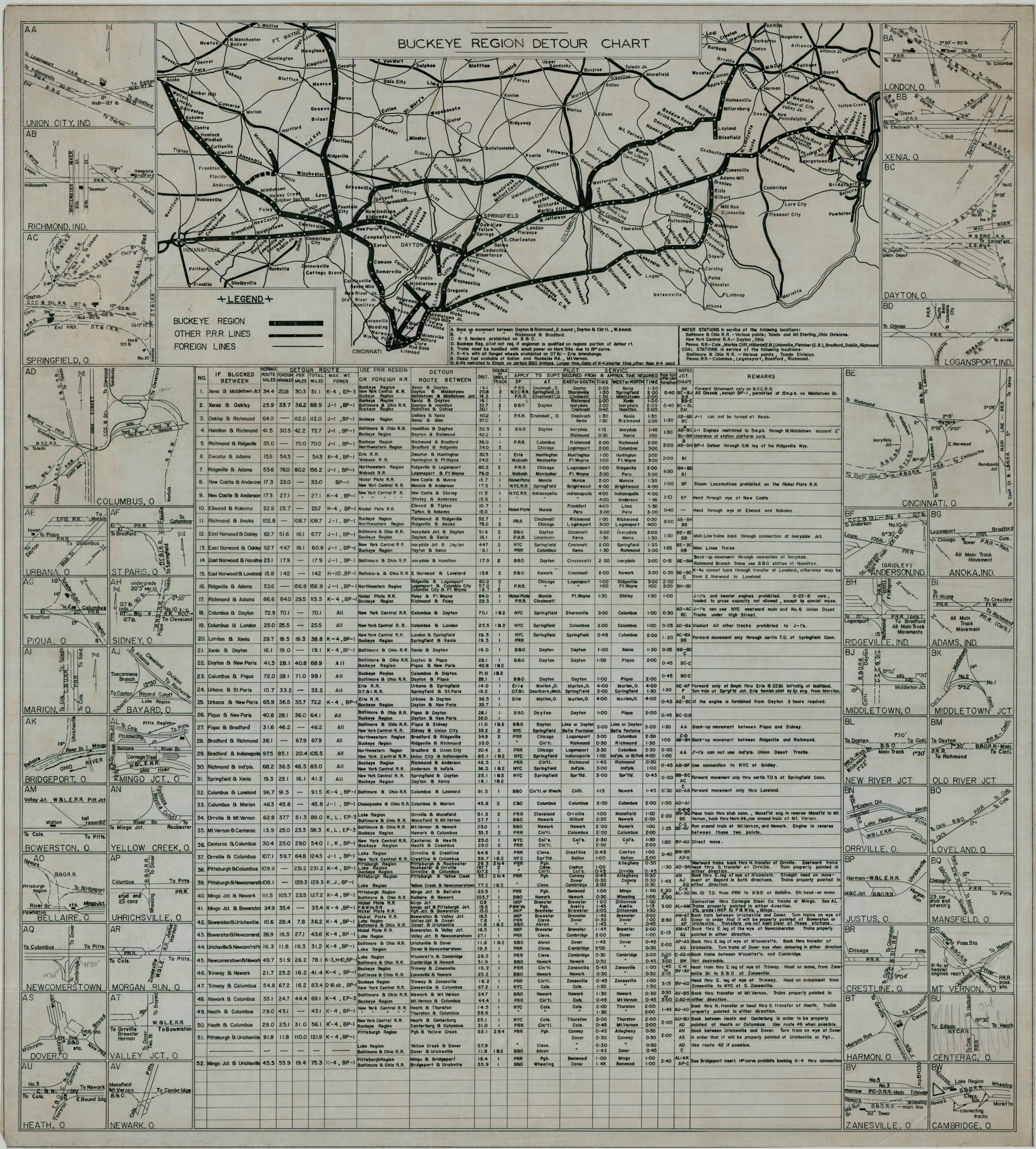
Three versions of a Pennsylvania Railroad detour chart, covering the Buckeye Region.
1 in stock

Description
This interesting trio of operational diagrams was prepared by the Pennsylvania Railroad to help the company chart detours in the event of a specific track blockage. A simple route map along the top of the sheet shows the entire scope of the Buckeye Region, stretching from Indianapolis across southern Ohio. A table below outlines over fifty separate sections of tracks; listing their mileage, respective alternatives, timetables, and more. Over two dozen insets in the borders provide straightforward track plans of the primary towns and junctions served in the Buckeye Region, including Cincinnati, Columbus, and Dayton.
The three sheets each reflect an important revision in the reproduction process. The linen blueprint, likely drawn by hand (with mechanical assistance) shows a ‘complete’ border of track plans. The printed versions, issued on a plastic treated and paper sheet, respectively, show fewer insets as the Pennsylvania Railroad abandoned various lines. A tag notes the group was stored for Misc. Valuation purposes – likely issued in the late 1960s, prior to the 1968 landmark merger with the New York Central.
Map Details
Publication Date: c. 1967
Author: Pennsylvania Railroad
Sheet Width (in): 31.50
Sheet Height (in): 37.25
Condition: A
Condition Description: Three sheets on paper, linen, and plastic - each showing the same overall image. Light marginal wear and faint wrinkling, where previously rolled. Very good condition overall.
$500.00
1 in stock