
[Japanese Map of Brown Island/Eniwetok Atoll]
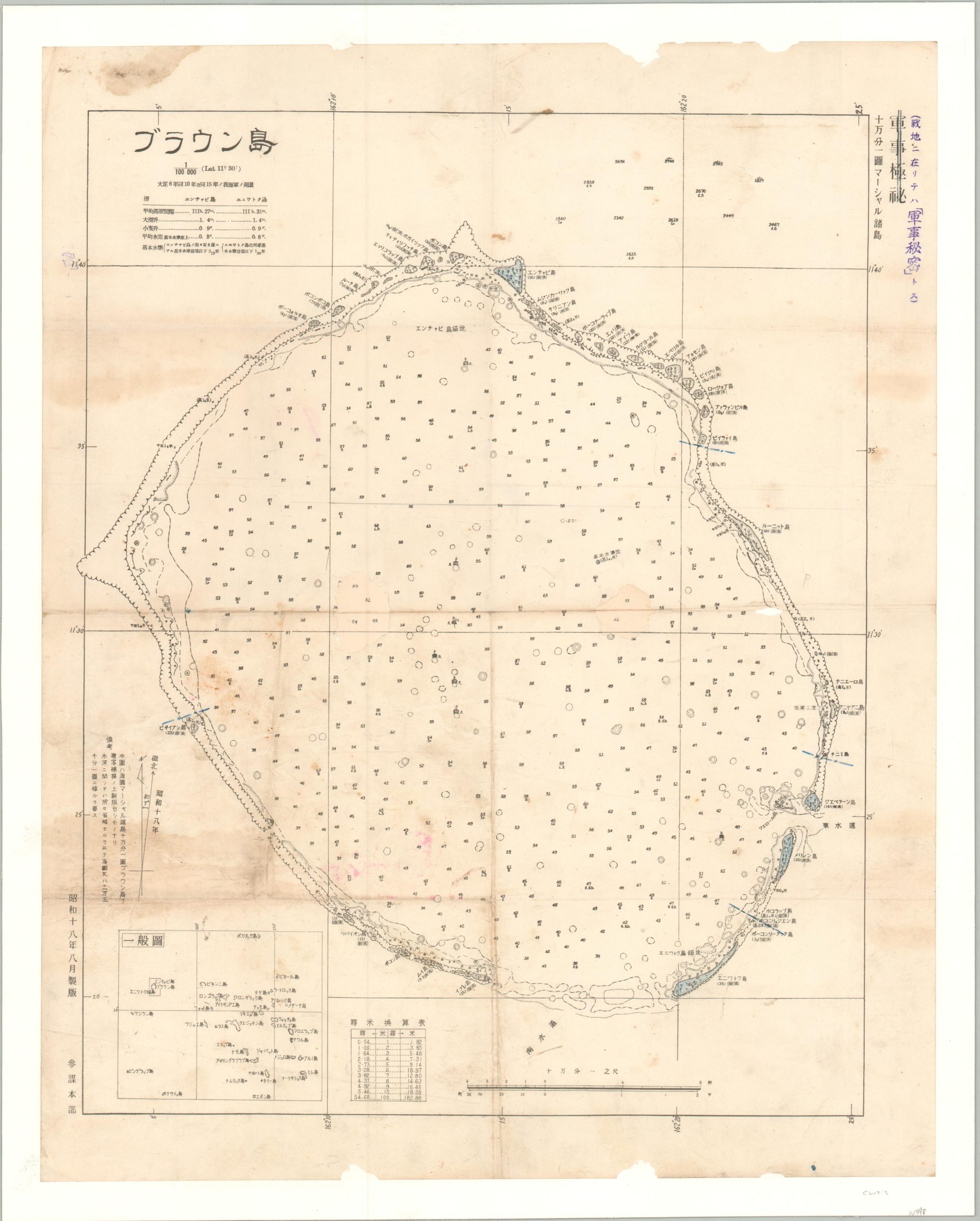
Japanese naval map of the Eniwetok Atoll.
Out of stock
Description
This scarce Japanese nautical chart provides a detailed overview of the Eniwetok Atoll, part of the Marshall Islands in Micronesia. First colonized by Germany in 1885, the remote atoll was awarded as a Japanese mandate by the United Nations following World War I. Its strategic importance increased during World War II with the construction of several air bases and naval facilities.
The map was published in August 1943 by the Japanese Navy General Staff, about six months before Eniwetok (also known as Brown Island in Japan) was captured by Allied forces on their advance across the Pacific. The image, marked TOP MILITARY SECRET, offers numerous depth soundings for the central lagoon. Information on elevation, the physical landscape, and important features is noted throughout. An inset in the lower left shows the relation of Eniwetok Atoll (outlined) to the rest of the Marshall Island group.
Map Details
Publication Date: 1943
Author: Japanese Navy General Staff
Sheet Width (in): 19.5
Sheet Height (in): 24.5
Condition: B
Condition Description: Professionally cleaned and mounted onto linen for preservation and stability. Minor image loss visible in 2 holes, each about quarter sized, in the center of the sheet (filled in). Scattered soiling, minor marginal loss, and soft creasing along old folds all present. About good condition overall.
Out of stock