Brooklyn and Vicinity
$100.00
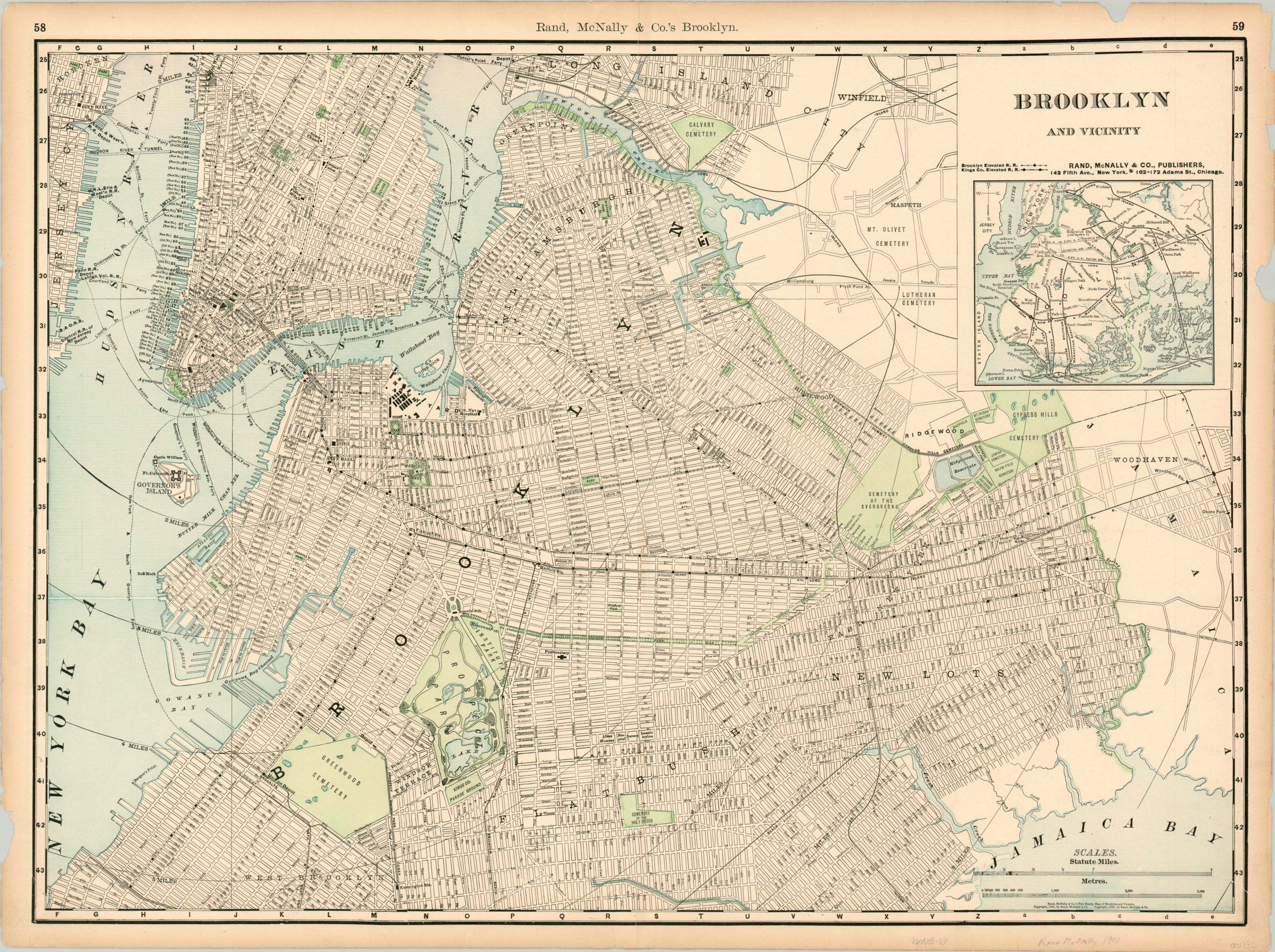
Brooklyn at the turn of the century.
1 in stock
Description
This detailed city plan of Brooklyn, Long Island City, southern Manhattan and east Jersey City was published in 1901 by Rand McNally. In addition to the expected street grid, the map identifies railroads, transit lines (notably the Brooklyn Elevated and Kings Co. Elevated), and ferries as additional transportation options. An inset map in the upper right provides further information on the local lines in operation.
Parks and cemeteries, both popular destinations for outdoor retreats in the early 20th century, are highlighted with green. Major public buildings and notable landmarks are also outlined and labeled. An interesting turn of the century snapshot of New York from one of America’s foremost cartographic firms.
Map Details
Publication Date: 1901
Author: Rand McNally
Sheet Width (in): 27.50
Sheet Height (in): 20.40
Condition: B+
Condition Description: The outer margins are toned and worn, with several chips and missing pieces. One small tear in the lower right corner enters the image, otherwise it's in very good condition.
$100.00
1 in stock