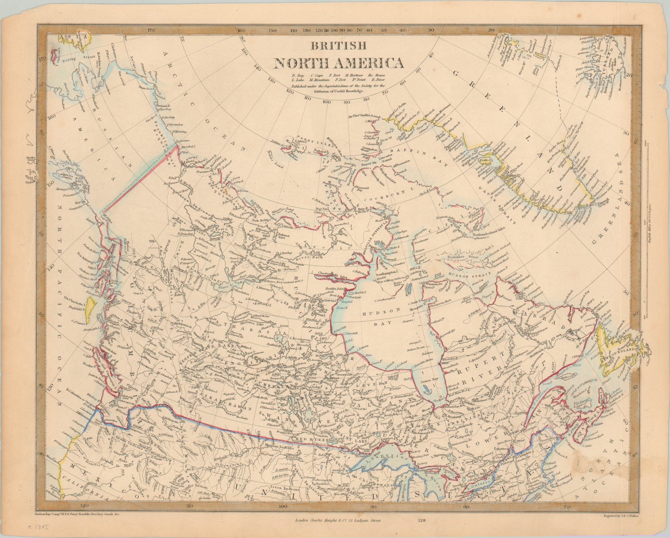
British North America
$75.00
Map of British Canada published shortly after the departure of Sir John Franklin’s ‘lost expedition.’
1 in stock
Description
In the second half of the 19th century, the polar regions represented one of the last great unexplored frontiers on the globe. There are many tales of heroism and heartbreak, but the lost expedition of Sir John Franklin is one of the most tragic stories in the history of Arctic exploration.
In 1845, Franklin departed England with two ships, the HMS Terror and the HMS Erebus, determined to be the first to successfully navigate the Northwest Passage through upper Canada. Both ships were caught in the ice for over a year, after which point the remaining survivors attempted to trek to the mainland. Ultimately, all hands on both ships were lost, but that didn’t prevent numerous rescue missions supported by Franklin’s wife and the British government.
This map, published either the same year or the year following Franklin’s departure, reflects the contemporary status of British geographic knowledge about the Arctic in the Western Hemisphere. Speculative coastlines are left blank or shown with dotted lines, and a handful of sources are listed in the lower left corner.
The map was engraved by J. & C. Walker and published in London by Charles Knight on behalf of the Society for the Diffusion of Useful Knowledge.
Map Details
Publication Date: c. 1845
Author: SDUK
Sheet Width (in): 16.75
Sheet Height (in):
Condition: B+
Condition Description: Light stain, about 2" across, in the lower right corner. A bit of toning visible in the margins, which are chipped in a few areas, but remains in good to very good condition overall.
$75.00
1 in stock

