
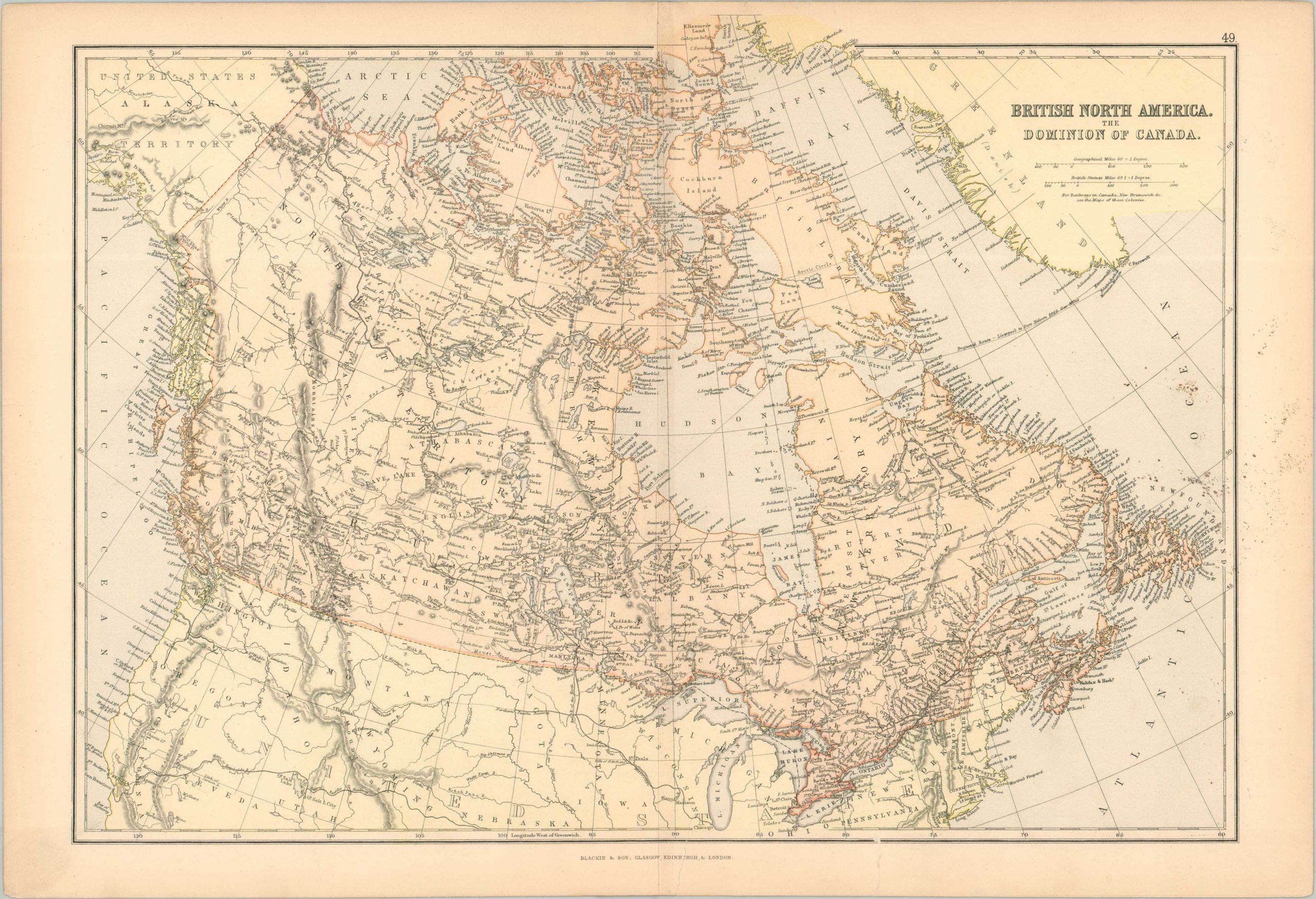
British North America. The Dominion of Canada.
$45.00
Map of Canada during a period of intense expansion in the 19th century.
1 in stock
Description
This finely detailed map of Canada was published around 1884 by the firm of Blackie & Son. It presents the British territorial possession of the Dominion of Canada, then undergoing a period of significant westward expansion made possible by the (ongoing) construction of the Canadian Pacific Railway.
Toponyms identify a fascinating variety of locations – landmarks, old fur trading posts, lumber towns, missions, and indigenous villages. Conflict with local tribes was a persistent theme of the period, erupting into the North-West Rebellion of 1885.
The amorphous boundary with Alaska is also notable, as the 1896 discovery of gold in the Yukon region would prompt the Klondike Gold Rush and encourage both British and American governments to conclusively define the border.
Map Details
Publication Date: c. 1884
Author: Blackie & Son
Sheet Width (in): 22.1
Sheet Height (in): 15.2
Condition: B
Condition Description: Color lithographed map on somewhat brittle and lightly toned paper. Two irregular closed tears, about 2" each, repaired on the verso with archival tape. Scattered black spotting visible within the image on the center right. About good condition overall.
$45.00
1 in stock