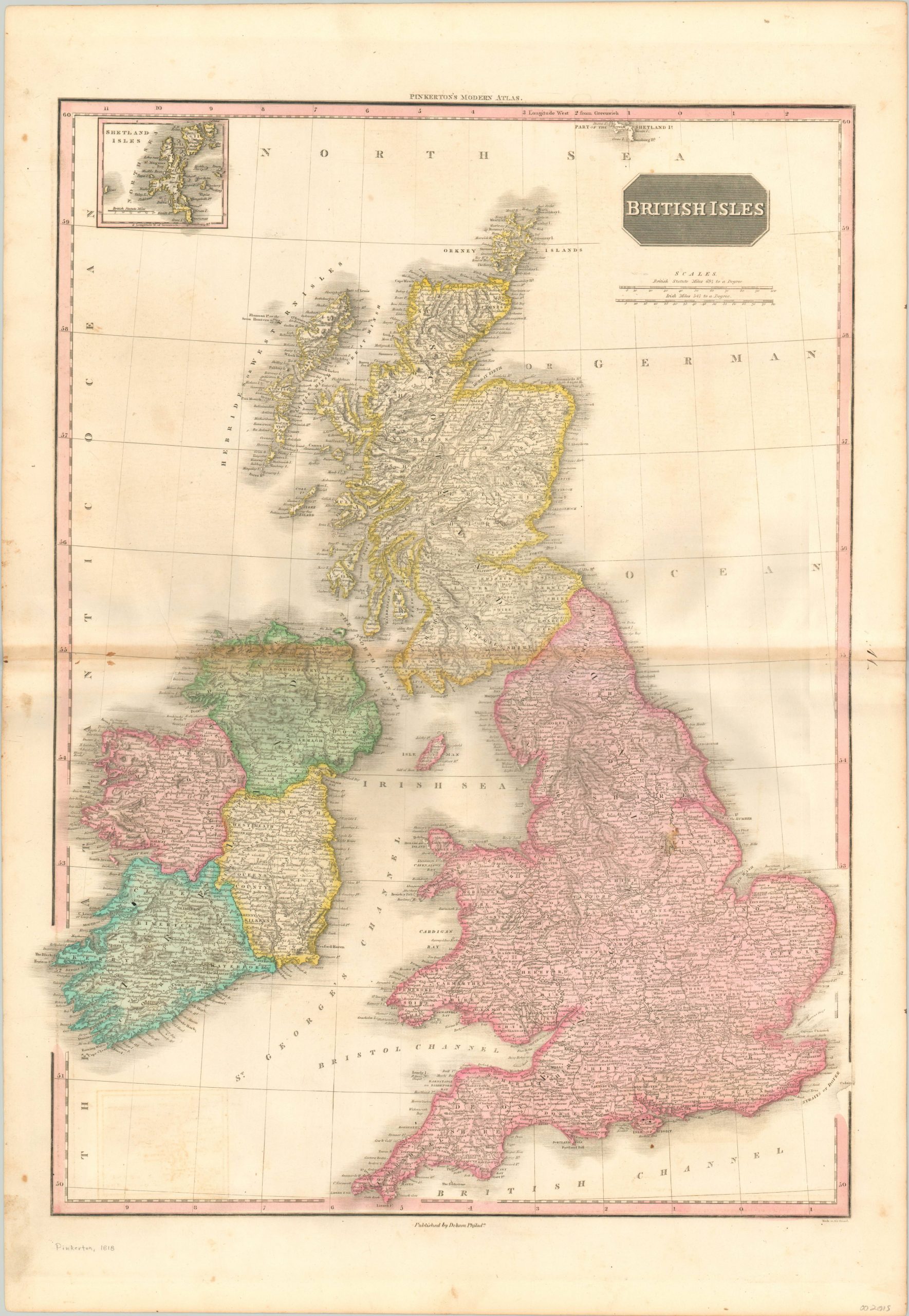
British Isles
$250.00
The United Kingdom before the establishment of an independent Ireland.
1 in stock
Description
To outsiders, the concept of the United Kingdom can often be nebulous and confusing with regards to the political status of the various participants. The state presented here was officially in existence between 1801 and 1922, and was known as United Kingdom of Great Britain and Ireland. The countries of Britain, Scotland, and Ireland are identified with color (applied by hand), and the latter is further sub-divided into its four historic provinces.
A myriad of place names can be found within the image, which also notes the UK’s relatively robust transportation network of roads and canals at the forefront of the Industrial Revolution. An inset map of the Shetland Islands can be seen in the upper left.
The map was originally designed by Scottish cartographer John Pinkerton. As part of the Edinburgh School of Cartography (which included the likes of John Cary and John Thomson), Pinkerton was responsible for creating some of the most highly detailed and precise atlas maps of the early 19th century. Today, his maps are prized for their size, color, and wealth of information. This particular example was included in the American edition of Pinkerton’s Modern Atlas, published in Philadelphia by Thomas Dobson in 1818.
Map Details
Publication Date: 1818
Author: John Pinkerton
Sheet Width (in): 22.30
Sheet Height (in): 32.50
Condition: B+
Condition Description: Moderate discoloration along the horizontal centerfold (including two spots near the left side), and moderate offsetting visible from the inset map in the lower left. One large stain near Lincoln. A few other scattered spots of faint soiling within the image and around the borders, but overall the map remains in good to very good condition. Original hand color.
$250.00
1 in stock

