British Empire Exhibition May-October 1925
$195.00
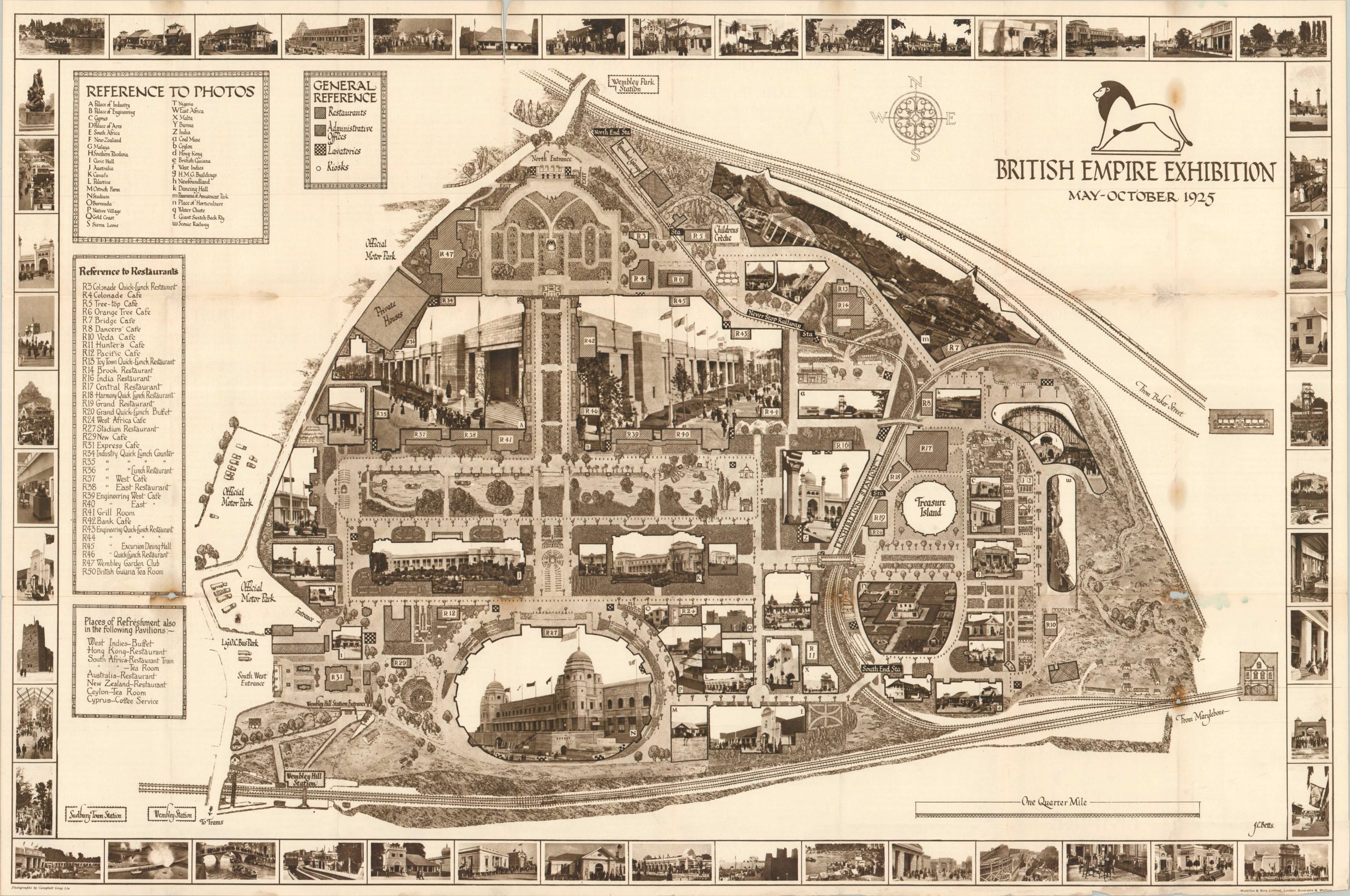
An unusual, and quite literal, picture map of the grounds of the 1925 British Empire Exhibition.
1 in stock
Description
This fascinating monotone plan shows the grounds of the second year of Britain’s Empire Exhibition, held in London’s Wembley Park from May to October, 1925. Representative photographs of major buildings and attractions occupy their respective footprints across the guide map, including the Empire (Wembley) Stadium in the lower center and the Amusement Park in the upper right. Dozens more images of what to see and do are shown in the border.
In addition to the primary exhibits, numerous restaurants and places of refreshment reflecting Britain’s expansive global empire are listed in the adjacent indices. There were a few places in the world during the mid-1920s where one could choose to dine at a tree-top cafe, the British Guinea Tea Room, the Wembley Club, the West Indies-Buffet, or the South Africa Restaurant Train!
The verso of the sheet is comprised of numerous panels of text that describe the major attractions, recommended transportation options, and all the new features available for the 1925 season, including Peter Pan on Treasure Island (one of the few features not pictured). The map was illustrated by J.C. Betts and published in London by Waterlow & Sons, Limited, in 1925. Photography credit given to Campbell Gray.
Map Details
Publication Date: 1925
Author: J.C. Betts
Sheet Width (in): 29.5
Sheet Height (in): 19.6
Condition: B
Condition Description: Double-sided brochure with a large centerfold map. Heavy wear along folds, with severe toning at certain joins on the right side that has resulted in minor image loss (see scan in lower right). Most splits repaired on verso. About good condition overall.
$195.00
1 in stock