
British Battles During 1918 (8th Aug. to 11th Nov. 1918)
$600.00
Postwar justification for the tremendous Allied losses during World War I.
1 in stock
Description
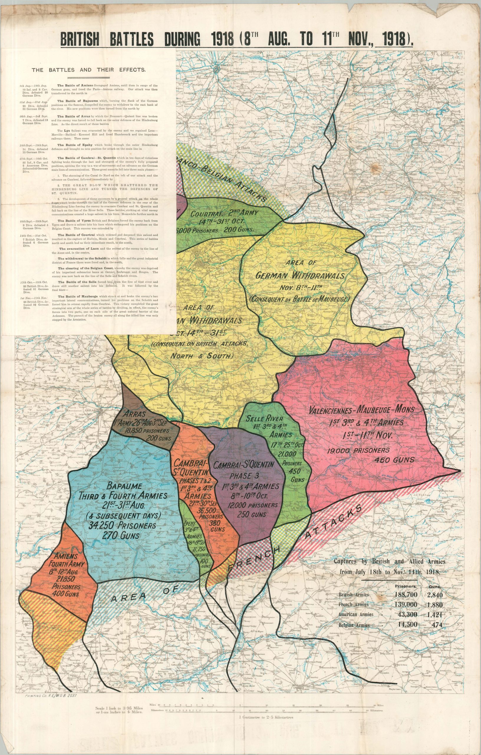
This vibrant poster map of the Western Front in WWI was published near the end of 1918 to commemorate the Allied advances during the Hundred Days Offensive, the massive series of coordinated attacks that ultimately forced Germany to retreat. Segments of different colors show the chronological advance across France, along with the progress of German withdrawals. Tallies of captured guns and prisoners are carefully recorded as the spoils of war and payback for losses earlier in the war. An attached sheet, titled The Battles and Their Effects, offers a highly sanitized account of the major engagements during the offensive. According to a description from the collections of the British Library, referring to a slight variant,
“This colourful map was produced by the War Office, printed by Waterlow & Son and available for public sale. It provides a summary of the British, American and Empire troops’ Hundred Days offensive leading to German surrender on 11 November 1918.
It shows the advance as distinctly ordered phases, coloured first yellow, then green, red and blue. Diagonal stripes in these same colours distinguish German withdrawals from retreats. Text descriptions and figures of prisoners captured by Allied forces are also supplied.
The language of the map suggests an inevitability to German defeat in which even withdrawals (such as to the Hindenburg line in February 1917) were part of the Allied plan. The map contributed to the public’s evaluation and official justification of the cost of four years of war.”
This example was not produced by Waterlow & Son, but is rather attributed to the British War Office and the Royal Engineers, according to the printer’s code in the lower left. Both variants appear to be uncommon on the market and in institutional collections. About half a dozen copies were located in WorldCat across three separate editions (the third, attributed to GSGS), with a handful of additional examples in the British Library and other digital databases.
Sources: University of Illinois; British Library;
Map Details
Publication Date: 1918
Author: British War Office
Sheet Width (in): 22.40
Sheet Height (in): 35.00
Condition: B
Condition Description: Color printed map on a large, single-sided sheet. Creasing and light wear along folds, including some wrinkling at intersections. Moderate marginal wear, including further wrinkling/creasing, toning (noticeably along the upper edge) and creased corners. A few small spot on the right side of the sheet. Includes separate sheet, affixed to upper left and also creased.
$600.00
1 in stock