Britannia
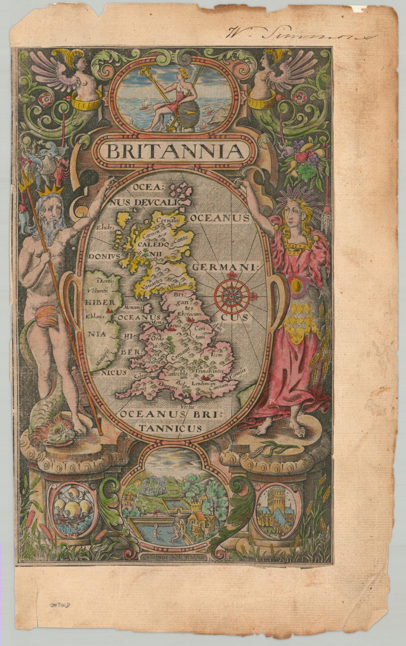
The title page to William Camden’s influential historical volume, Britannia.
Out of stock
Description
This elaborately engraved sheet served as the title page to Camden’s Britannia, likely the 1607 edition published in London. A central map of Great Britain, engraved by William Hale, features simple pictorial topography, a compass rose, and a handful of important toponyms. Figures of Neptune and Ceres stand on either side, with additional allegorical motifs in the negative space, including Britannia ruling the waves at the top. Vignettes at the bottom of the page include a cathedral, sailing ships, and Roman baths with Stonehenge in the background.
William Camden’s Britannia, first published in 1586, stands as a monumental work as the first comprehensive survey of Great Britain and Ireland. The volume offers a detailed account of the geography, Roman antiquities, and early history of the British Isles, organized by county. Rich with classical references, inscriptions, and early maps, Britannia aimed to trace the legacy of Roman and medieval Britain through a scholarly lens. This pioneering endeavor established a new standard for scholarly inquiry into national antiquities, blending classical sources with contemporary fieldwork.
Map Details
Publication Date: c. 1607
Author: William Camden
Sheet Width (in): 7.6
Sheet Height (in): 12.4
Condition: B-
Condition Description: A rough copy, trimmed close and slightly entering the neatline on the left side. Otherwise margins are soiled and worn, with an old owner's inscription in the upper right. The age-toned image features attractive, though modern, hand color.
Out of stock