
BOAC World Air Routes Western Hemisphere & Eastern Hemisphere
$500.00
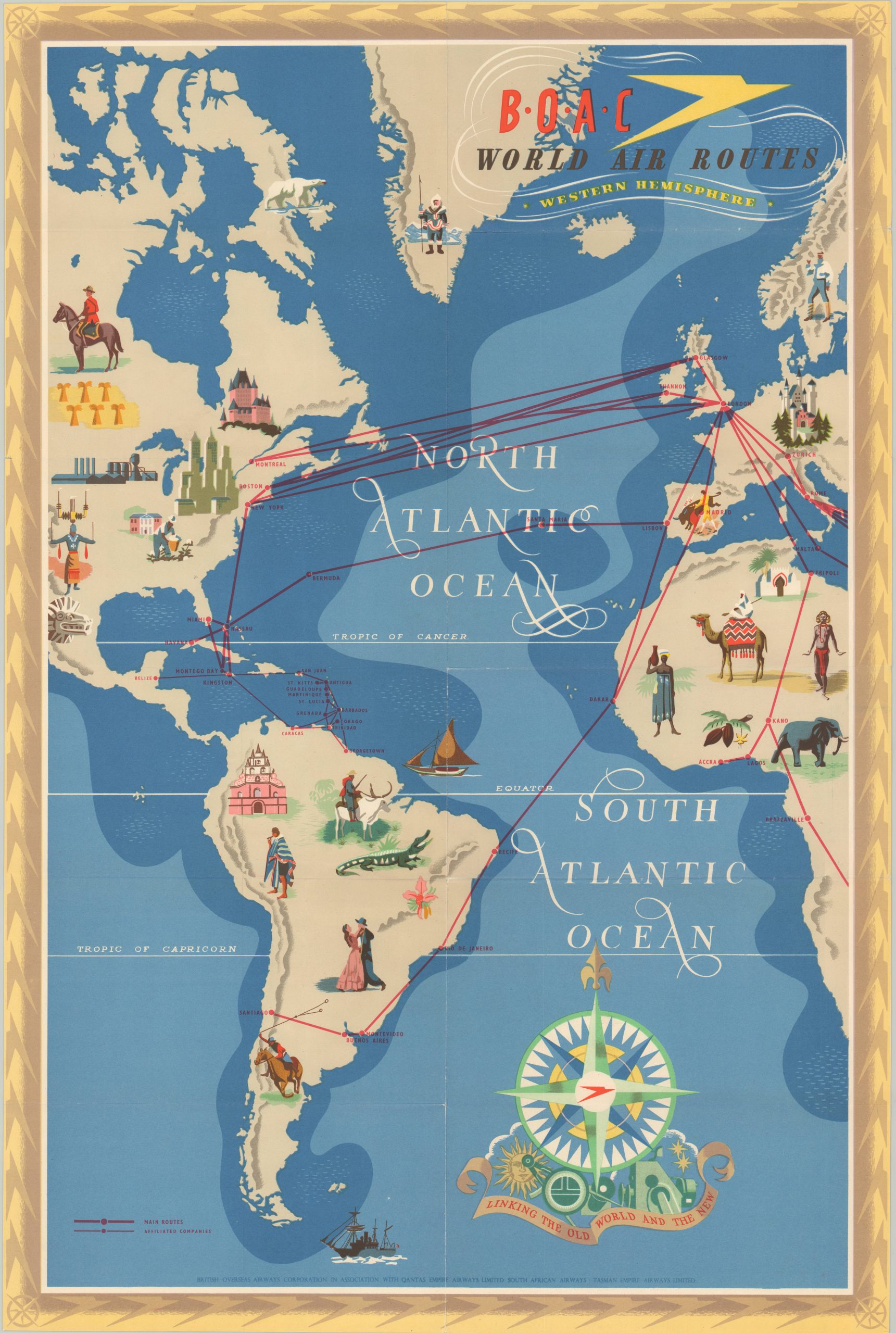
Beautiful double-sided pictorial highlighting the global reach of BOAC in the postwar world.
1 in stock

Description
This stunning pictorial map was illustrated by E.O. Seymour and printed in 1949 by McCorquodale & Co. on behalf of the British Overseas Airway Corporation, or BOAC. Two sides to the sheet show the routes in operation across the Eastern and Western Hemispheres, surrounded by a cleverly designed border incorporating the BOAC logo.
National borders are completely omitted as bright red lines traverse a world apparently unified by the ability to travel through the air. Far-flung destinations like Bangkok, Nairobi, Auckland, and Santiago are made accessible by a huge network of air routes that crosses vast oceans, mountain ranges, and deserts. Of note is the absence of any service to the U.S.S.R., conveniently occupied by the large title block. Illustrated vignettes represent the people, architecture, transportation methods, industries, and fauna of these various locales.
Interestingly, sailing ships make up the vast majority of vessels plying the waves. Certainly on par with the ‘foreign-ness’ of the theme, but also perhaps an effort to highlight air travel as the superior form of transportation. Taken as a whole, the image provides an interesting overview of contemporary Western perceptions of a world made much smaller by WWII.
Map Details
Publication Date: 1949
Author: E.O. Seymour
Sheet Width (in): 30
Sheet Height (in): 10
Condition: A
Condition Description: Light wear along originally issued fold lines and a few tiny tears around the outer edges of the sheet. Near fine overall.
$500.00
1 in stock