
Bible Lands of the Old Testament
The Middle East around 1,000 BC.
Out of stock
Description
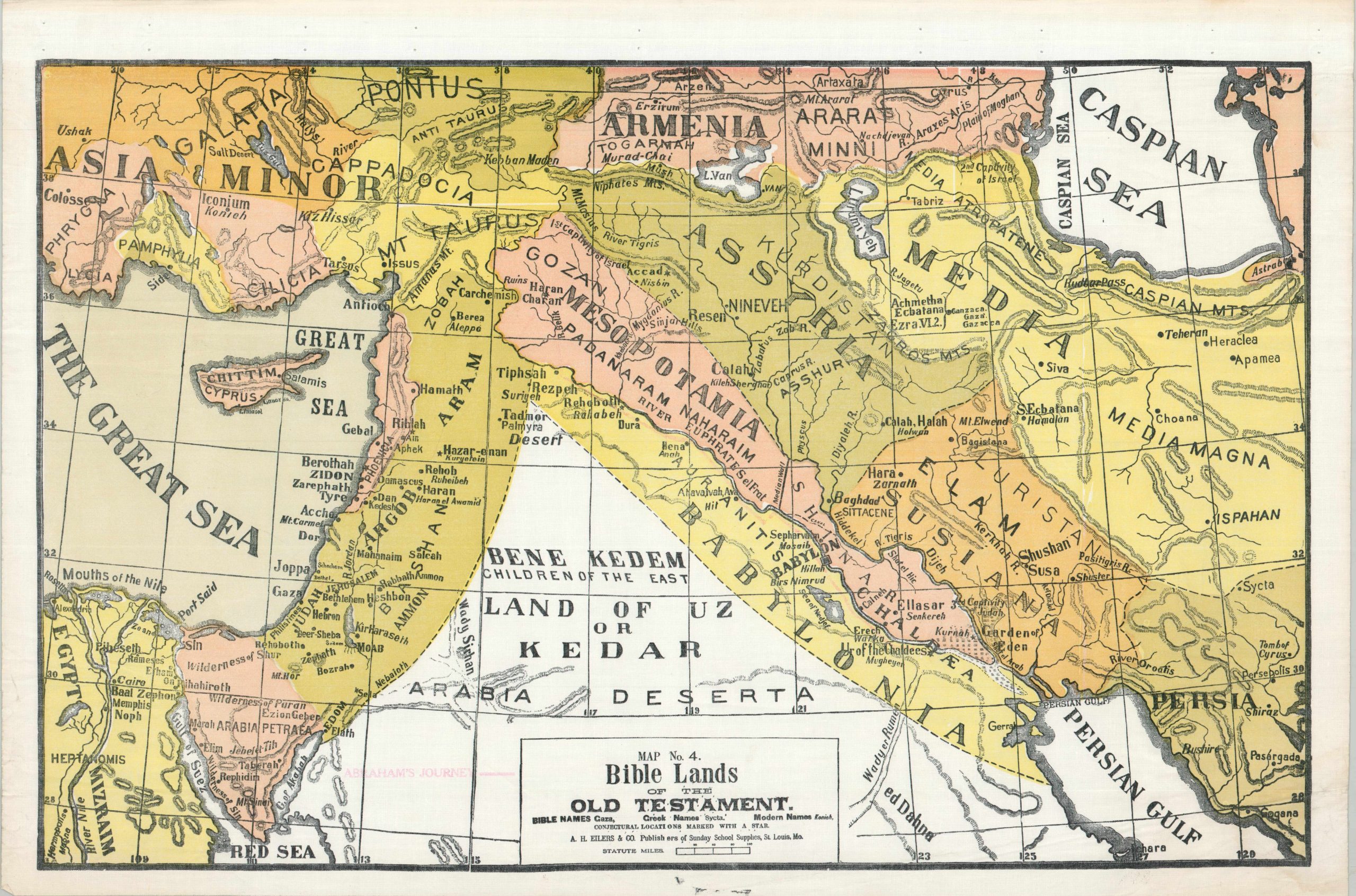
This colorful map of Western Asia provides a topographic overview of the historic region, according to the Old Testament of the Bible. Various important places are given their Biblical, Greek, and modern English names, where applicable. Conjectural locations, like the city of Accad, are marked with small stars. A handful of notable events are labeled, including the 1st Captivity of Israel and the 3rd Captivity of Judah. Also of interest is the Garden of Eden, situated adjacent to the Tigris River, and the route of Abraham’s journey, faintly overprinted with a red (now pinkish) line.
The sheet was published in the early 1900s by A.H. Eilers & Co. as Map No. 4 in the Peerless Series of Sunday School Maps. The company was originally established in St. Louis during the early 1870s as a bookseller and stationer, but soon transitioned to the production of material related to Sunday School education in the United States. Eilers produced a number of religiously themed materials, including collection envelopes, marriage certificates, ledgers, and wall maps in a variety of custom sizes and formats.
Map Details
Publication Date: c. 1910
Author: A.H. Eilers
Sheet Width (in): 28.25
Sheet Height (in): 18.75
Condition: B+
Condition Description: Color printed map (possibly silkscreen) on a sheet of waxed cloth. Formerly attached to a wooden roller, with creasing and holes along the upper margin as a result. Moderate wear elsewhere in the margins, including a sharp crease in the lower right corner, faint toning along the edges, and a small ink stain in the lower center. Good to very good overall. Blank on verso.
Out of stock