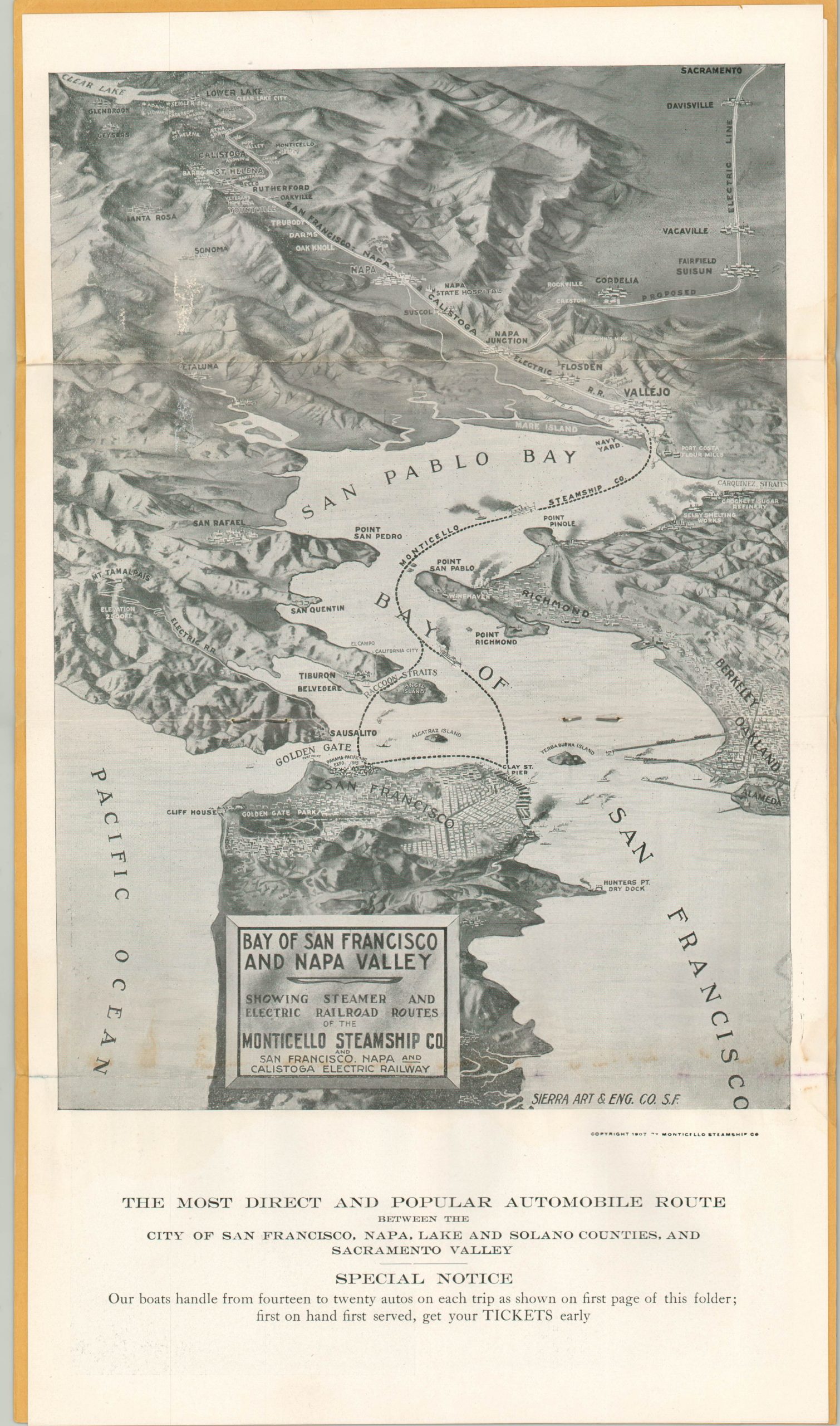
Bay of San Francisco and Napa Valley
Early transportation map of San Francisco Bay and the California wine country.
Out of stock
Description
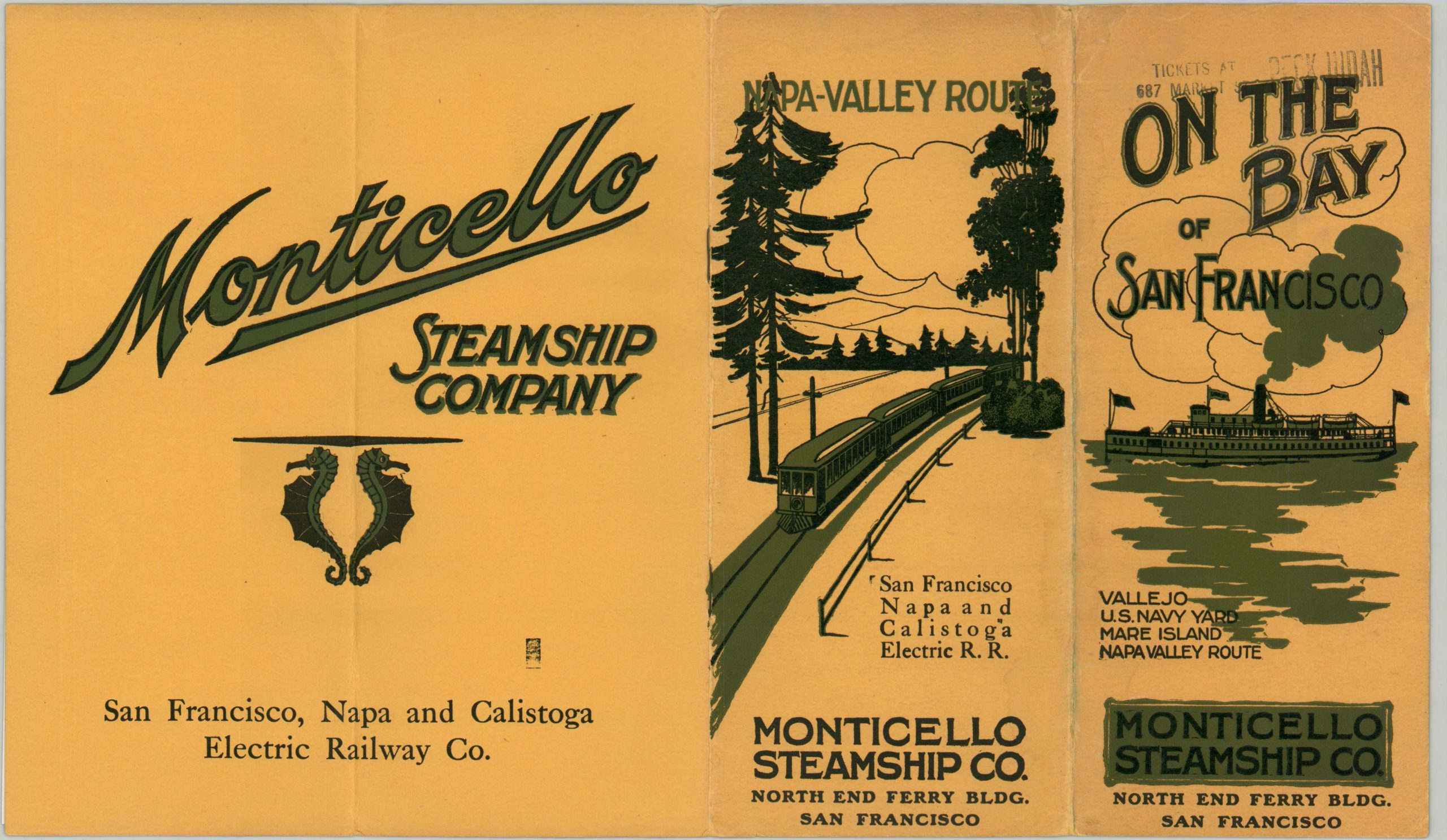
This promotional pamphlet was published in San Francisco by the Monticello Steamship Company in 1907. At the time of publication, the company operated ferry routes between San Francisco and Vallejo, where connections to electric lines and paved roads facilitated early tourism to California’s wine country. The bird’s eye view contained within the brochure highlights this transportation network, showing a proposed line extending north to Sacramento and the Mt. Tamalpais Electric Railway. Sonoma, Santa Rosa, and Napa are all also included within the image.
The pamphlet also includes timetables, information on hosted excursions, detailed background on the Napa Valley Route, and photographs of the luxurious amenities available. Printed by Vallejo Chronicle Printers.
Map Details
Publication Date: 1907
Author: Monticello Steamship Co.
Sheet Width (in): 9.00
Sheet Height (in): 15.90
Condition: B+
Condition Description: Four page promotional booklet folded into four segments, with a bird's eye view of San Francisco Bay as the centerfold. Minor wear along fold lines, and a bit of discoloration within the image near the bottom fold line. Otherwise the booklet is in very good condition, with stapled binding and original yellow paper covers.
Out of stock