
Bavaria Political Sub-Divisions Under Control of Office of Military Government for Bavaria
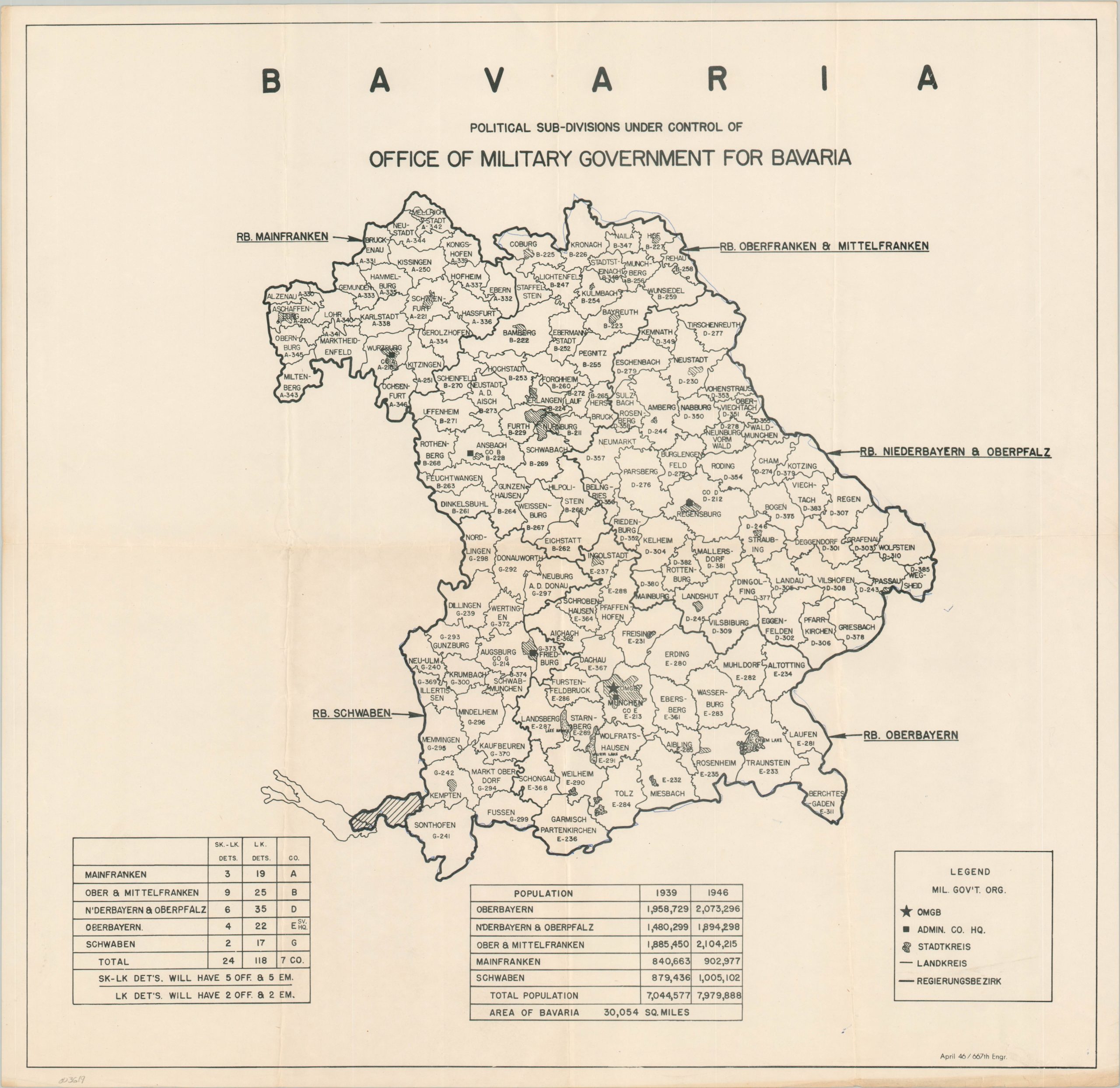
Organizational map of the U.S. occupation of postwar Bavaria.
Out of stock
Description
The Allied powers who defeated Nazi Germany in World War II divided the country into four occupation zones for administrative purposes during the period 1945 to 1949. The American zone consisted of Bavaria and Hessen in Southern Germany and the northern portions of the present-day German state of Baden-Würtemberg.
This map shows the area under the control of the Office of Military Government for Bavaria (OMGB) as of April 1946. The various zones are organized into stadtkries and landkries for urban and rural communities, respectively, and outlined within the image. Tables at the bottom of the page provide population statistics for each district, reflecting significant postwar growth, as well as the respective number of offices and detachments.
Map Details
Publication Date: 1946
Author: 667th Engineer Topographic Company
Sheet Width (in): 22.10
Sheet Height (in): 21.40
Condition: A-
Condition Description: Creased and lightly worn along former fold lines. A bit of wear and discoloration along the outer edges of the sheet, confined to the margins. Blue pen marks are visible along the outer borders.
Out of stock