
Barrington Estate District
$200.00
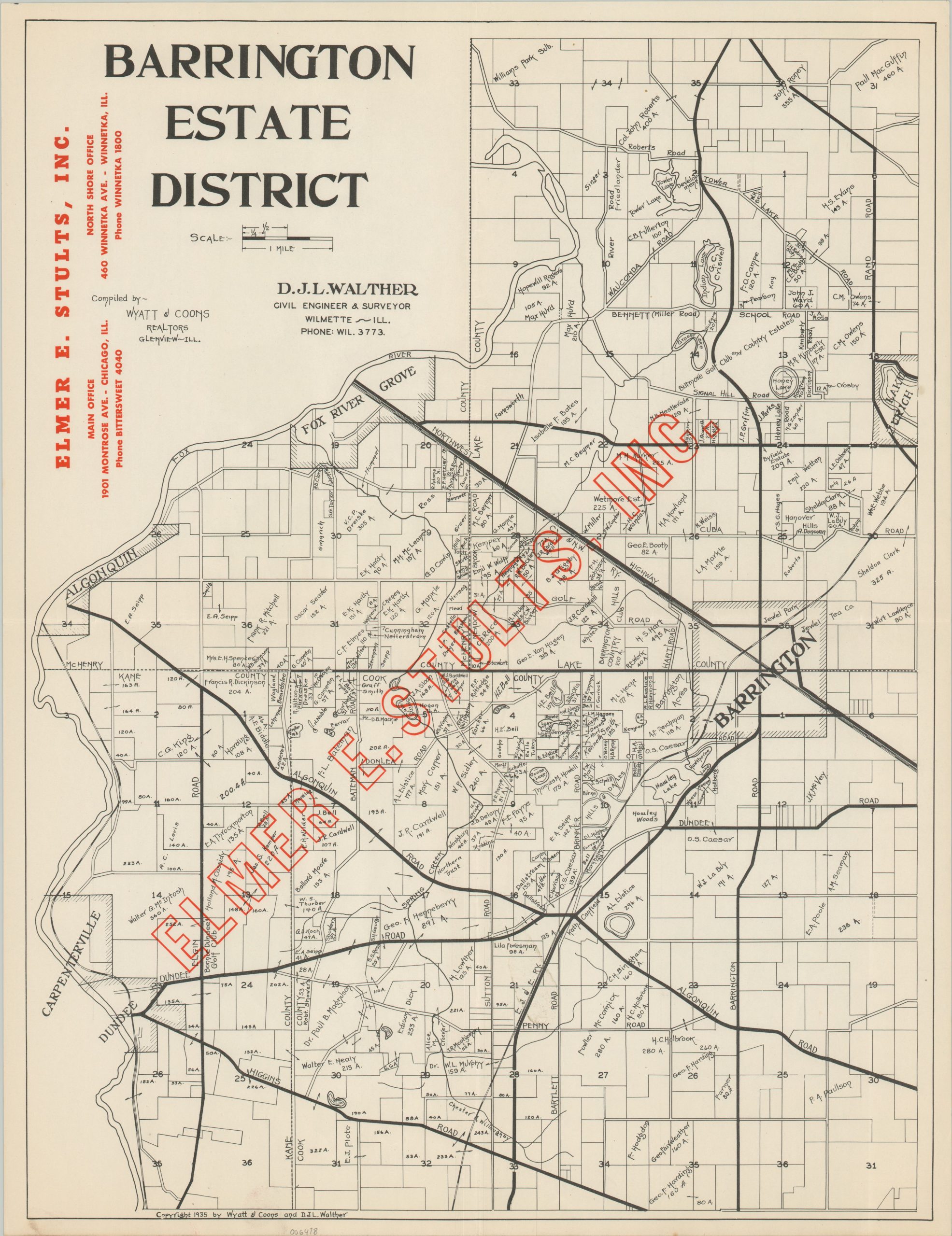
Uncommon Depression-era map of Barrington Hills and the surrounding area
1 in stock
Description
This uncommon real estate map of Barrington Hills, Illinois was copyrighted in 1935 as a collaborative effort between the Glenview real estate firm of Wyatt & Coons and the Wilmette-based engineering firm of D.J.L. Walther. It was issued to promote Elmer E. Stults, Inc. – a Chicago-based real estate company.
The image shows the affluent suburban region, located about 35 miles northwest of downtown Chicago, during a period of gradual growth and development. Golf courses and lavish country estates began to replace the local farms and dairies during the Roaring 20s, though the pace declined during the Depression.
Chicago’s notorious gangster culture, especially prominent at the time, would also seep into the area. Bootleggers would occasionally use the primary roads, represented with thick black lines. The violent Battle of Barrington between Baby Face Nelson and two lawmen, Herman Hollis and Samuel Cowley, took place the year prior to publication, Red overprinting across much of the presented area gives the impression that the reach of Elmer E. Stults, Inc. encompasses all.
Map Details
Publication Date: 1935
Author: D.J.L. Walther
Sheet Width (in): 16.8
Sheet Height (in): 21.9
Condition: A
Condition Description: Light creasing along old fold lines and faint wear along the outer edges, consistent with age. A bit of faint surface soiling in the lower center. Very good to near fine condition overall. Blank on verso.
$200.00
1 in stock