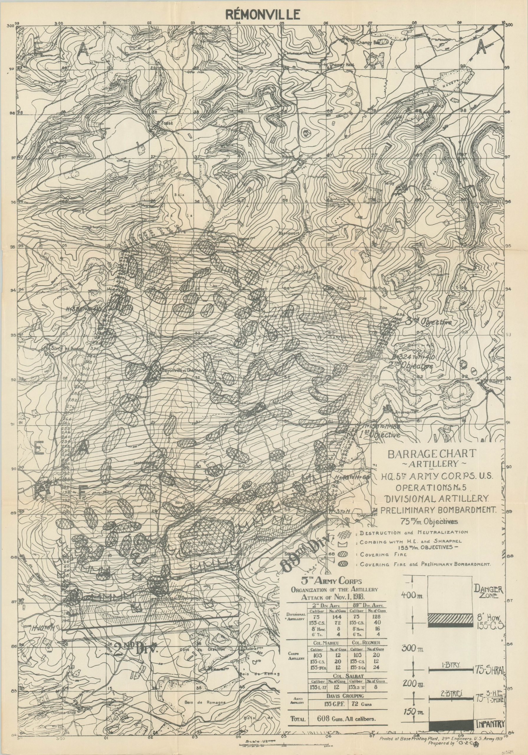
Barrage Chart Artillery HQ 5th Army Corps U.S. Operations No. 5 Divisional Artillery Preliminary Bombardment
Documenting the utter devastation of World War I artillery across the French countryside.
Out of stock
Description
Though at first difficult to decipher to an untrained audience, this contour map of the area around the French town of Remonville captures the immense scope of artillery operations on the Western Front during the First World War. A diminutive legend immediately under the title block identifies the different patterns employed to highlight artillery barrage areas, ranging in intensity from covering fire to total destruction and neutralization. The breakdown of the various artillery units attached to the U.S. 5th Army Corps can be seen just below, totaling just over 600 guns.
Divisional headquarters, operational objectives, and place names are noted within the image, though the eye is drawn to the immense fire zone marked out across the center. Tens of millions of artillery rounds were expended by the various belligerents on all fronts during WWI, thousands of which remain unexploded and embedded in the ground.
The map was prepared by the G-2 (Intelligence) Section of the 5th Army Corps and printed at the Base Printing Plant by the 29th Engineers in 1919. The map is quite scarce. Several editions of the repurposed base topographic map can be found in library and institutional holdings, though only three examples of the barrage chart were found in WorldCat.
Map Details
Publication Date: 1919
Author: G-2 Section 5th Army Corps
Sheet Width (in): 20.50
Sheet Height (in): 29.50
Condition: A-
Condition Description: Creased along former fold liens and four small spots of separation at the fold intersections. Lightly toned from age, but overall in very good condition.
Out of stock

