
Baltimore
$200.00
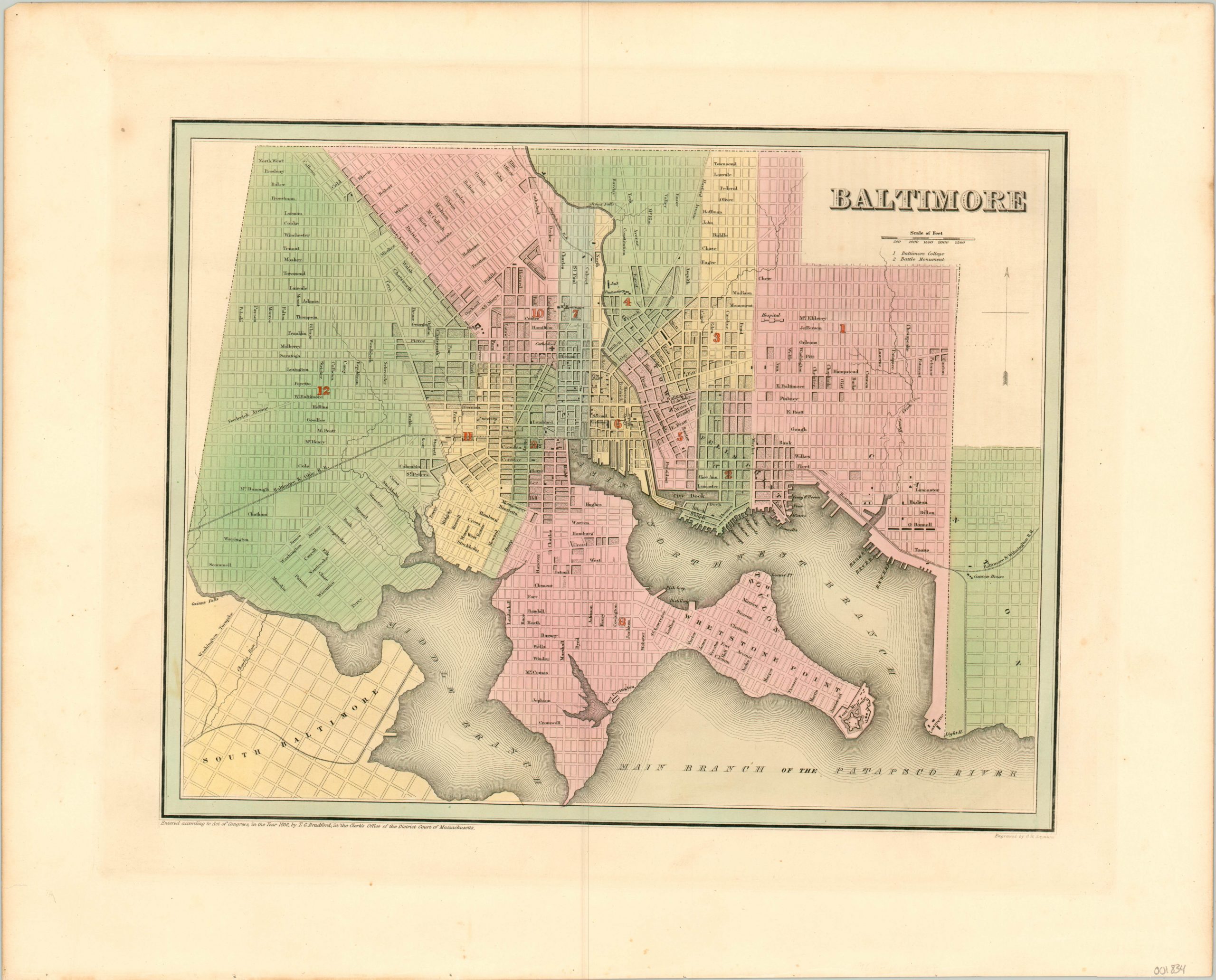
Gorgeous engraved map of Baltimore with original hand color.
1 in stock
Description
This finely detailed plan of Baltimore, Maryland was published by T.G. Bradford in 1838. It shows the city colored by wards, which are also numbered and highlighted in red. Developed blocks are shaded and numerous buildings are outlined, but only a handful of the most important are identified; such as the cathedral, university, market, city hall, and penitentiary. Numbers below the title identify the location of Baltimore College and the Battle Monument. Even the batteries at Fort McHenry are shown.
Local transportation routes are also prominently featured, with dotted lines indicating streetcar routes. Three of the city’s earliest steam railroads; the Baltimore & Ohio, Susquehanna, and Boston, Baltimore & Wilmington, are shown entering from the west, north, and east, respectively.
Map Details
Publication Date: 1838
Author: T.G. Bradford
Sheet Width (in): 19.25
Sheet Height (in): 15.50
Condition: A
Condition Description: The far edges of the sheet are slightly toned, but overall the map is in near fine condition. Beautiful original hand color on a bright sheet.
$200.00
1 in stock