
Automobile Routes to the Kensico Cemetery
$425.00
A road map to the last stop for some of those who go there.
1 in stock
Description
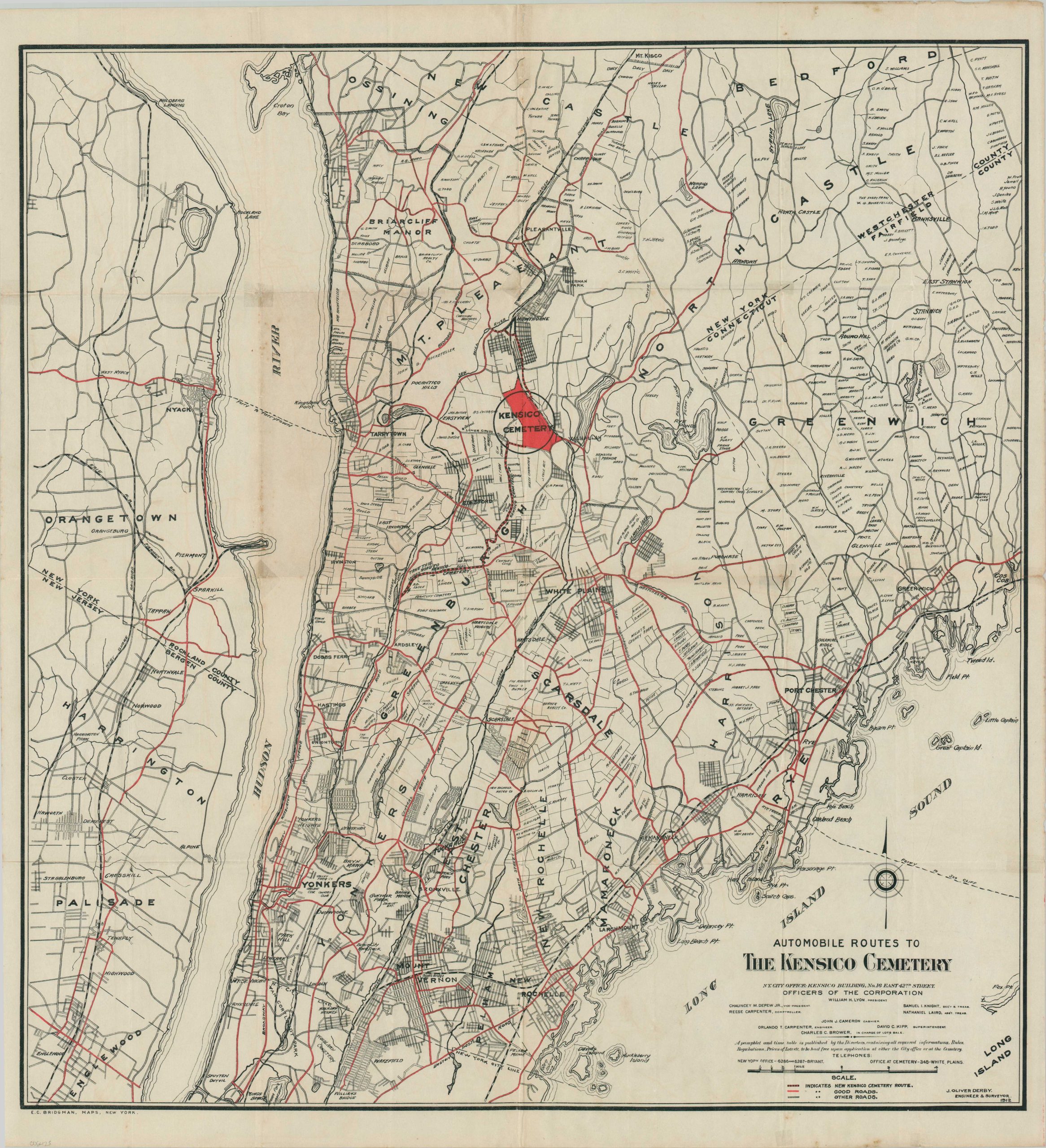
This fascinating map covering much of New York’s Westchester County was designed in 1912 by J. Oliver Derby. It was published by E.C. Bridgman on behalf of The Kensico Cemetery Corporation, which was advertising a new automobile route to the fashionable burial grounds just north of New York City. The approximately 5-mile thoroughfare is shown with a dotted line within the image, while other ‘Good Roads’ are highlighted in red. Numerous large landowners are labeled throughout the image, possibly to add a sense of prestige to the area. Other toponyms identify townships, prominent geographic features, and other (less ideally suited) cemeteries.
Kensico Cemetery was founded in 1899 on 240 acres of rolling farmland in the hamlet of Valhalla. An idyllic alternative to New York City’s overcrowded cemeteries, the grounds expanded to nearly 600 acres in the early 20th century. Around the time of publication, a portion had been sold off to the Gate of Heaven Cemetery. Kensico is the final resting place for Lou Gehrig, Sergei Rachmaninoff, Ayn Rand, and numerous other entertainers and performing arts figures. The map is rare and unlisted in WorldCat or other online repositories as of October 2024. https://www.kensico.org/history/
Map Details
Publication Date: 1912
Author: J. Oliver Derby
Sheet Width (in): 28
Sheet Height (in): 30.5
Condition: A-
Condition Description: Large color printed map on a single sided sheet, issued on thin paper with sharp creasing along folds. Scattered soiling and wear visible in the margins and a few small pinholes at fold intersections. Very good condition overall.
$425.00
1 in stock