
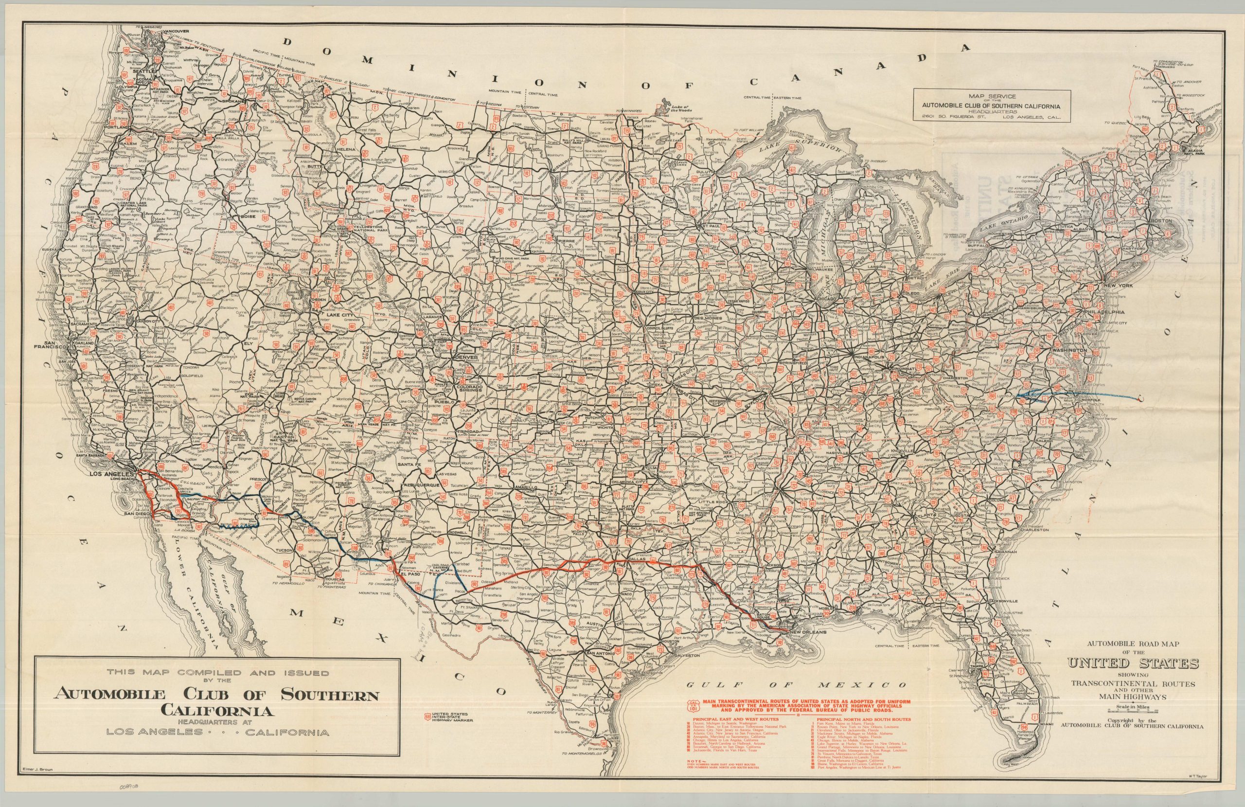
Automobile Road Map of the United States Showing Transcontinental Routes and Other Main Highways
$145.00
U.S. Highways near the end of the Roaring 20
1 in stock
Description
This thoughtfully designed highway map of the United States highlights the incredible road-building progress enjoyed nationwide during the first three decades of the 20th century. Heavy black lines reflect improved surfaces (almost certainly paved), while the thinner routes, largely confined to rural areas, are of a secondary class. Bright red overprinting identifies the network of numbered U.S. Highways introduced just a few years prior, in 1926. A list of principal transcontinental routes (both North/South and East/West) is provided in the lower center.
The map is undated, but a printer’s code on the front cover indicates it was likely issued around 1929, based on the highway configuration (notably, the lack of U.S. 281 or 216). Published in Los Angeles by the Automobile Club of Southern California (ACSC), the map reflects a region that adopted the automobile at a much faster pace than the rest of the nation, thanks to its climate, geography, and a high concentration of affluent consumers. The cartography is credited to Elmer J. Brown and W.T. Taylor, two prominent figures within the ranks of the ACSC map department.
Map Details
Publication Date: c. 1929
Author: Elmer J. Brown and W.T. Taylor
Sheet Width (in): 36.00
Sheet Height (in): 22.50
Condition: A-
Condition Description: Folding map brochure printed in black and red with a title on the front cover (verso). Creasing and some light wear along the folds, with noticeable wrinkling at the joints. Old annotations in red and blue highlight a custom route across the South.
$145.00
1 in stock