Automobile Road Map of California
$250.00
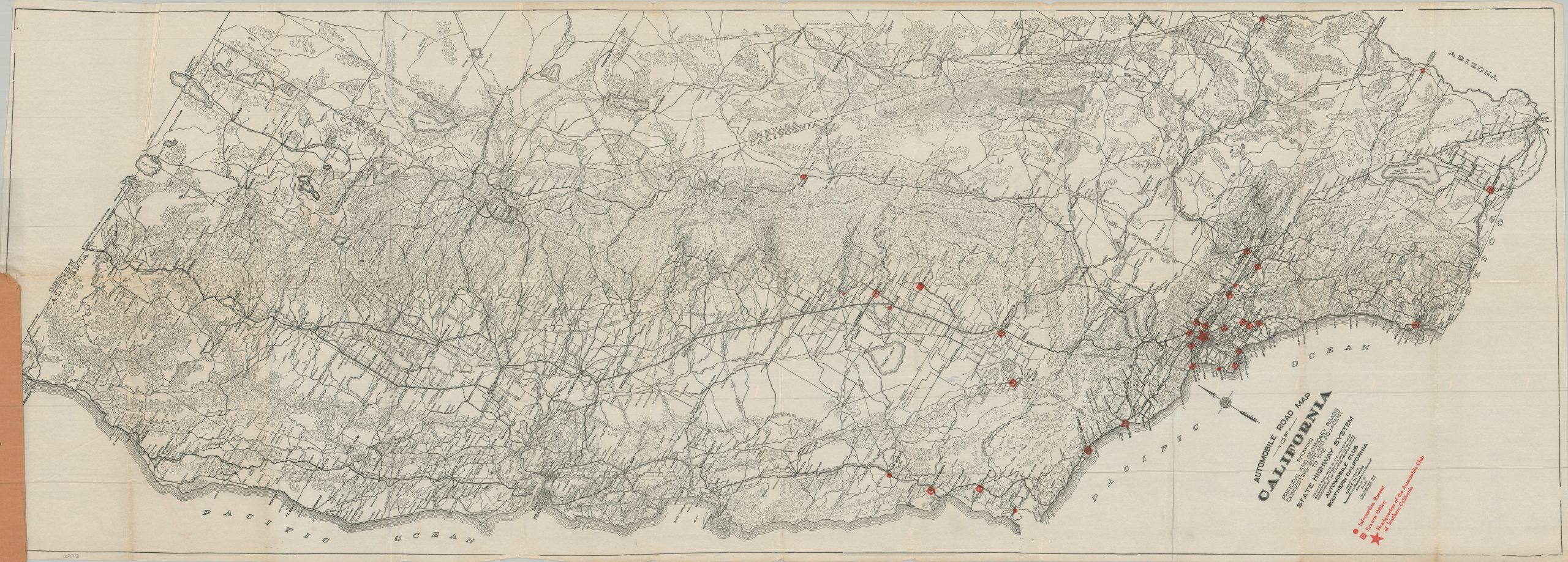
The roads of California during the First World War.
1 in stock
Description
This uncommon road map of California and western Nevada offers an interesting look at the relationship between the physical landscape and the transportation network of America’s Far West. Simple hachures give a generalized impression of the mountainous terrain. Main roads and, to a lesser extent, railroads, are concentrated in the more easily navigable Central Valley and along the Pacific Coast. An embryonic network of state highways is emphasized, reflecting how the adventurous motorists concentrated in the south can now more easily access other parts of the state.
The map was drawn by E.J.B. and copyrighted in 1917 by the Automobile Club of Southern California, with the firm’s L.A. headquarters marked prominently with a red star. Further overprinting identifies the locations of Information Bureaus (dots) and Branch Offices (squares). Text on the inside of the front cover presents a ‘Few Facts’ about the organization, including that it maintained over 84,000 guideposts (marking specific trails) and was the largest organization of its kind in America (prior to its later incorporation by AAA).
Map Details
Publication Date: 1917
Author: Automobile Club of Southern California
Sheet Width (in): 50.5
Sheet Height (in): 18.5
Condition: B+
Condition Description: Lithographed pocket map on thin paper, folded and affixed to original brown paper covers (moderately worn along the edges). Heavy creasing and faint toning along folds, with small spots of separation at the fold joints. A bit of minor wear and wrinkling along the lower edge of the sheet. Good to very good condition overall.
$250.00
1 in stock