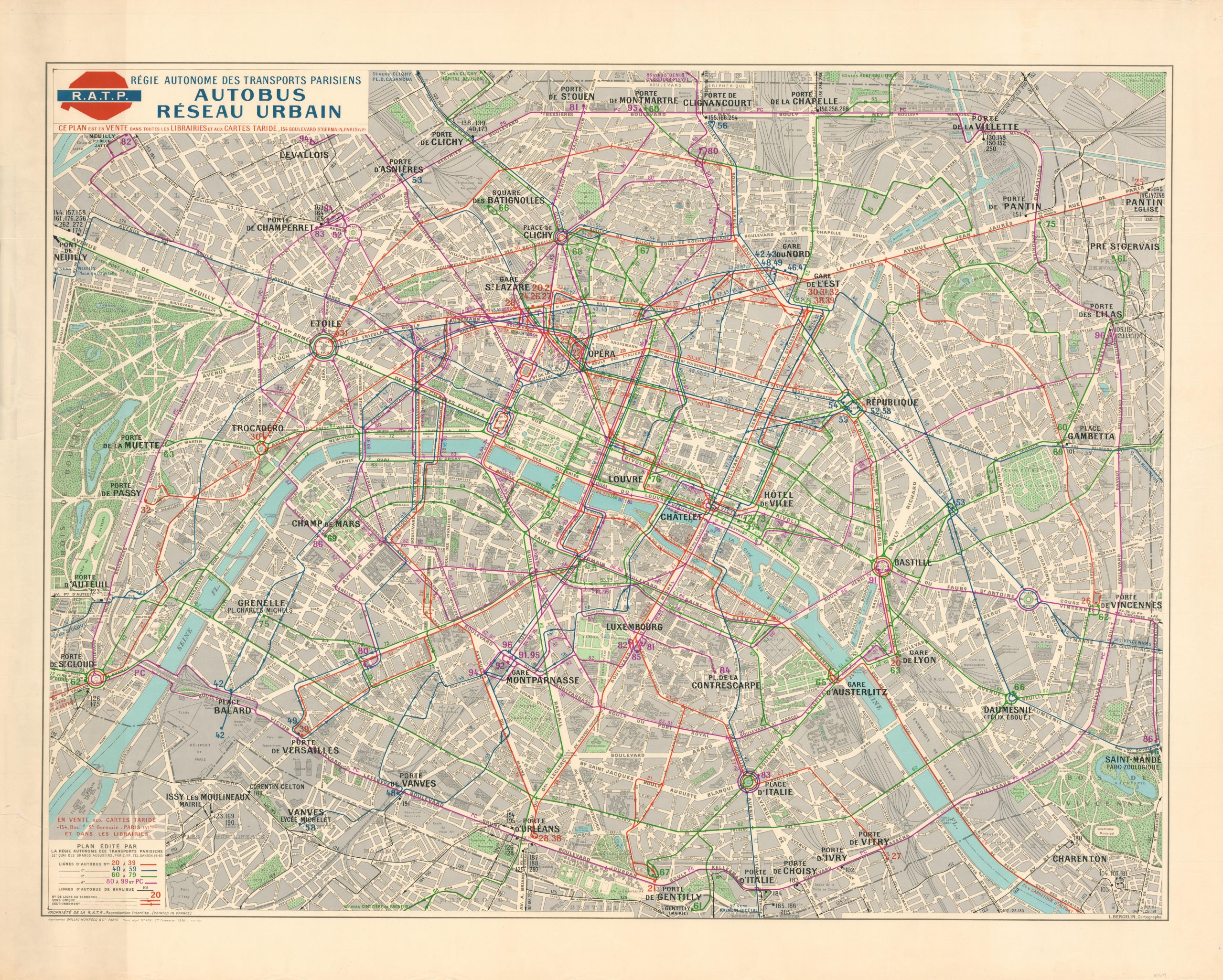
Autobus Reseau Urbain [Paris Urban Bus Network]
$300.00
Huge map of the Paris bus system from 1958.
1 in stock
Description
This vibrant mid-century map of Paris highlights the bus lines in operation by the Régie autonome des transports parisiens (R.A.T.P.). The Paris Transportation Administration was organized in 1949 as a state-owned public transit operator and today carries over 3 billion passengers per year across the Ile-de-France region (including the Paris Metro).
Urban bus routes are colored and numbered according to the legend in the lower left, with numerous stops boldly named across the image. Dozens of locations of interest are also labeled.
The map was designed by cartographer L. Bergelin for the R.A.T.P. and published in Paris by Gaillac-Monrocq & Cie. in 1958. The same year as publication, Charles de Gaulle came out of retirement to lead France by decree for a period of six months and was elected President of the new Fifth Republic.
Map Details
Publication Date: 1958
Author: L. Bergelin
Sheet Width (in): 53.6
Sheet Height (in): 43.3
Condition: A-
Condition Description: Moderate wear visible along the outer edges of the sheet, including some toning and numerous small tears, confined to the margins. One 6" tear in the lower left enters the legend, but has been repaired on the verso with archival tape. Very good overall.
$300.00
1 in stock

