Auto Routing Chart Coast-to-Coast
$225.00
Uncommon Depression-era travel planning device.
1 in stock

Description
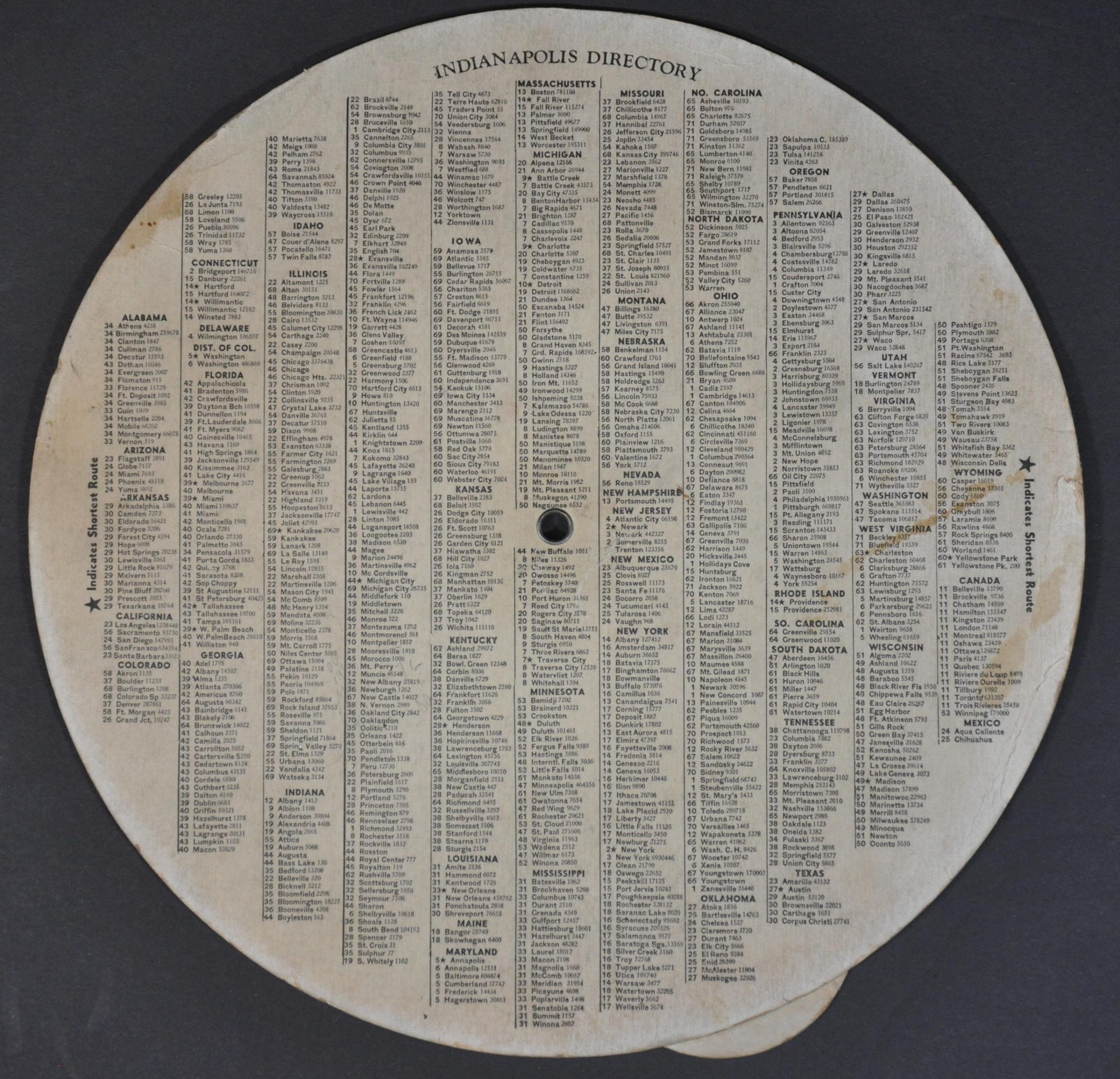
“71 Routes Out Of Indianaplis – National Trunk Routes of the U.S. Totaling Over 65,000 Miles – Where to Go and How to Go – Route Numbers, Population and Mileage to 1,000 Towns and Cities”
This unusual route-finding aid was published in 1936 by the National Chart Company of Chicago. The clever volvelle provide point-by-point directions, starting in Indianapolis, IN, to hundreds of different destinations across the United States and Canada (listed on verso).
Seventy-one different ‘keys’ are used, each accessed by spinning one of the two rotating paper wheels. Information in the blank boxes then offers the general direction of travel, recommended highway, and distance between towns. An impressive and useful tool from the prewar years of automobile tourism.
Map Details
Publication Date: 1936
Author: National Chart Company
Sheet Width (in): 9.25
Sheet Height (in): 9.25
Condition: B
Condition Description: Circular volvelle comprised of three pieces of rotating cardstock connected with central metal rivet. The tabs along the outer edges of two dials show heavy wear. Moderate soiling and some curling to the edges on the 'top', most evident on the left side. Functions well and in about good condition overall.
$225.00
1 in stock