Auto Road Map of New Jersey & Eastern Penna. Showing Main Routes
$95.00
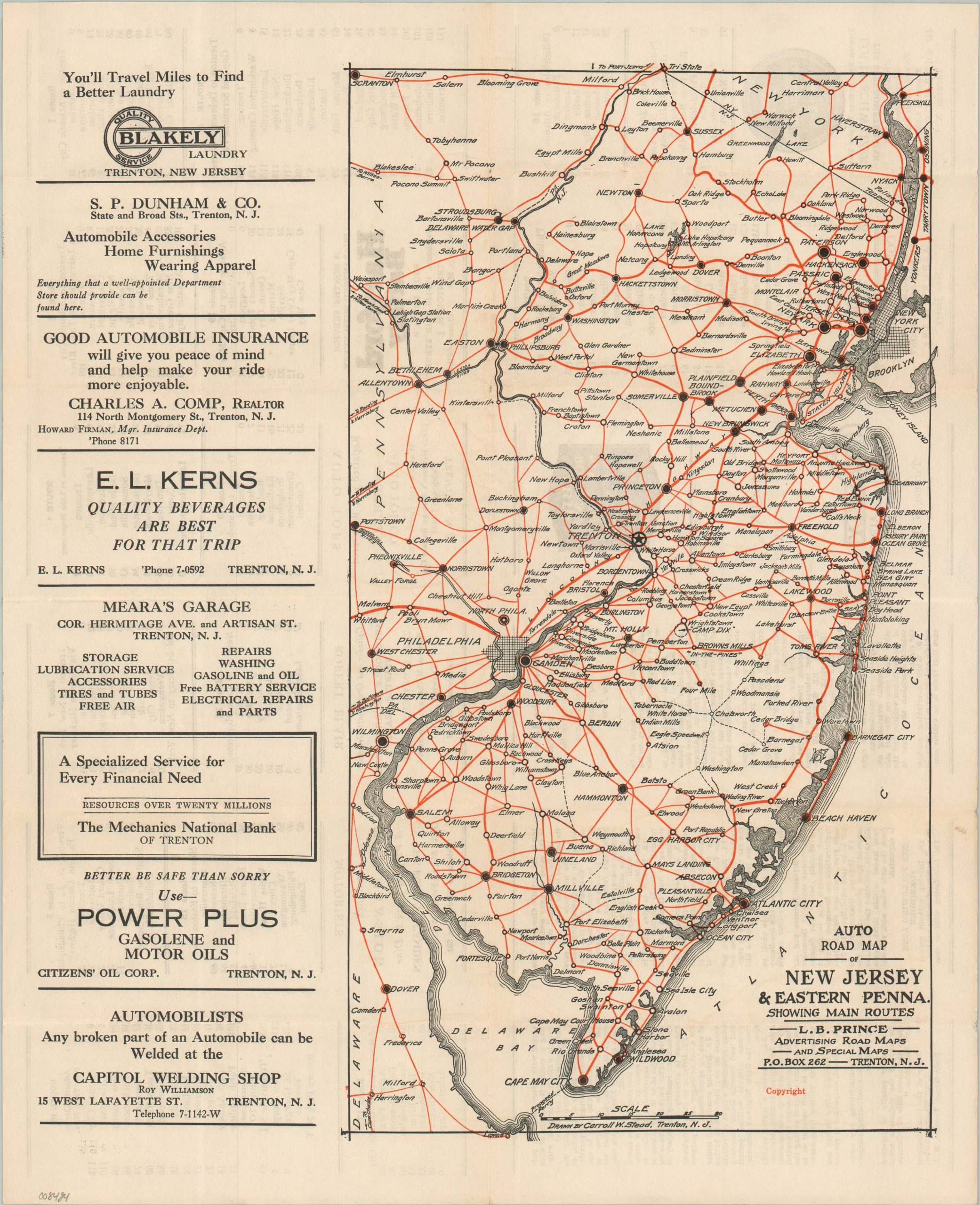
The roads of New Jersey during the early 1920s.
1 in stock

Description
This charming road map of New Jersey and Eastern Pennsylvania highlights the regional road network as of the early 1920s. Suspiciously straight red lines approximate the primary auto trails and state routes. Of particular interest is the Lincoln Highway, connecting Newark to Philadelphia and onward to San Francisco. Towns large and small are labeled throughout the image, including a number of coastal resorts that would have been popular destinations for contemporary motorists.
The map was drawn by Carroll W. Stead, named in the lower center. Published in Trenton around 1923 by the L.B. Prince Advertising Road Maps. Several promotions for Trenton businesses can be seen on both sides of the sheet. A list of twenty different routes, with mileage tables for each, is provided on the verso, along with a summary of New Jersey’s motor laws.
Map Details
Publication Date: c. 1923
Author: Carroll W. Stead
Sheet Width (in): 13.75
Sheet Height (in): 16.75
Condition: A
Condition Description: Double-sided map brochure with light wear along original folds and faint soiling on the front and back covers. A bit of marginal soiling also. Very good condition overall.
$95.00
1 in stock