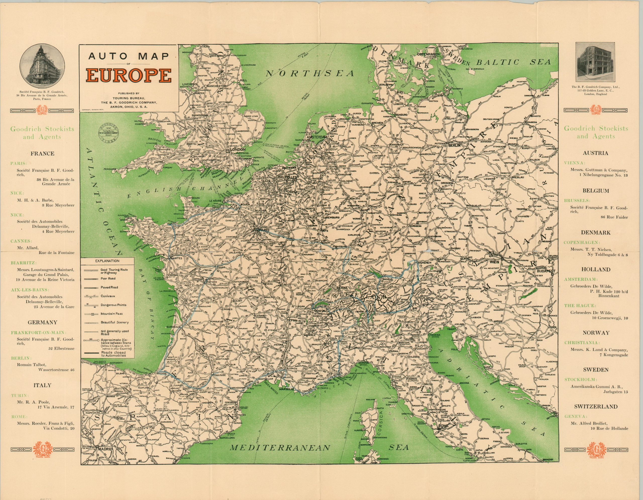
Auto Map of Europe
$350.00
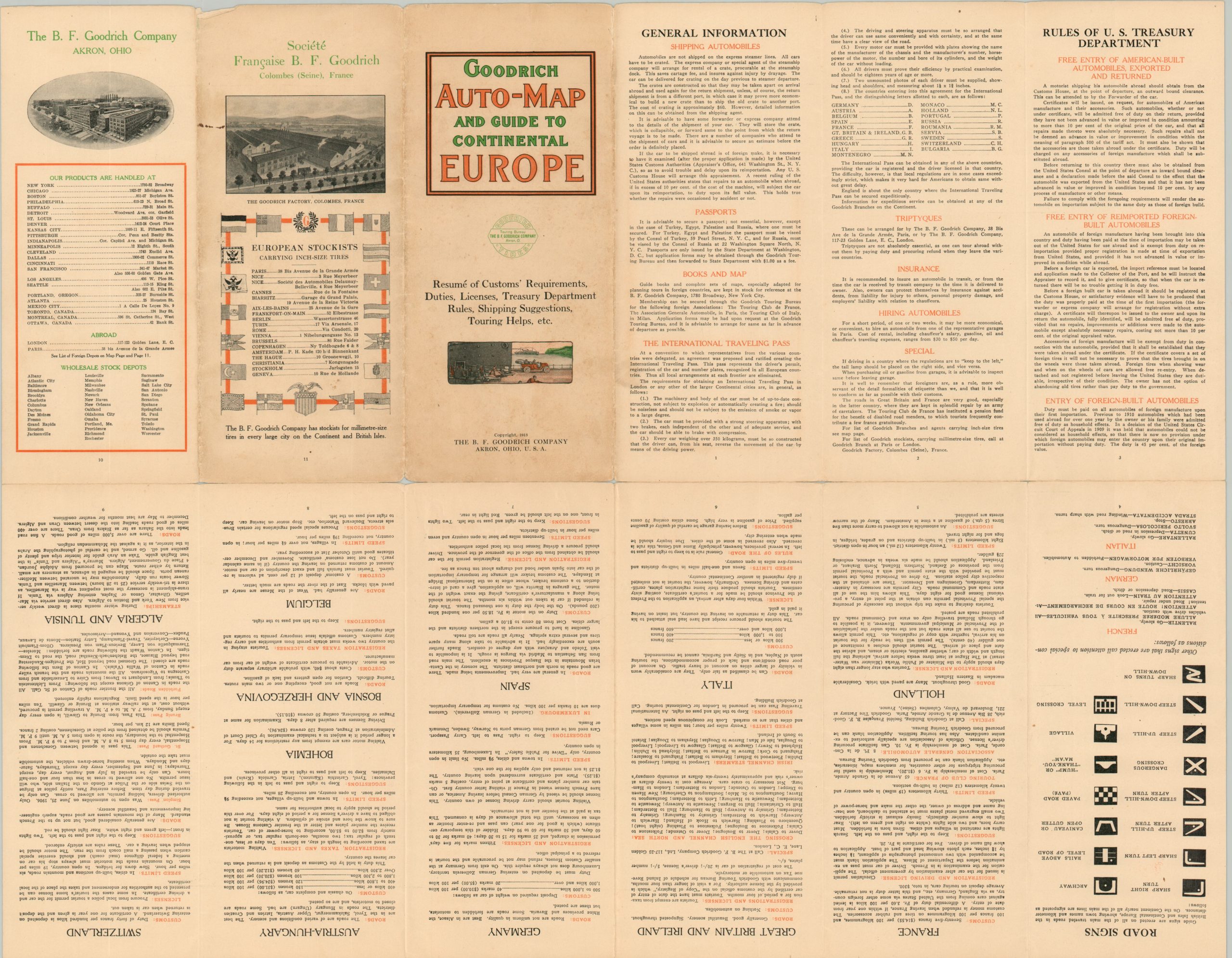
“Goodrich Auto-Map and Guide to Continental Europe” – verso.
1 in stock
Description
This interesting ‘do-it-yourself’ guide to European motor tourism was published in Akron, Ohio by the Touring Bureau of the B.F. Goodrich Company in 1914. The rubber manufacturer was founded in 1870 and grew quickly with the widespread adoption of first, the bicycle, and later, the automobile.
The map shows the status of road surfaces across Europe, ranging from ‘Good Touring Routes or Highways’ to ‘Poor Roads’ and those ‘Not Generally Used.’ Dangerous areas, mountain passes, canivaux (ravines), and beautiful scenery are noted according to the legend in the lower left. Distances between points are noted, reflecting a lack of scale that heavily distorts space. Lists of Goodrich retailers and agents on either side of the image highlight the firm’s widespread expansion across the continent.
Additional travel information is provided on the verso. Road signs, licensure, general travel details, shipping recommendations, U.S. Treasury Department rules, and customs requirements are all covered in detail. An all-in-one package for the adventurous (and necessarily wealthy) American motorist visiting Europe, then on the brink of war.
Map Details
Publication Date: 1914
Author: Raymond Beck
Sheet Width (in): 24.9
Sheet Height (in): 19.4
Condition: A-
Condition Description: Folding brochure, printed on both sides, with moderate wear along folds. Two spots of clean separation, about 2" each, along the horizontal seam. Good to very good condition overall.
$350.00
1 in stock