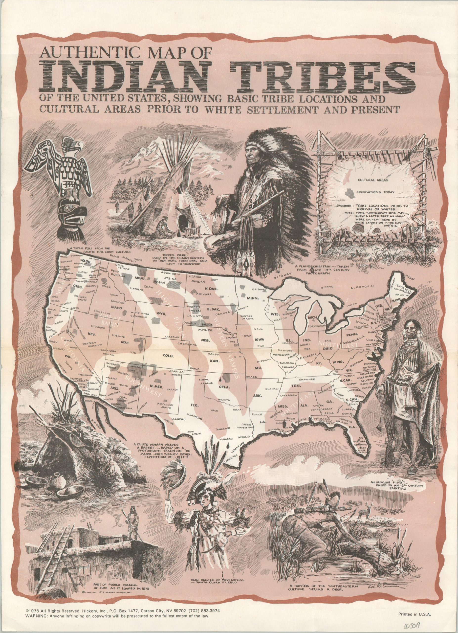
Authentic Map of Indian Tribes of the United States, Showing Basic Tribe Locations and Cultural Areas Prior to White Settlement and Present
Lavishly embellished map speculating on Native American tribal locations.
Out of stock
Description
This small poster-style map was drawn by Bob McGuinness and copywritten in 1973 by Hickory Plaque, Inc. of Carson City, Nevada. Per the publisher’s imprint in the lower left, this example has been updated to 1976.
A simple map of the United States identifies broad geographic regions and numerous Native American tribes in locations that ostensibly correspond to their original homelands, prior to encountering Europeans. The diminutive area encompassed by modern Indian Reservations is shaded drearily in gray.
A diverse array of spectacular captioned images surround the map; including a totem pole of the Pacific Northwest, Iroquois king, Pueblo village, and Paiute basket-weaver. An attractive celebration of indigenous culture across America.
Map Details
Publication Date: 1976
Author: Bob McGuinness
Sheet Width (in): 10
Sheet Height (in): 14
Condition: B+
Condition Description: Heavily wrinkled throughout from where roughly rolled previously. Much has been flatted out, but scattered creasing remains. Some light toning along a horizontal centerfold. Good condition overall.
Out of stock