Austria Archducatus
$400.00
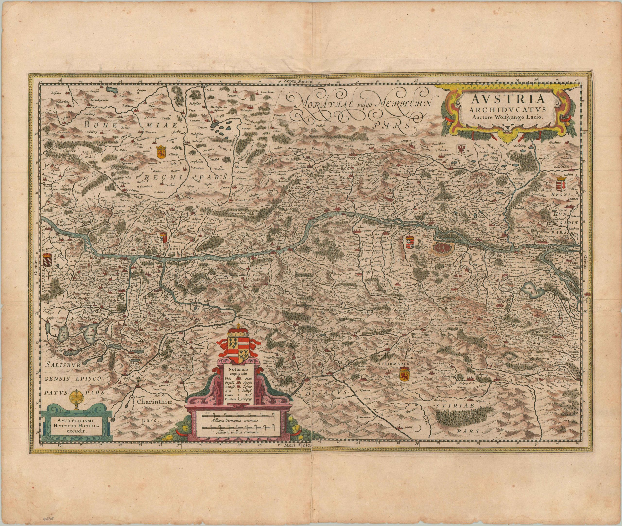
The hereditary heartland of the Habsburg Empire.
1 in stock
Description
This gorgeous copperplate engraved map of the Archduchy of Austria is rooted in the authoritative 1545 survey by Wolfgang Lazius, who is prominently credited within the title cartouche. The geography was later refined by Gerard Mercator and subsequently published in Amsterdam by Henricus Hondius, the source of this particular example. The composition is horizontally bisected by the Danube River, which serves as the primary longitudinal axis as it flows from Passau on the Bavarian frontier to Pressburg (modern-day Bratislava) in the Kingdom of Hungary.
At the heart of the Archduchy sits the fortified metropolis of Vienna, meticulously rendered to highlight its strategic role as the imperial capital. A dense topographical inventory identifies cities, monasteries, market towns, and even individual vineyards, categorized according to the decorative legend and scale in the lower center. Pictorial elements provide a charming approximation of the landscape, dotted with stylized mountain ranges, dense forests, and alpine lakes. In the upper corners, finely engraved coats of arms represent the diverse heraldry of the ruling dynasties, framing Austria as the central crossroads of the Holy Roman Empire.
Map Details
Publication Date: c. 1620
Author: Henricus Hondius
Sheet Width (in): 23.5
Sheet Height (in): 19.1
Condition: B
Condition Description: Copperplate engraved map on a sheet of laid paper with Latin text on the verso. Nice old hand color and full margins, with irregular closed tears in the center edges repaired on verso. Some wrinkling along the upper quarter of the sheet and a split along the centerfold has been repaired/reinforced.. Light scattered foxing. About good condition overall.
$400.00
1 in stock