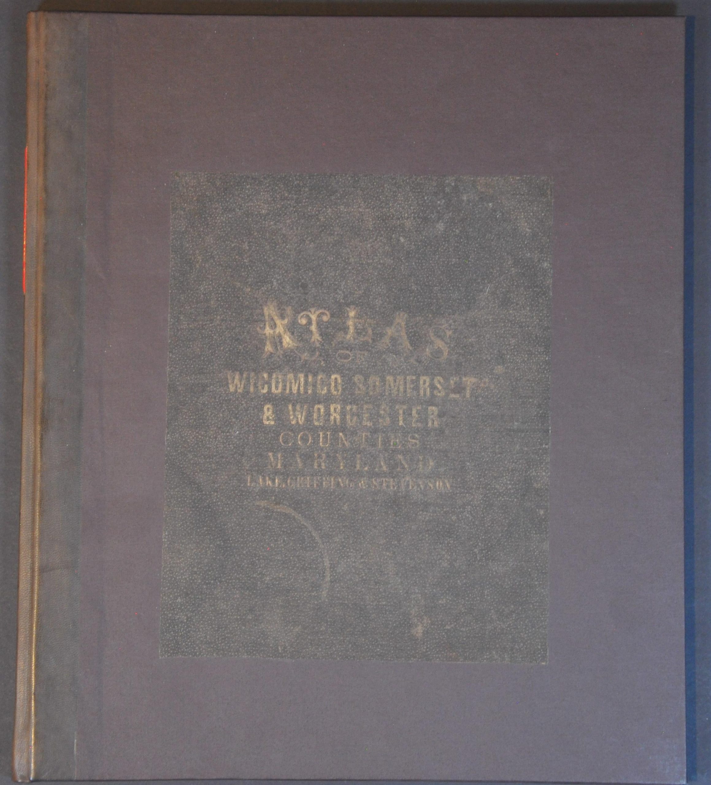
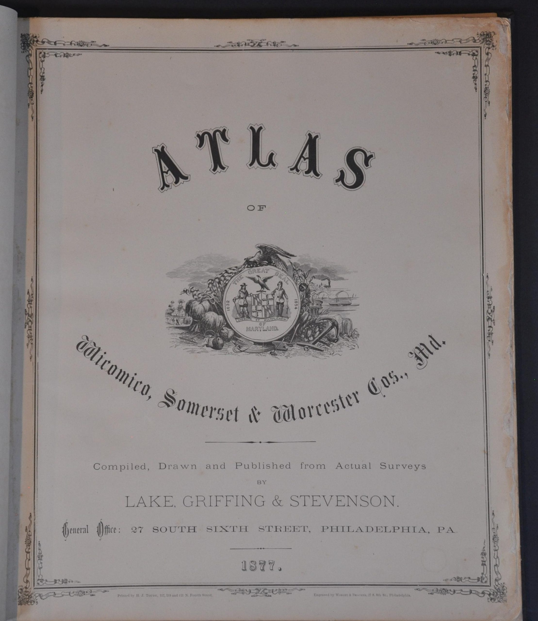
Atlas of Wicomico, Somerset, and Worcester Cos., Md.
$750.00
A detailed overview of Maryland’s three lower counties during the mid-1870s.
1 in stock


Description
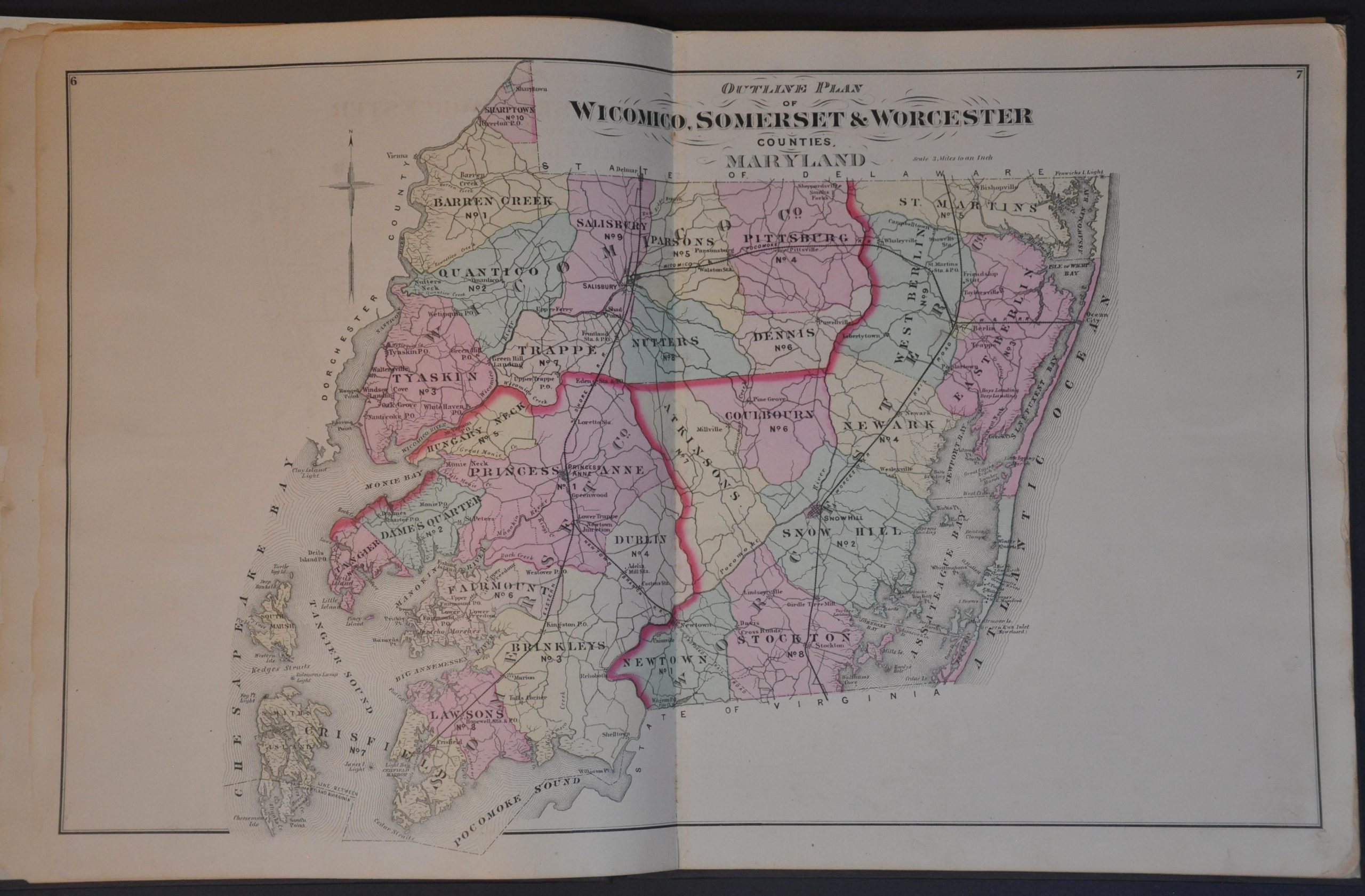
This fascinating Gilded Age atlas is a cartographic snapshot of three counties on Maryland’s Eastern Shore – Wicomico, Somerset, and Worcester. The arrival of the railroad and post-Civil War prosperity brought a tide of agricultural and industrial change to the coastal region, which was dotted with oyster houses, sawmills, farms, river landings, and depots.
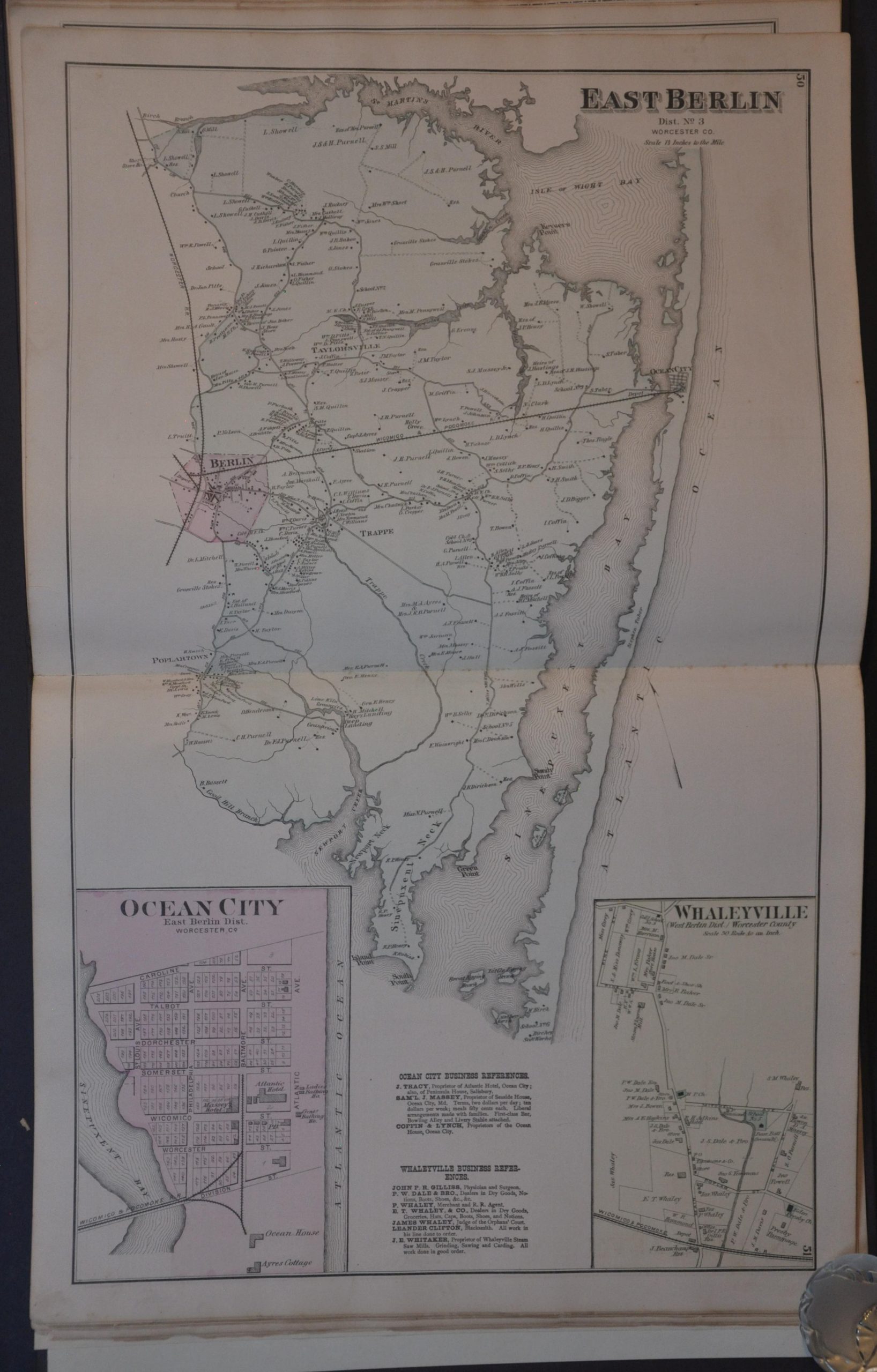
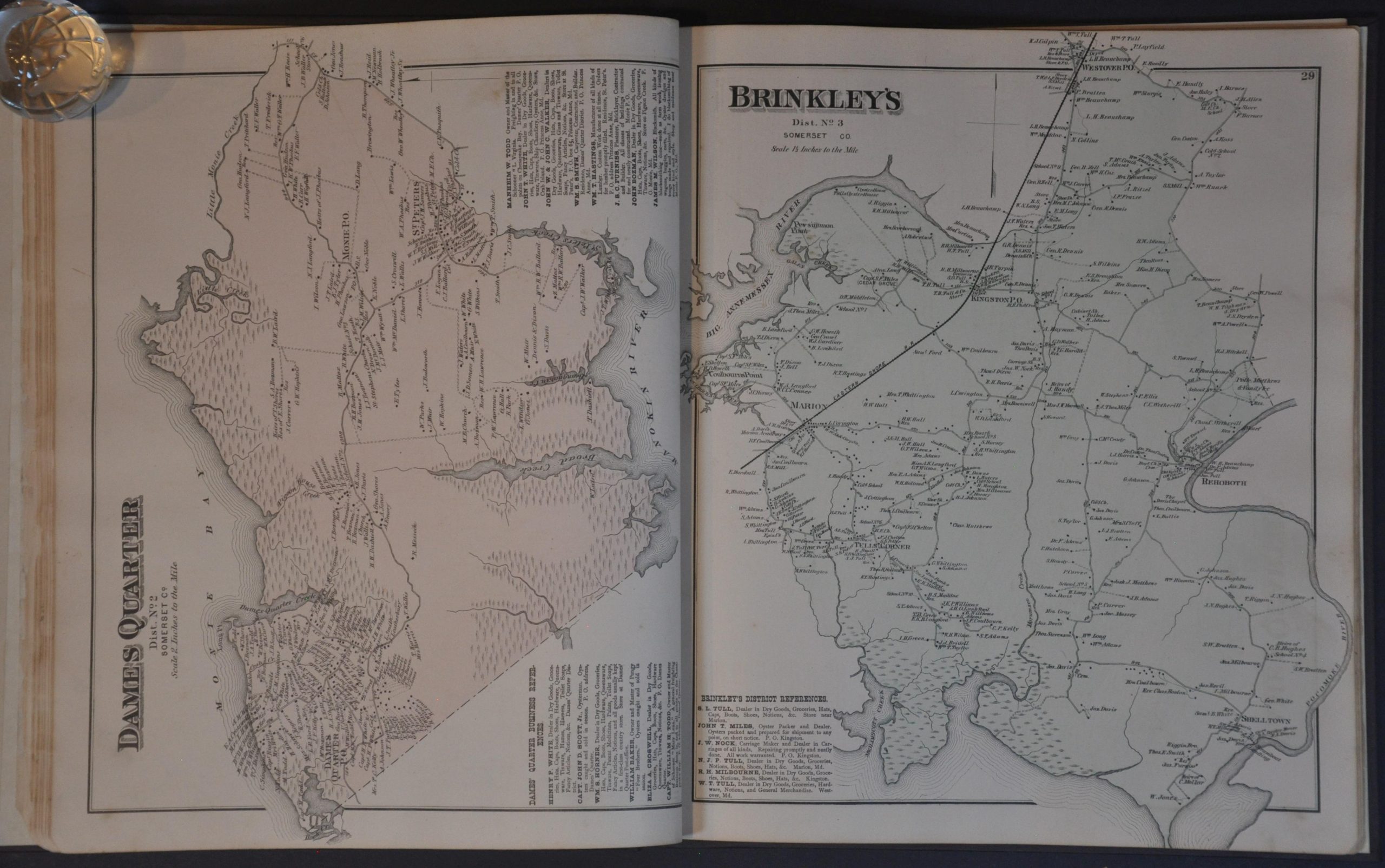
A double-page outline plan of all three counties highlights the regional transportation network, political organization, and basic geography. Large-scale maps of each election district provide an incredible amount of information – names of local landowners, lists of businesses, and the locations of specific buildings. Insets often capture important crossroads, small towns, or unincorporated communities.
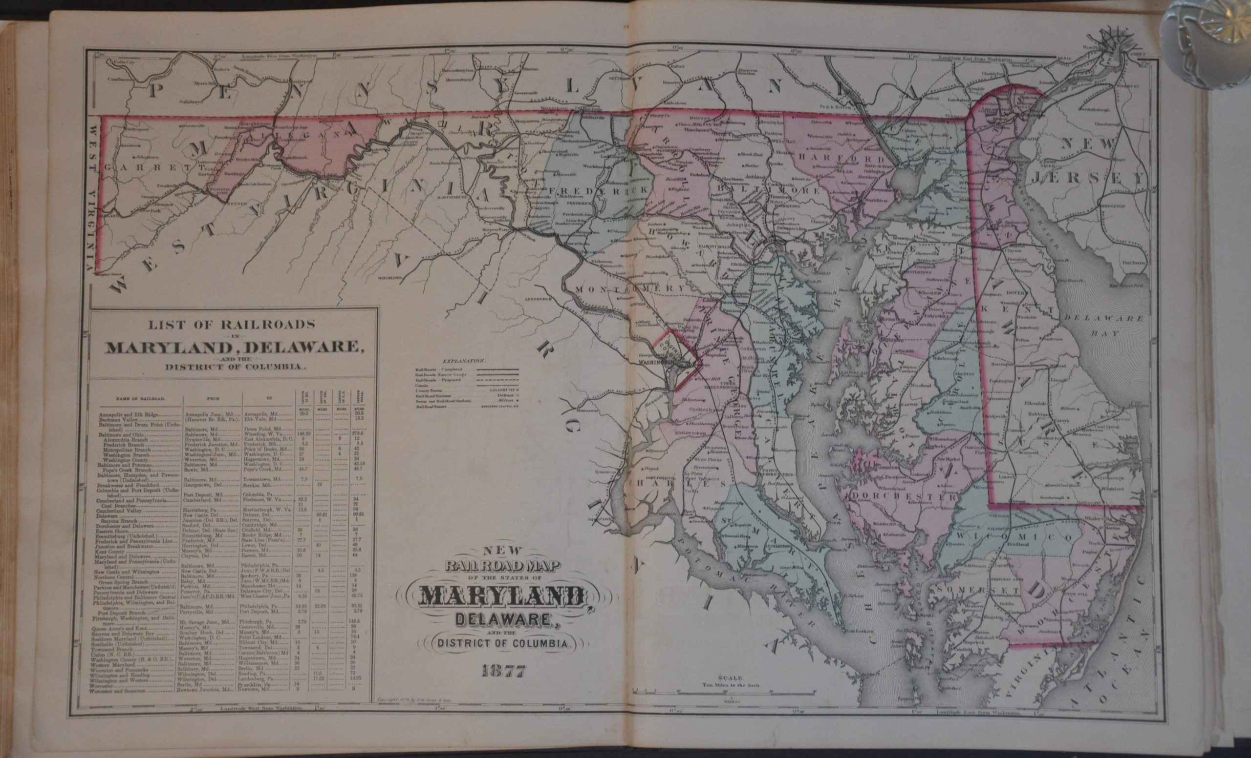
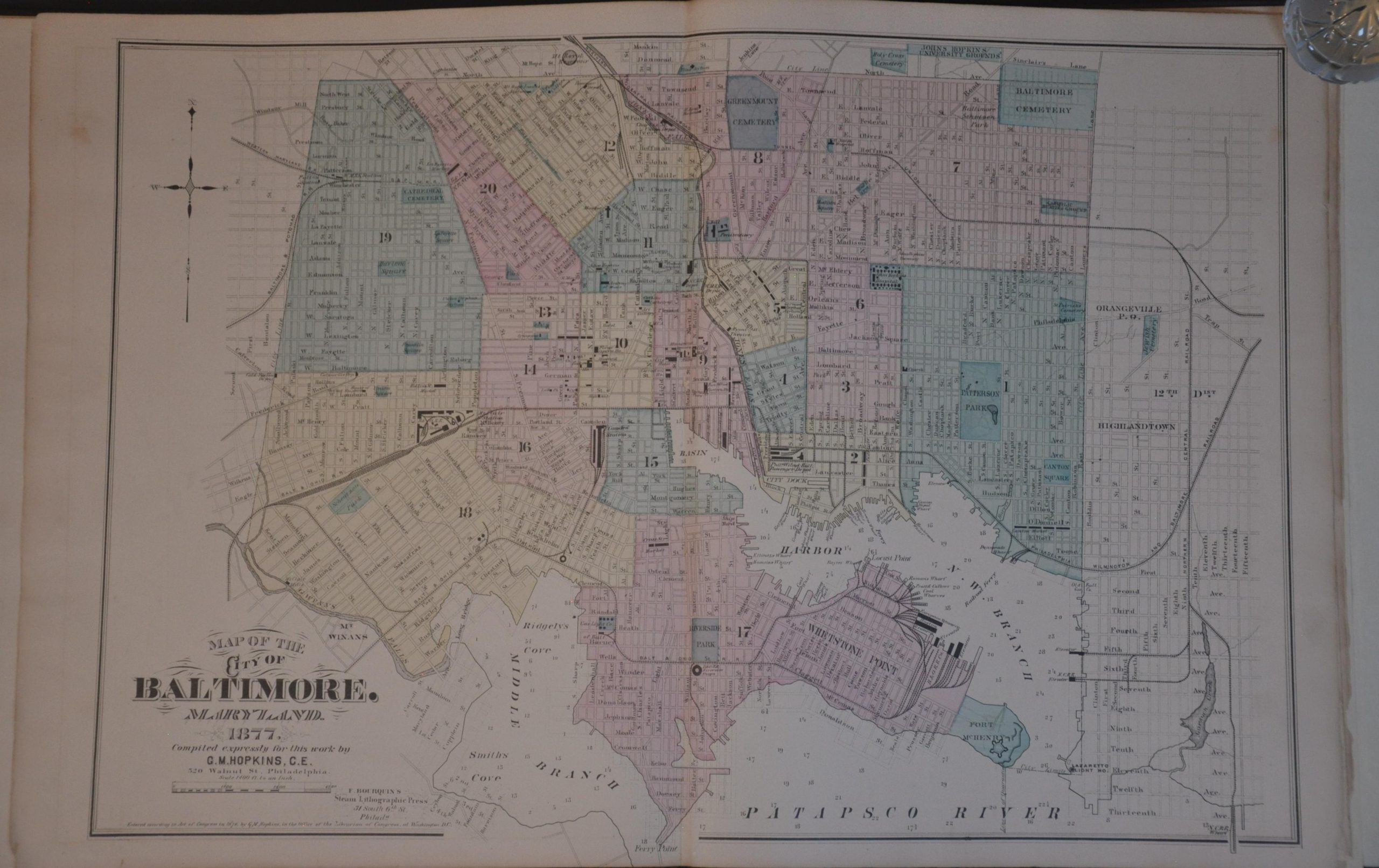
Full or double-page plans are given for Salisbury, Newton, Snow City, Princess Anne, and Crisfield. A list of patrons for each county is also provided, noting the name, occupation, place of birth, and date of settlement – invaluable genealogical data. The volume concludes with double-page maps of the state of Maryland, the city of Baltimore, the United States, and the Eastern/Western Hemisphere.
Compiled, drawn, and published from actual surveys by Lake, Griffing, and Stevenson in Philadelphia in 1877. The firm was part of a large commercial industry that often sold the works on a subscription basis, allowing potential buyers to include self-portraits, views of their homes, and even prized animals (for an extra fee). These atlases are frequently the only surviving record of contemporary land use outside of courthouse deeds.
Map Details
Publication Date: 1877
Author: Lake, Griffing, & Stevenson
Sheet Width (in): 14.25
Sheet Height (in): 16.25
Condition: B
Condition Description: Complete 72 pp. expertly rebound in full new brown cloth boards and endpaper, with original title block and spine carefully re-applied. A large circular stain on the left side of Lawsons District, but otherwise in the contents are in generally good shape. Some chipping and 'chewing' in the margins, along with dirty fingerprints and the errant spot of foxing. Scattered offsetting from the black printed ink (mostly from the title blocks) and the U.S. map has some moderate marginal damp staining.
$750.00
1 in stock