Atlas of Union & Snyder Counties Pennsylvania
$350.00
A fascinating atlas of the Susquehanna Valley issued just a few years after the end of the Civil War.
1 in stock


Description
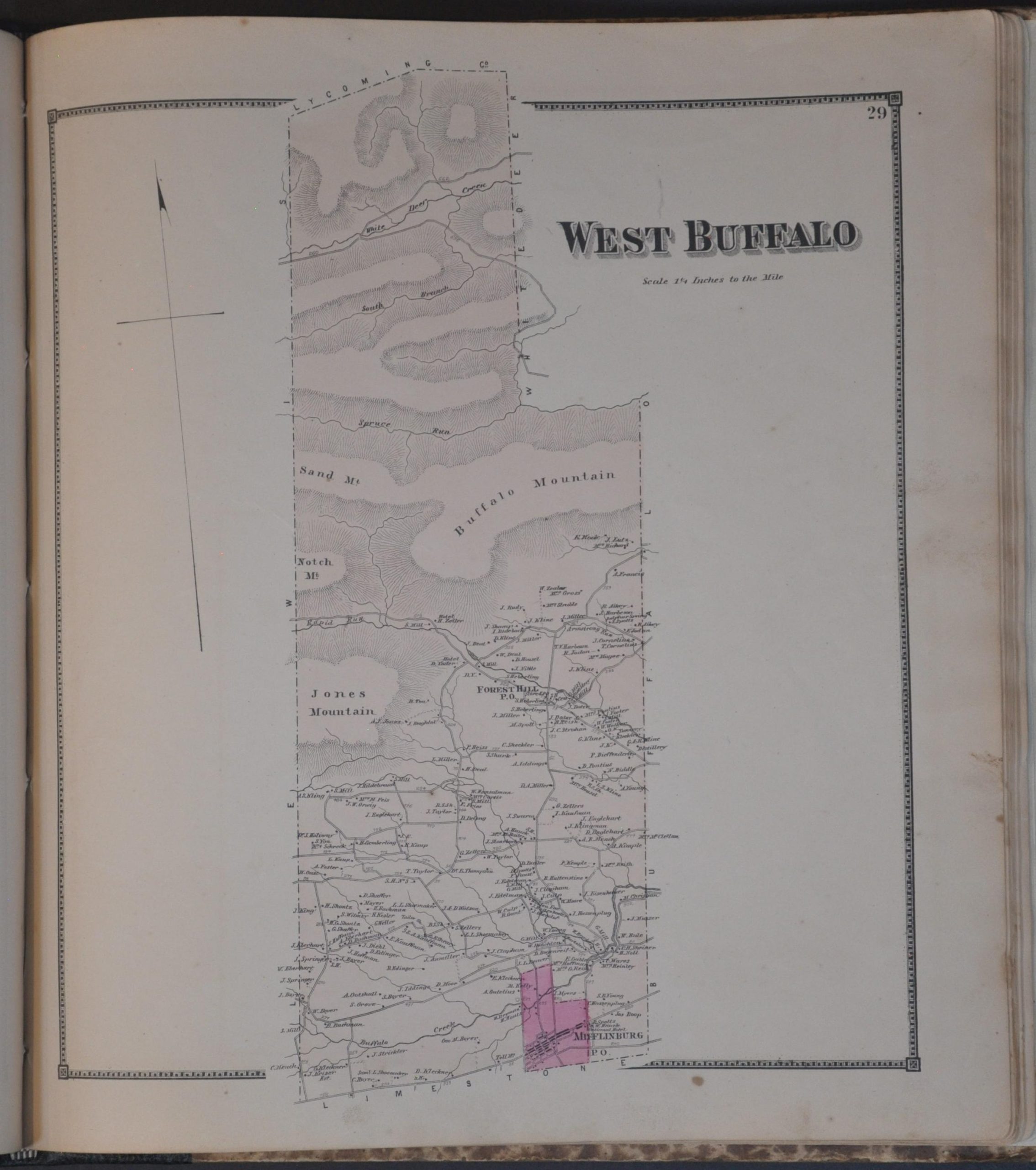
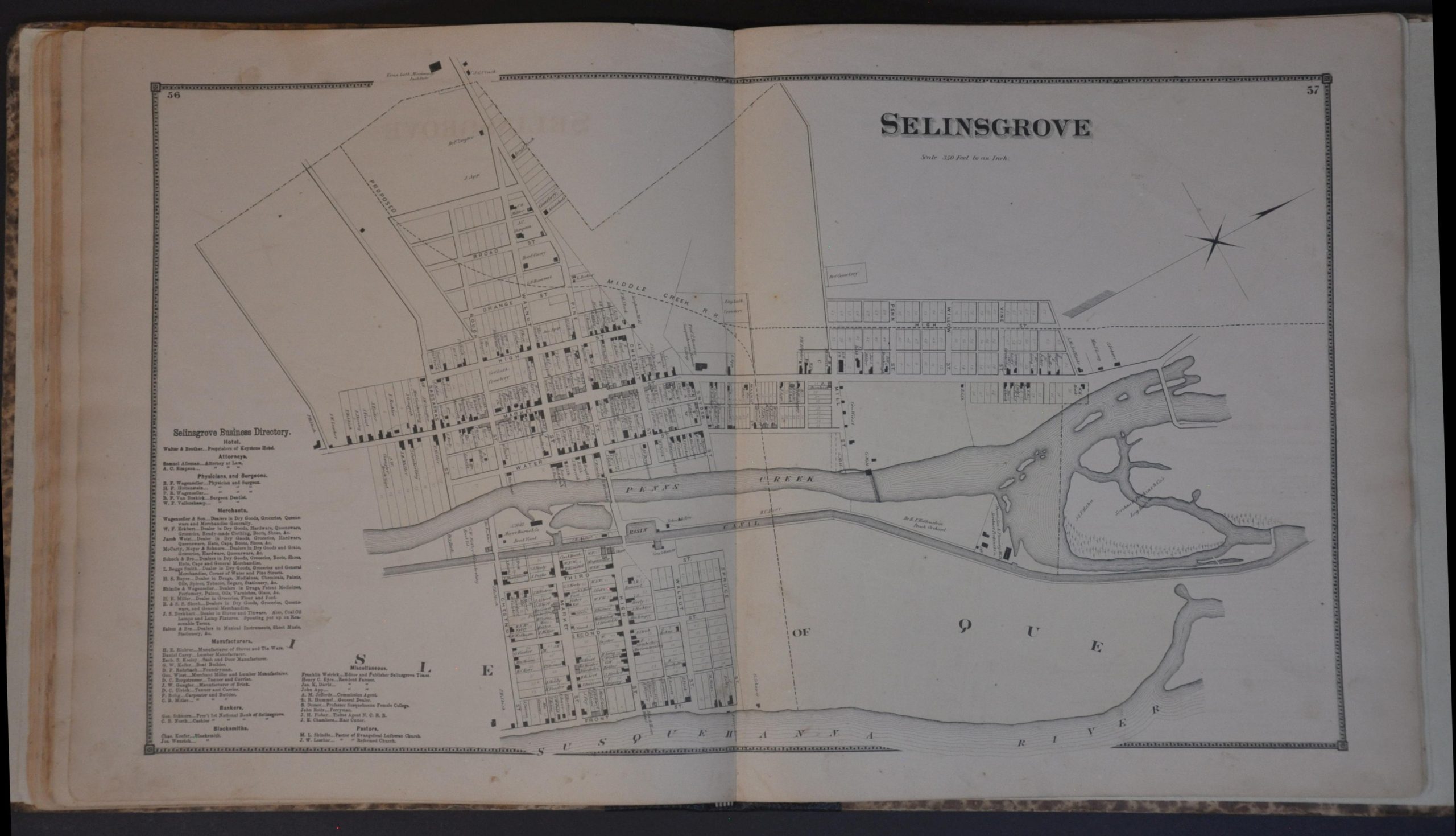
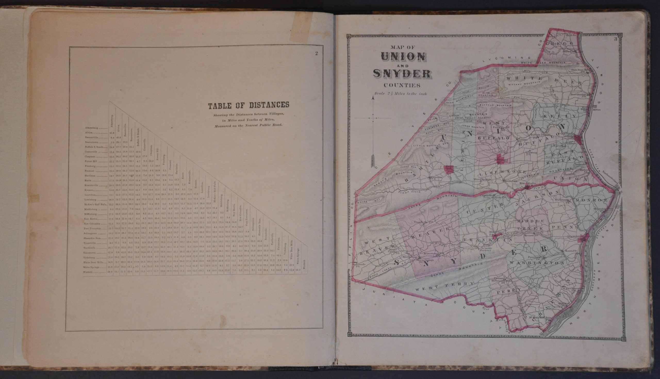
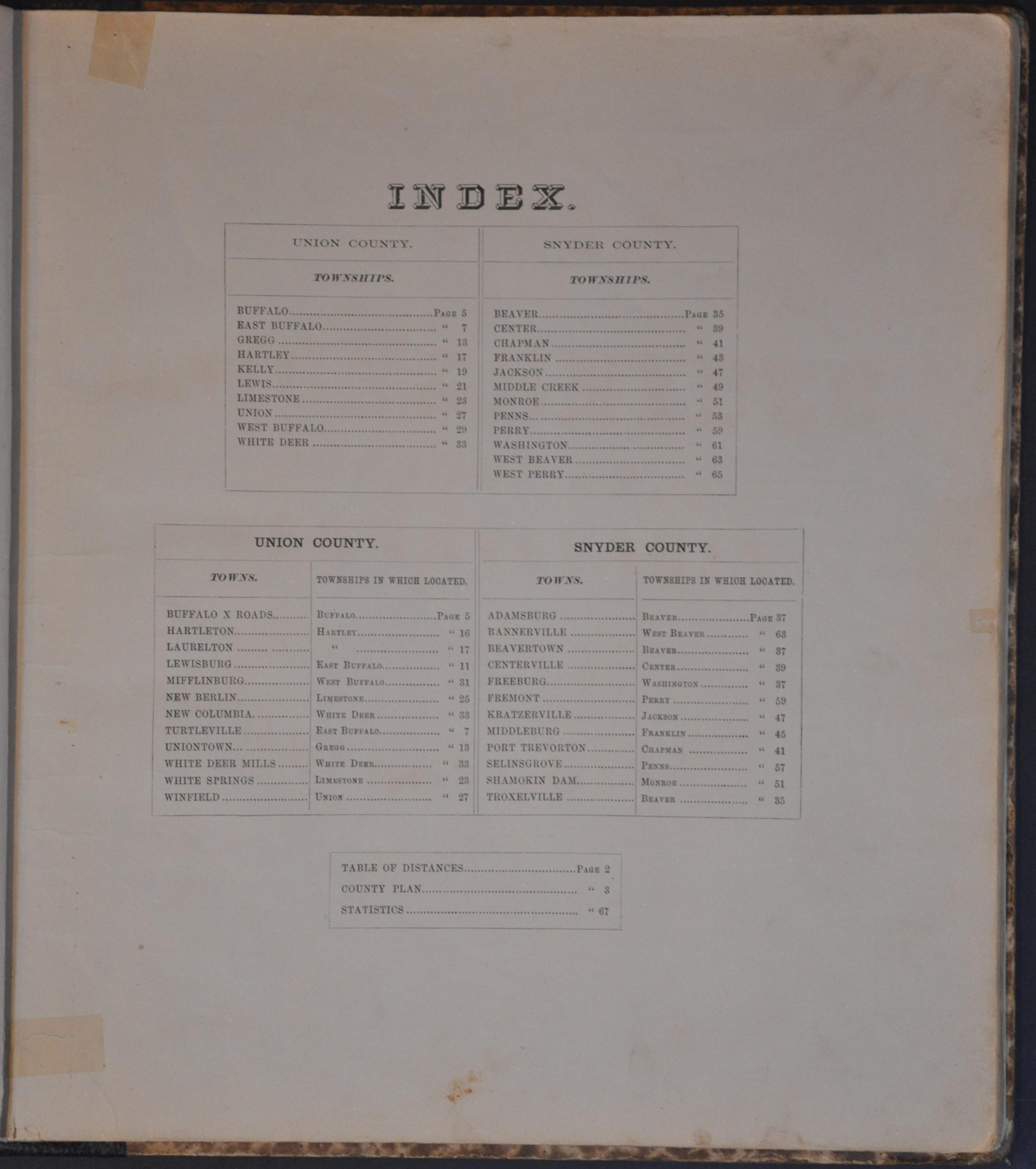
In the years following the Civil War, central Pennsylvania’s Union and Snyder Counties (split only in 1855) were functioning as a cohesive economic engine powered by the Susquehanna River and a rapidly expanding rail network. By the time this detailed atlas of the two counties was published, the region was moving away from its frontier origins and into a specialized industrial era. A Table of Distances and ‘Map of Union and Snyder Counties’ are followed by large-scale plans of each township and city. Often, insets will highlight the area around important crossroads or unincorporated communities. An incredible amount of information is provided, including the names of property owners, lists of local businesses, and the locations of specific buildings.
The volume was compiled from actual surveys under the direction of D.G. Beers. Published in Philadelphia in 1868 by Pomeroy & Beers. Engraved by Worly and Bracher, with printing by Frederick Bourquin. Beers created numerous county atlases during the 19th century. It was part of a large commercial industry that often sold the works on a subscription basis, allowing potential buyers to include self-portraits, views of their homes, and even prized animals (for an extra fee). These atlases are frequently the only surviving record of mid-19th-century land use outside of courthouse deeds.
Map Details
Publication Date: 1868
Author: D.G. Beers
Sheet Width (in): 14
Sheet Height (in): 15.75
Condition: B
Condition Description: Complete 67 pp. atlas (29 maps), expertly repaired with new endpapers and quarter leather spine, with original marbled cloth boards (somewhat ragged around the edges). Contents are generally in good condition, with soiled endpapers, old marginal repairs, and scattered foxing. Most of the soiling is concentrated in the margins, though some of the handcolored maps show spotting (most notably, Middleburgh and New Berlin).
$350.00
1 in stock