Atlas of the Hudson River Valley from New York to Troy
Interesting atlas showing land ownership along the banks of the Hudson River.
Out of stock


Description
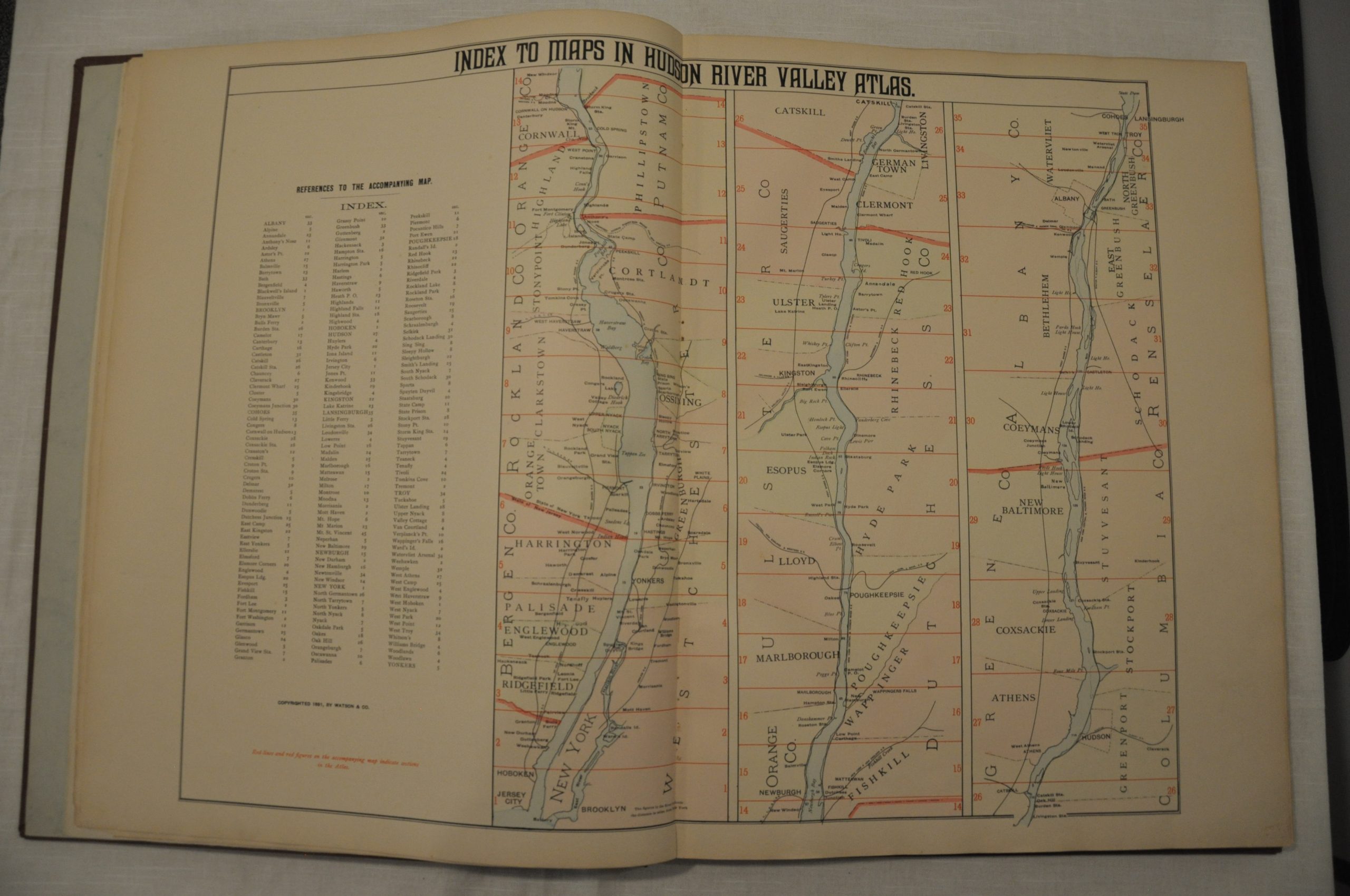
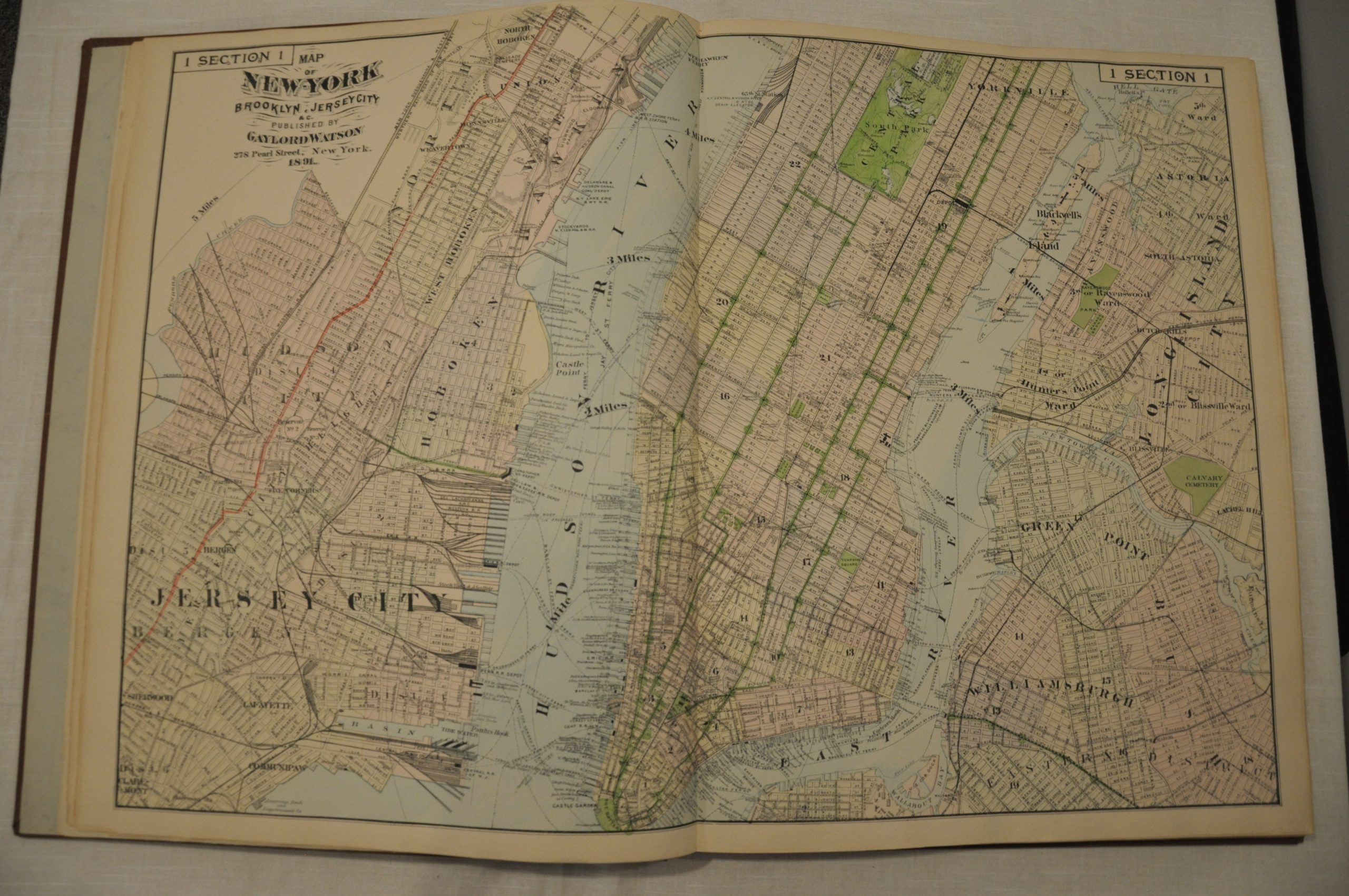
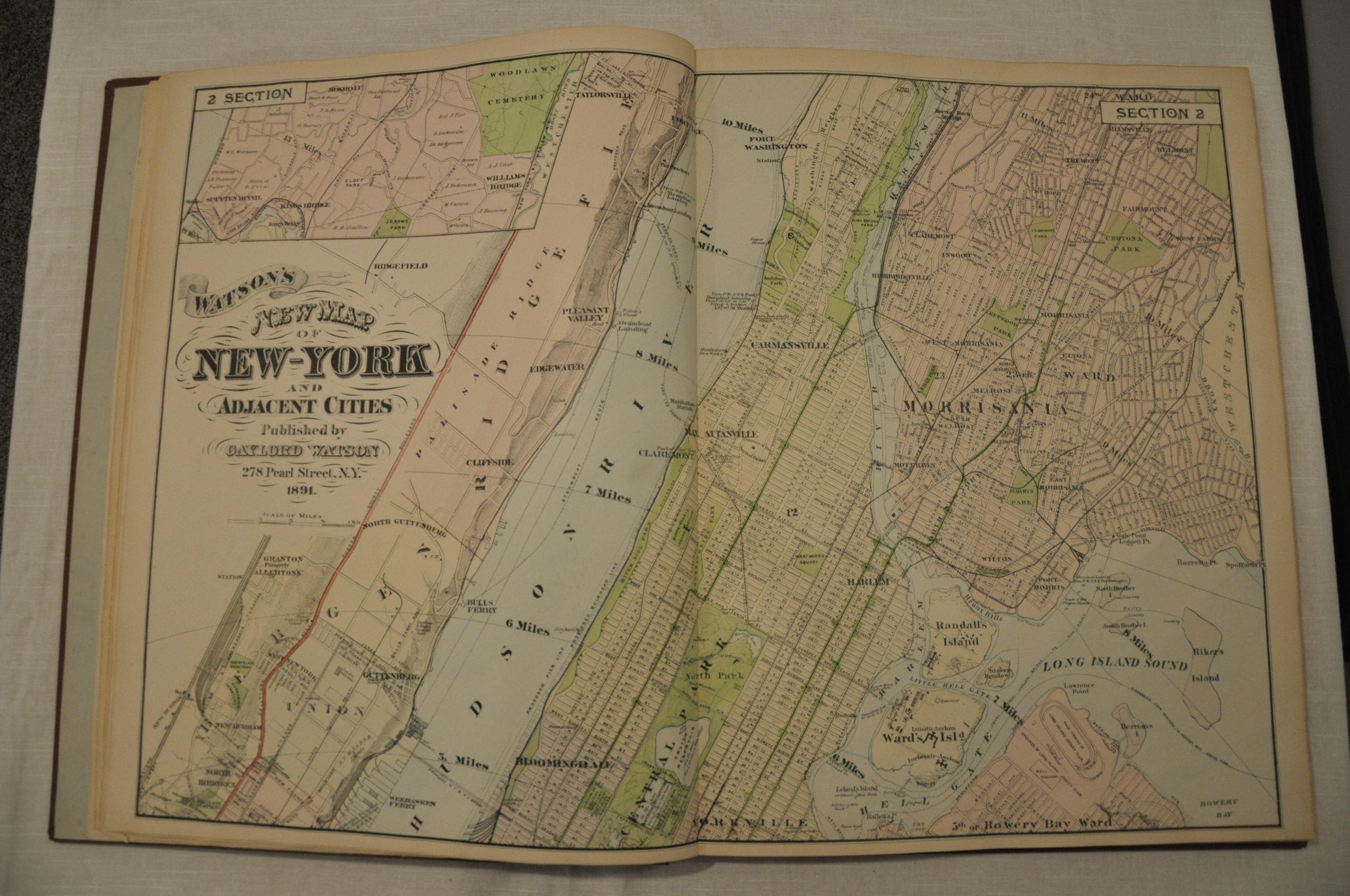
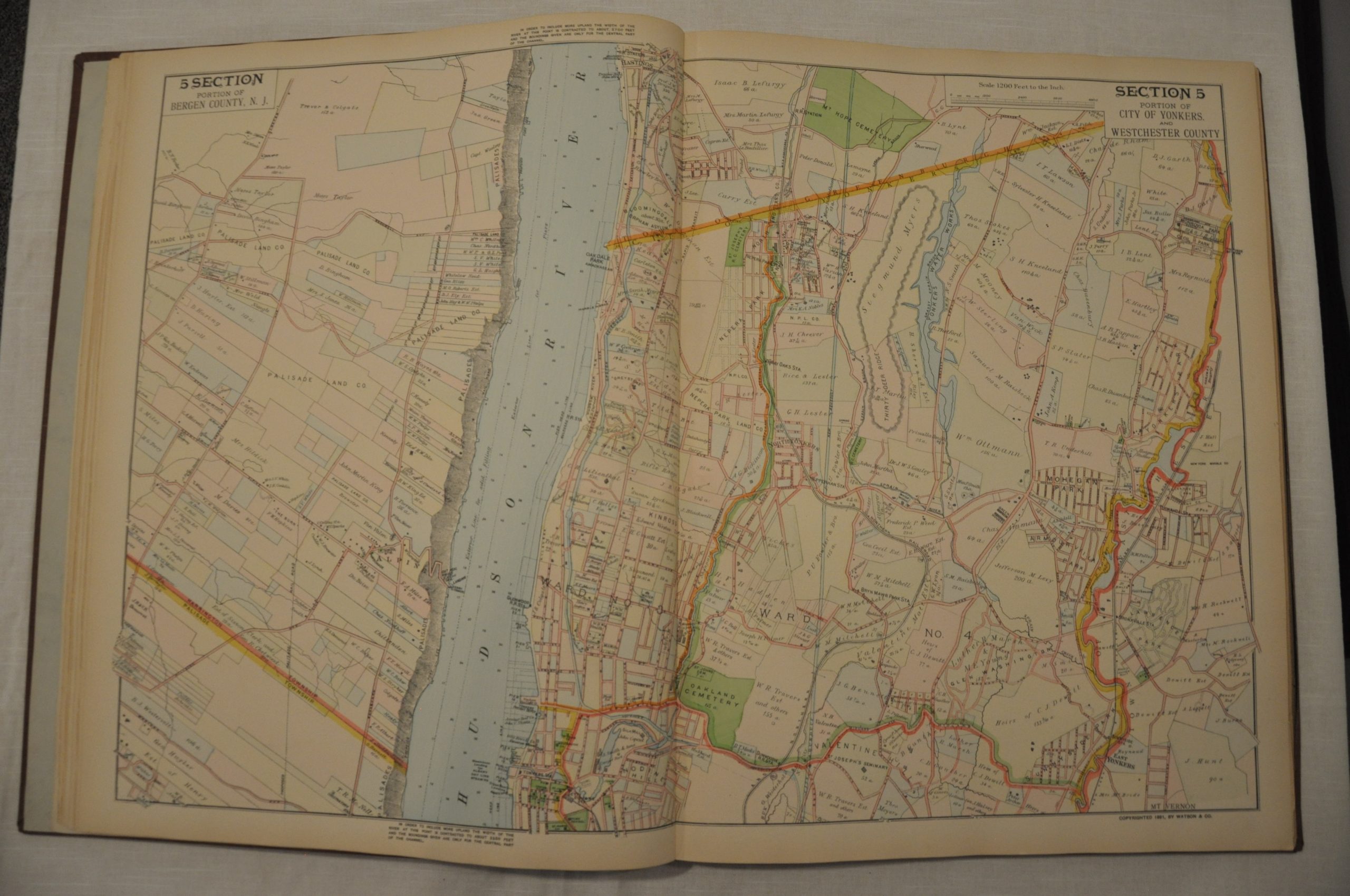
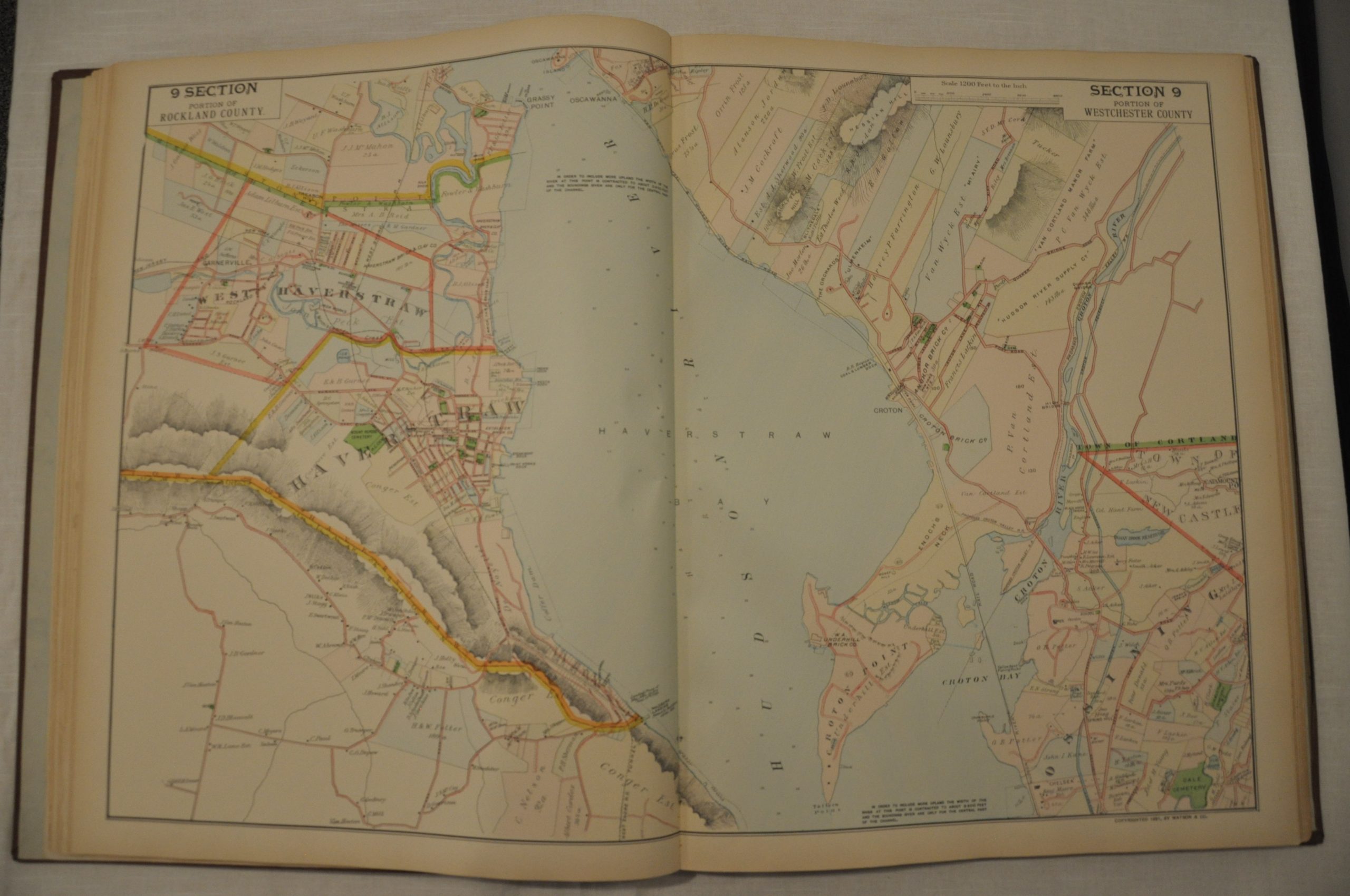
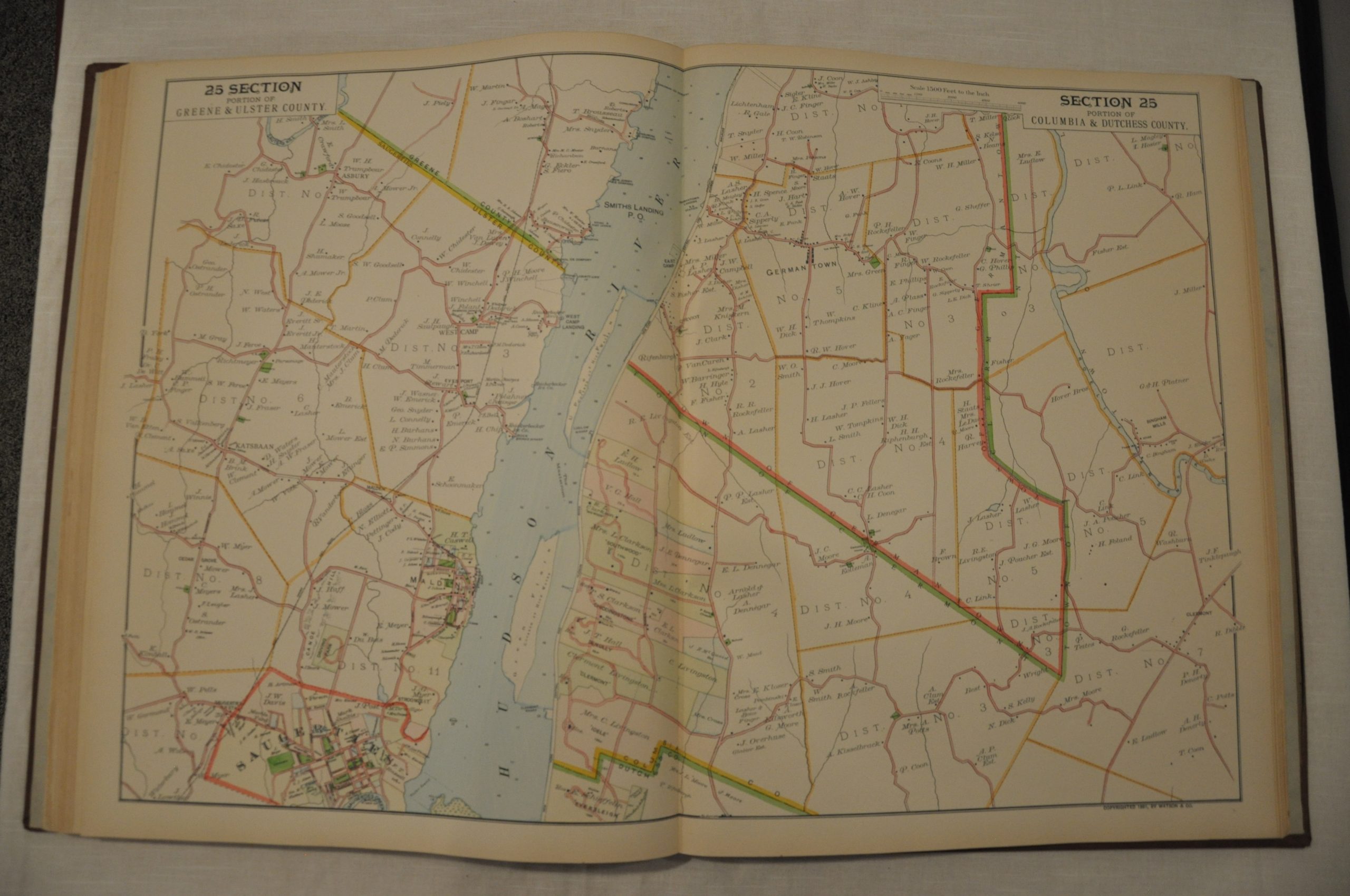
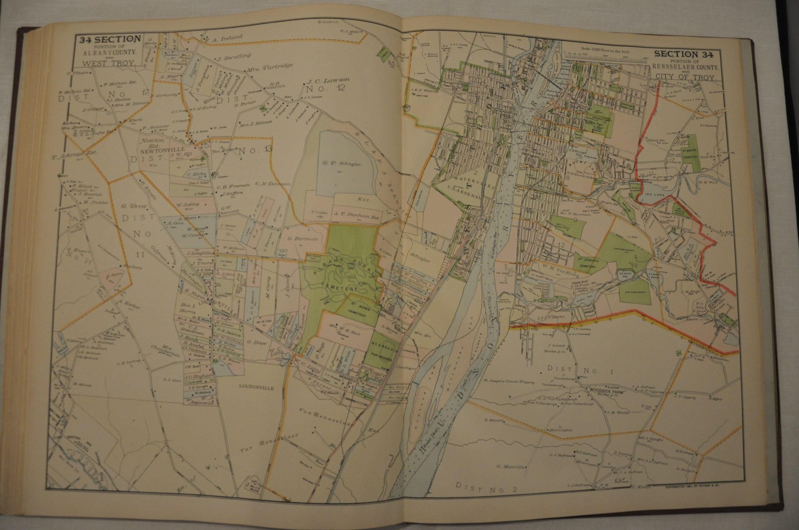
This fascinating atlas shows a section of land about 8 miles in width along the Hudson River Valley between New York City and Troy. An index map shows the organization of the following 35 double page maps, which are generally drawn to a scale of 1200 feet to the inch (with the exception of New York City).
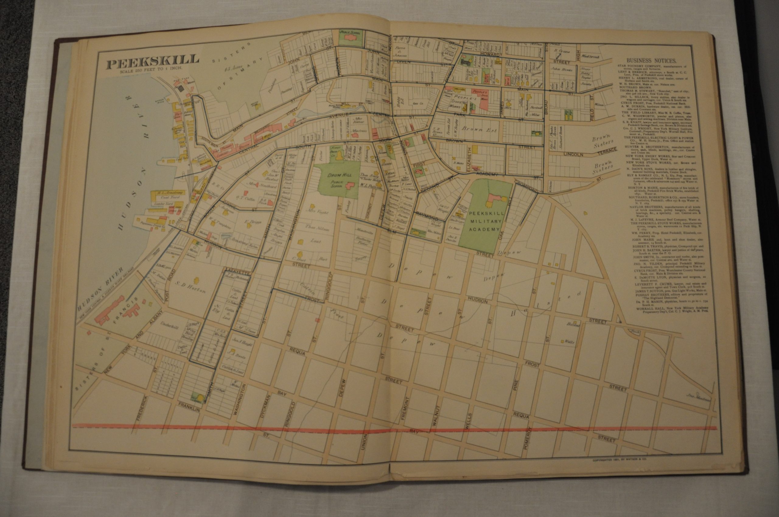
On each map, individual plots are shown in full color and labeled with size and owner. Transportation routes are noted and simple topographical detail is provide in hachure. In addition, there is a two sheet double folio city plan of Peekskill that was laid into the volume as a supplement.
Published in 1891 in New York by Watson & Co. Based on official government records and surveys conducted under the supervision of F.W. Beers. An interesting cartographic record of the ~150 mile trip along the Hudson.
Map Details
Publication Date: 1891
Author: Watson & Co.
Sheet Width (in): 16.25
Sheet Height (in): 20
Condition: A-
Condition Description: The atlas has been rebound in full brown cloth with original cover and title page (modern endpapers). The atlas is complete, with 38 double page color lithographed maps. Includes a rare supplemental city plan of Peekskill. A few small chips in the outer edges of 3-4 maps and very faint discoloration visible in the margins. Near fine condition overall.
Out of stock