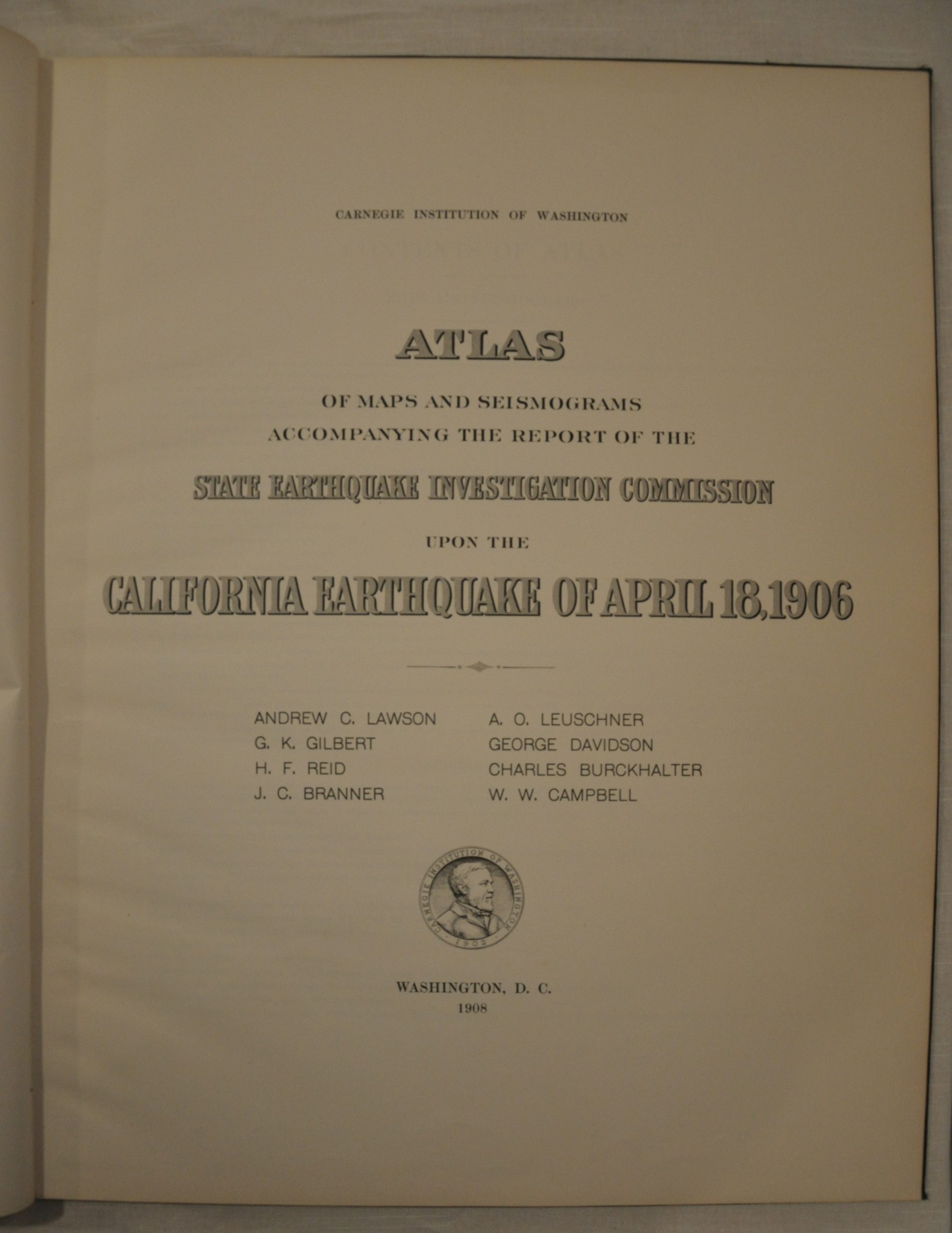
Atlas of Maps and Seismograms Accompanying the Report of the State Earthquake Investigation Commission upon the California Earthquake of April 18, 1906
$675.00
The most complete cartographic record of the 1906 earthquake that devastated San Francisco.


Description
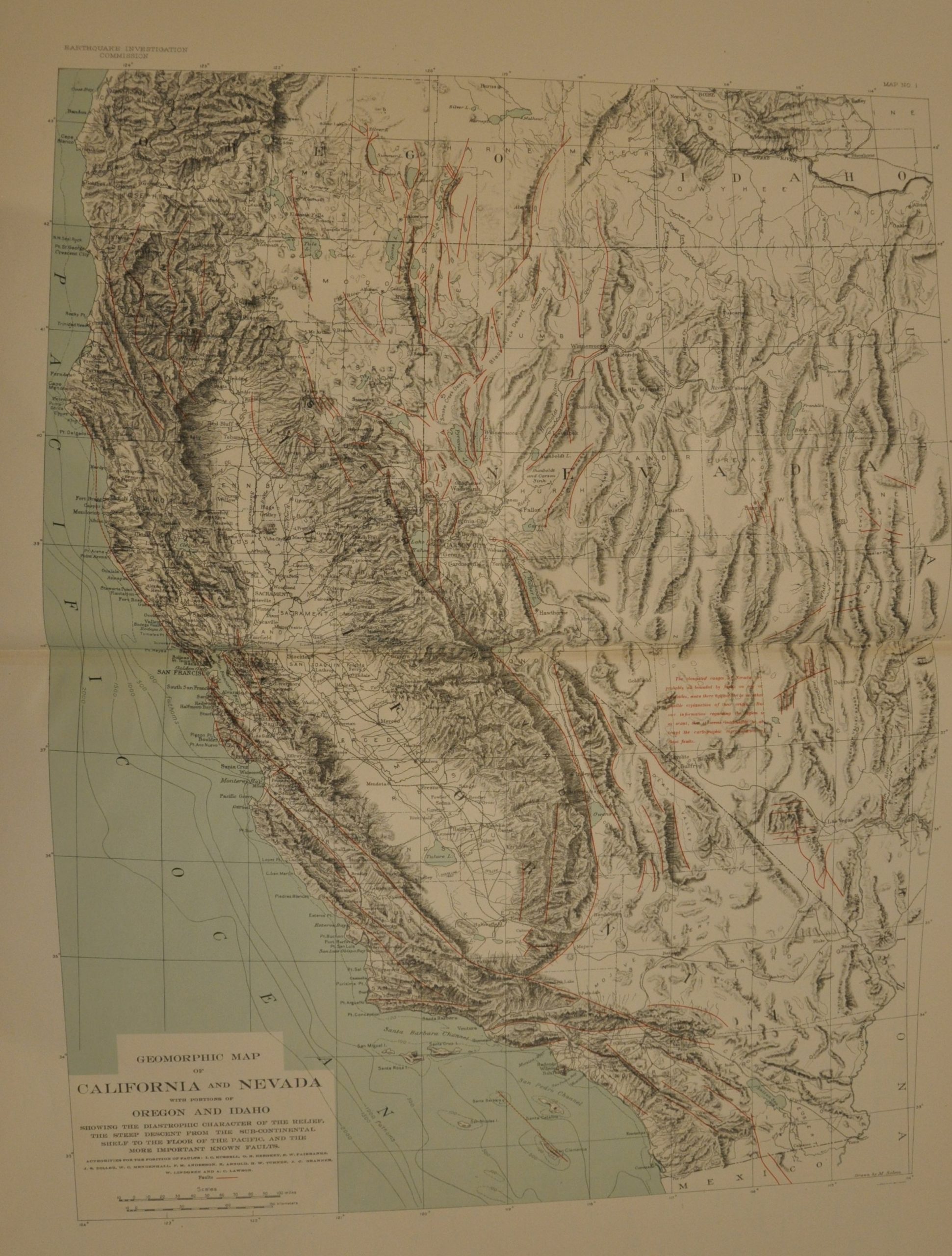
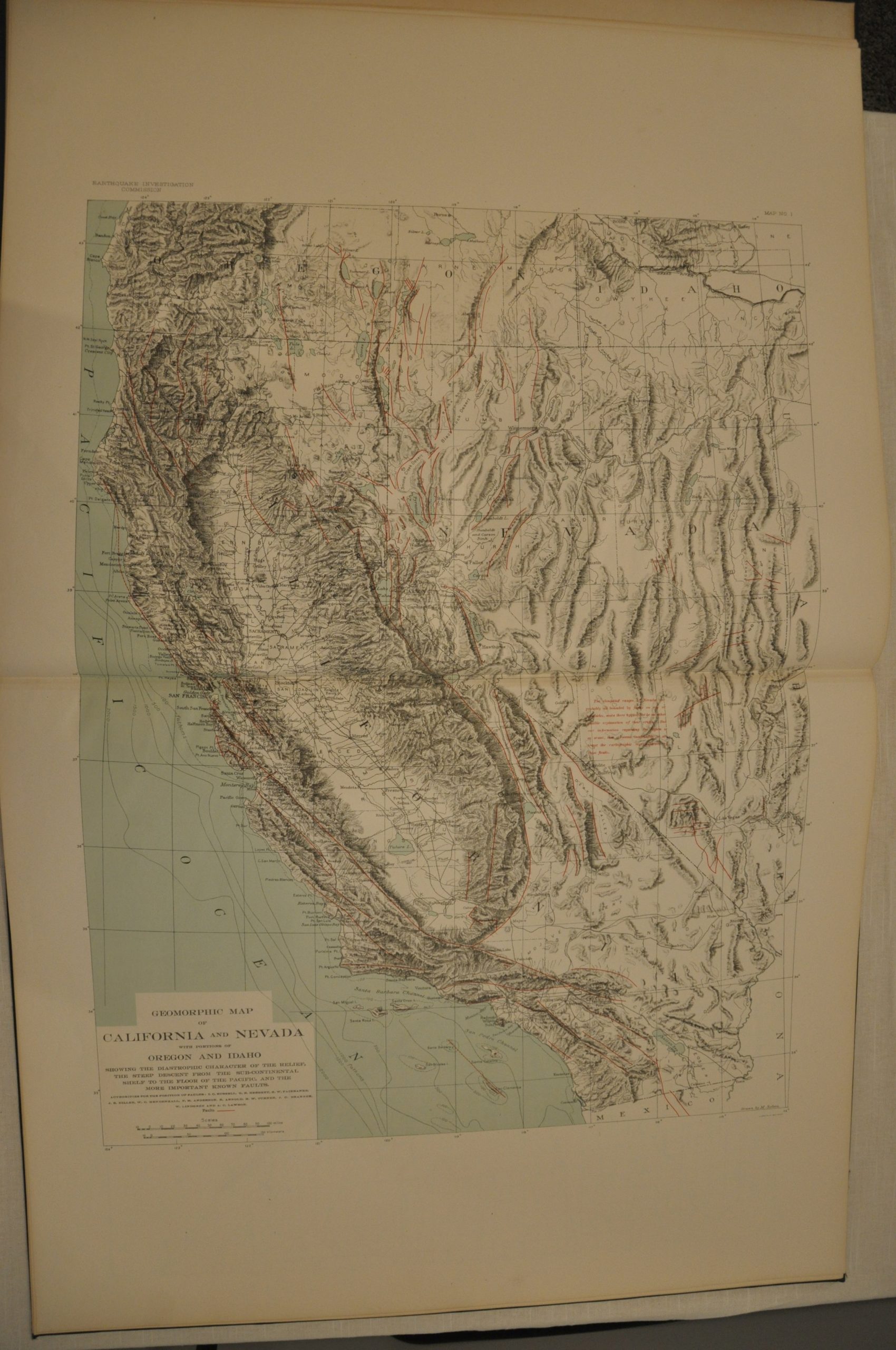
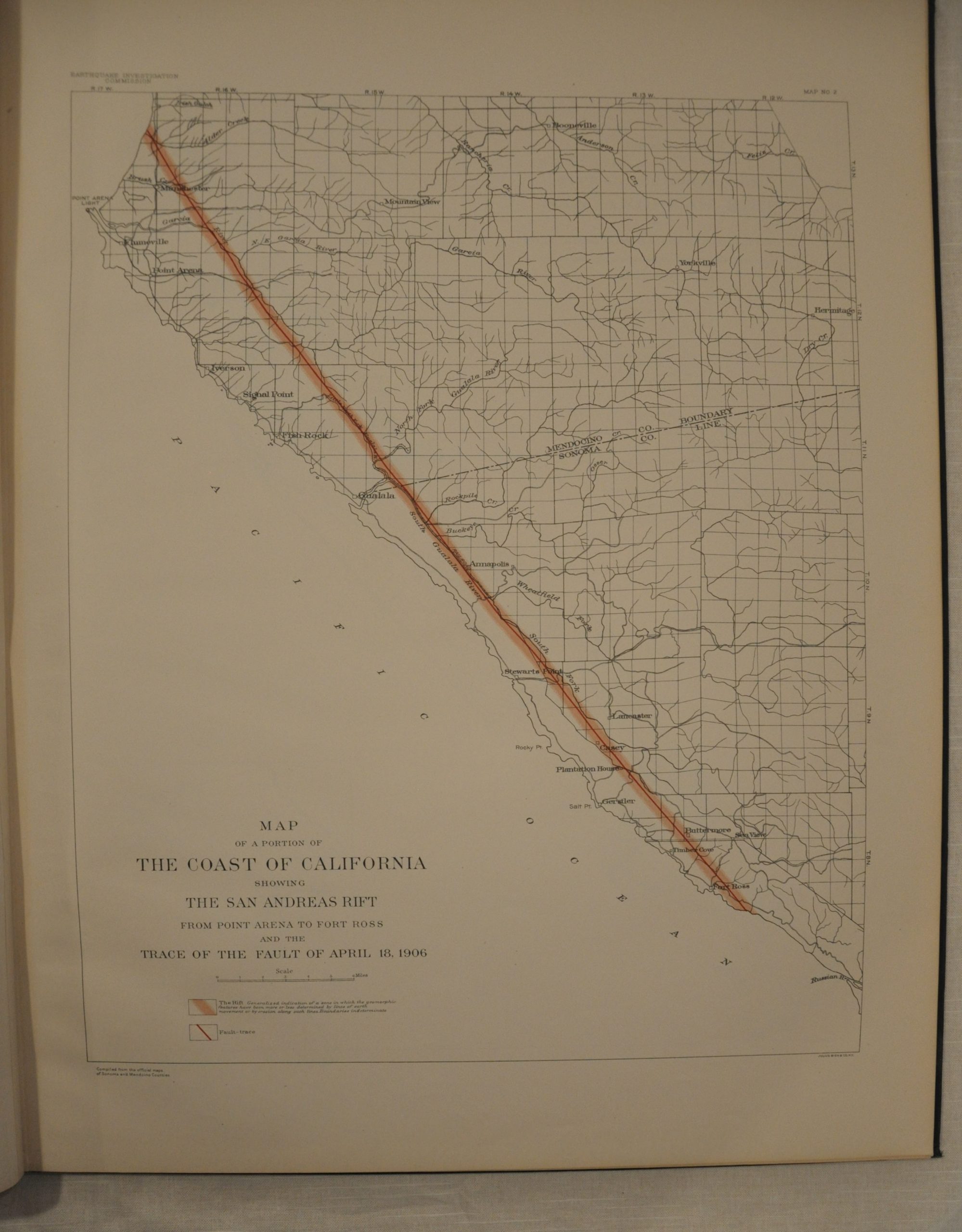
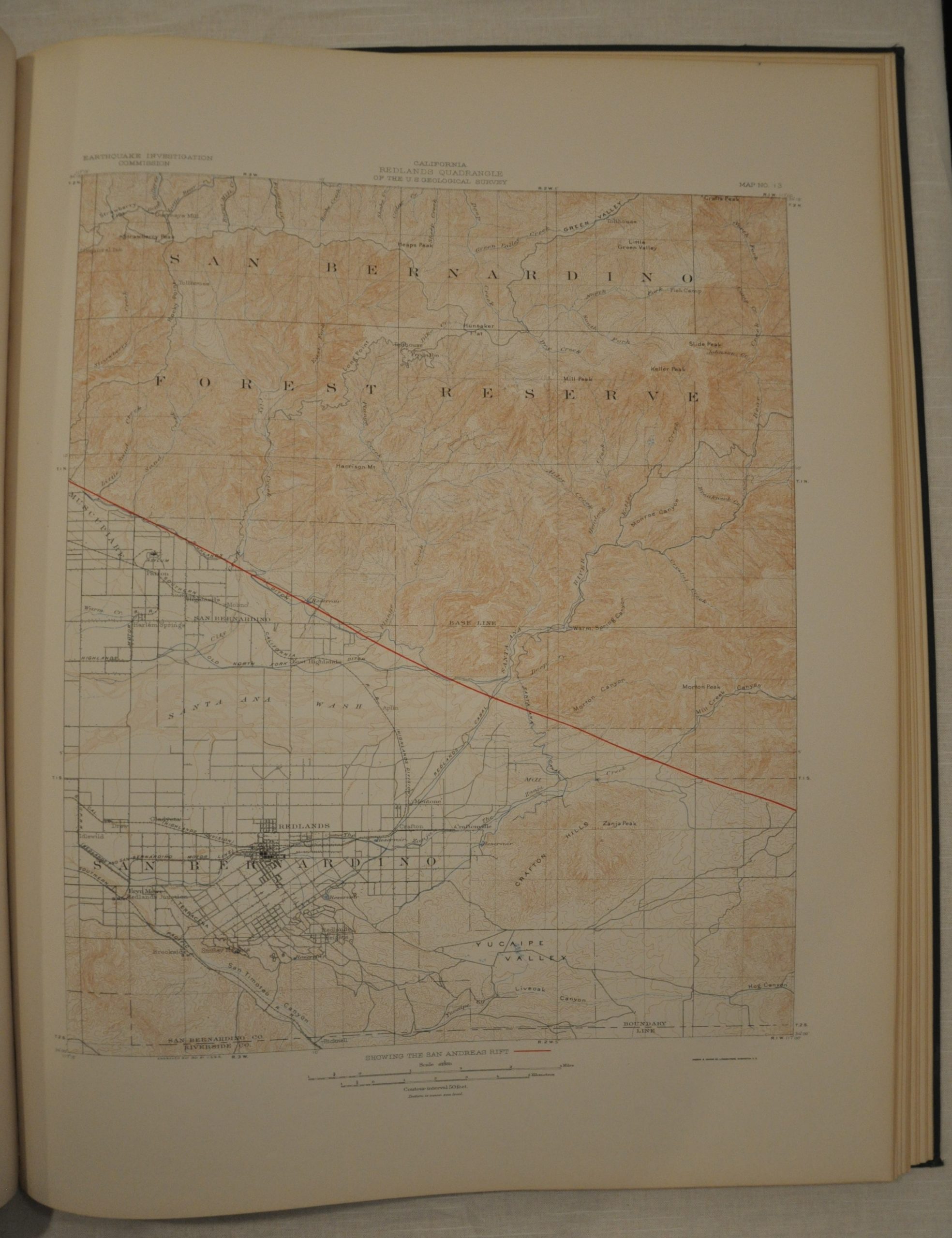
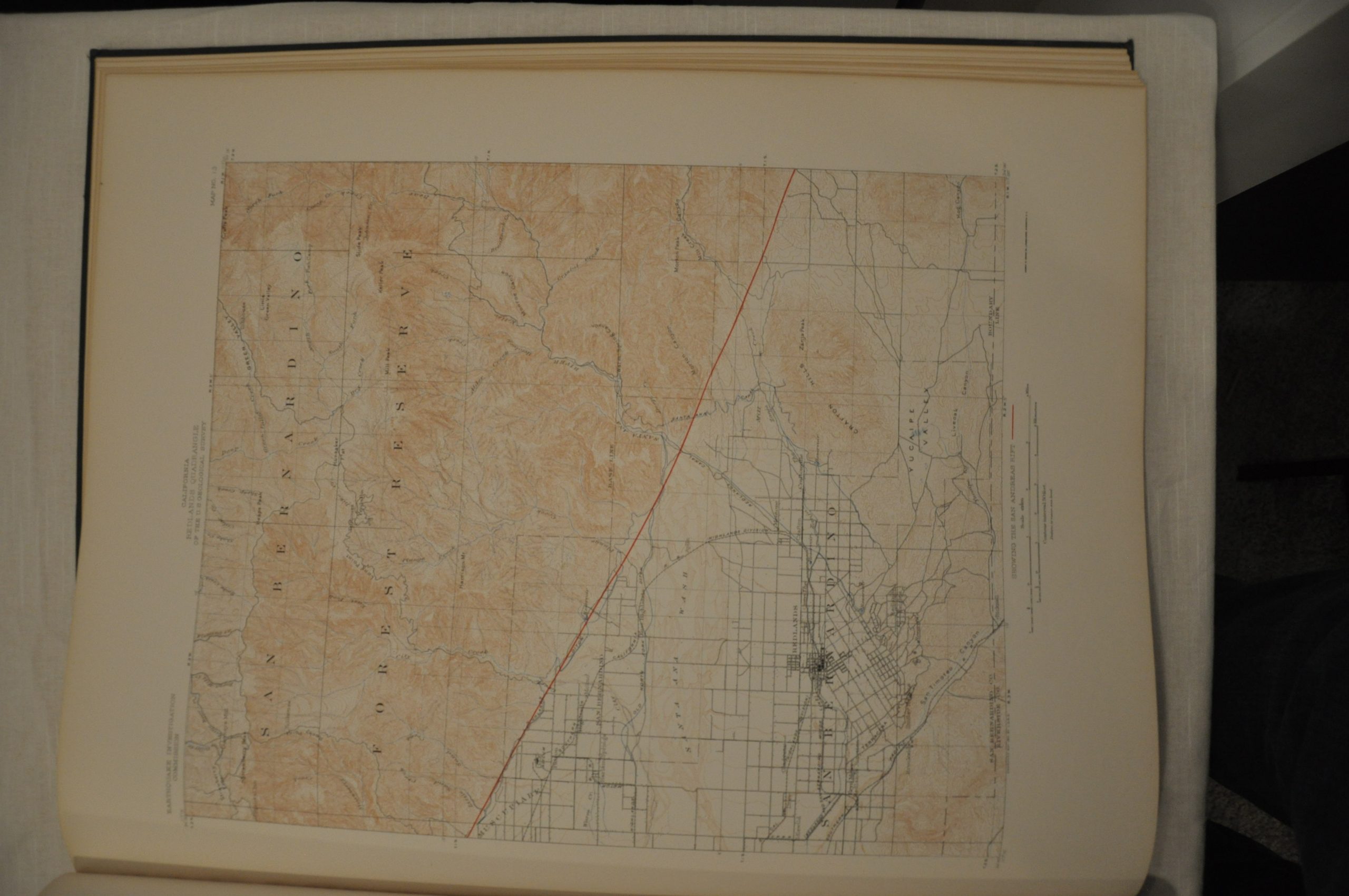
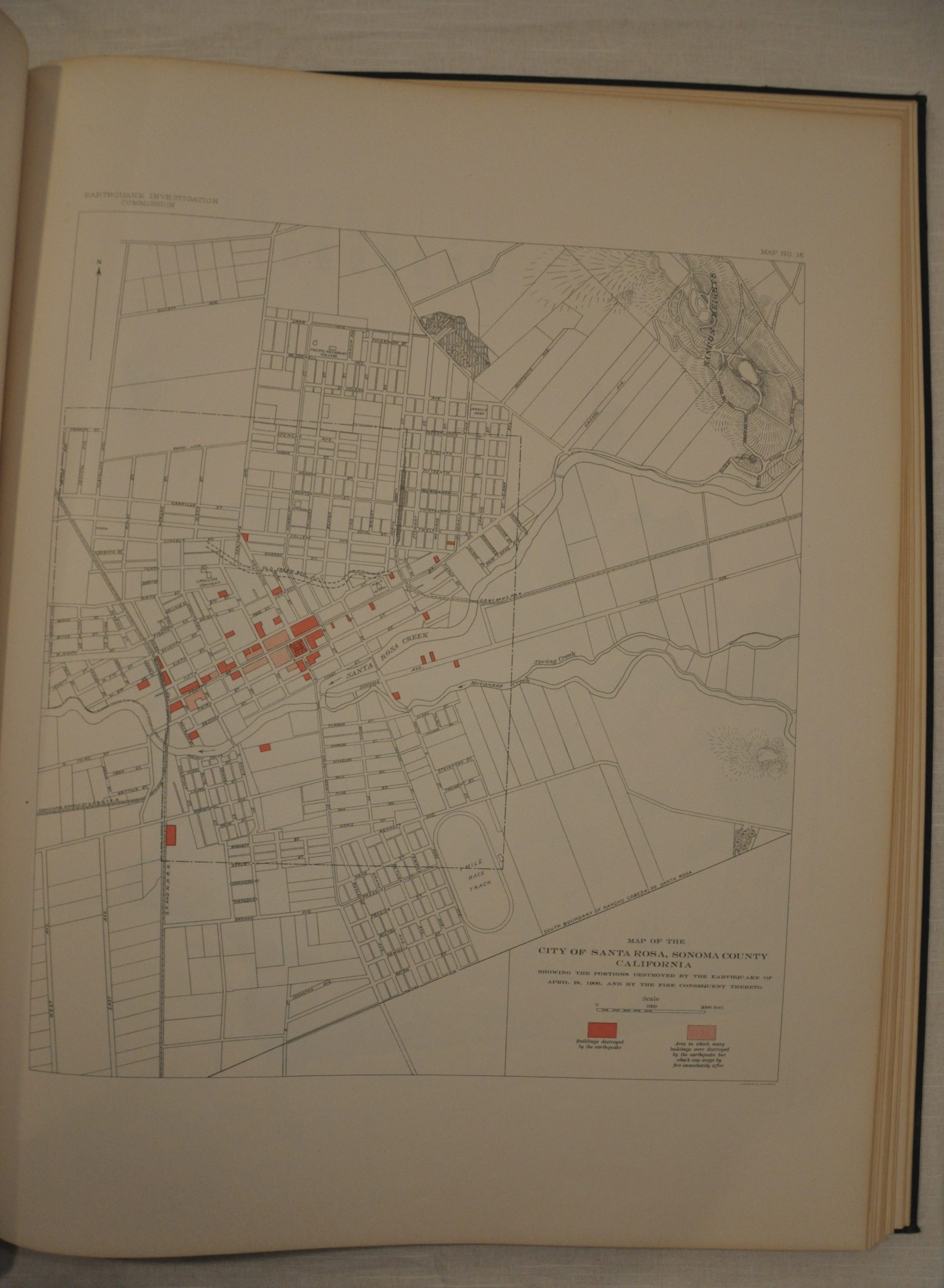
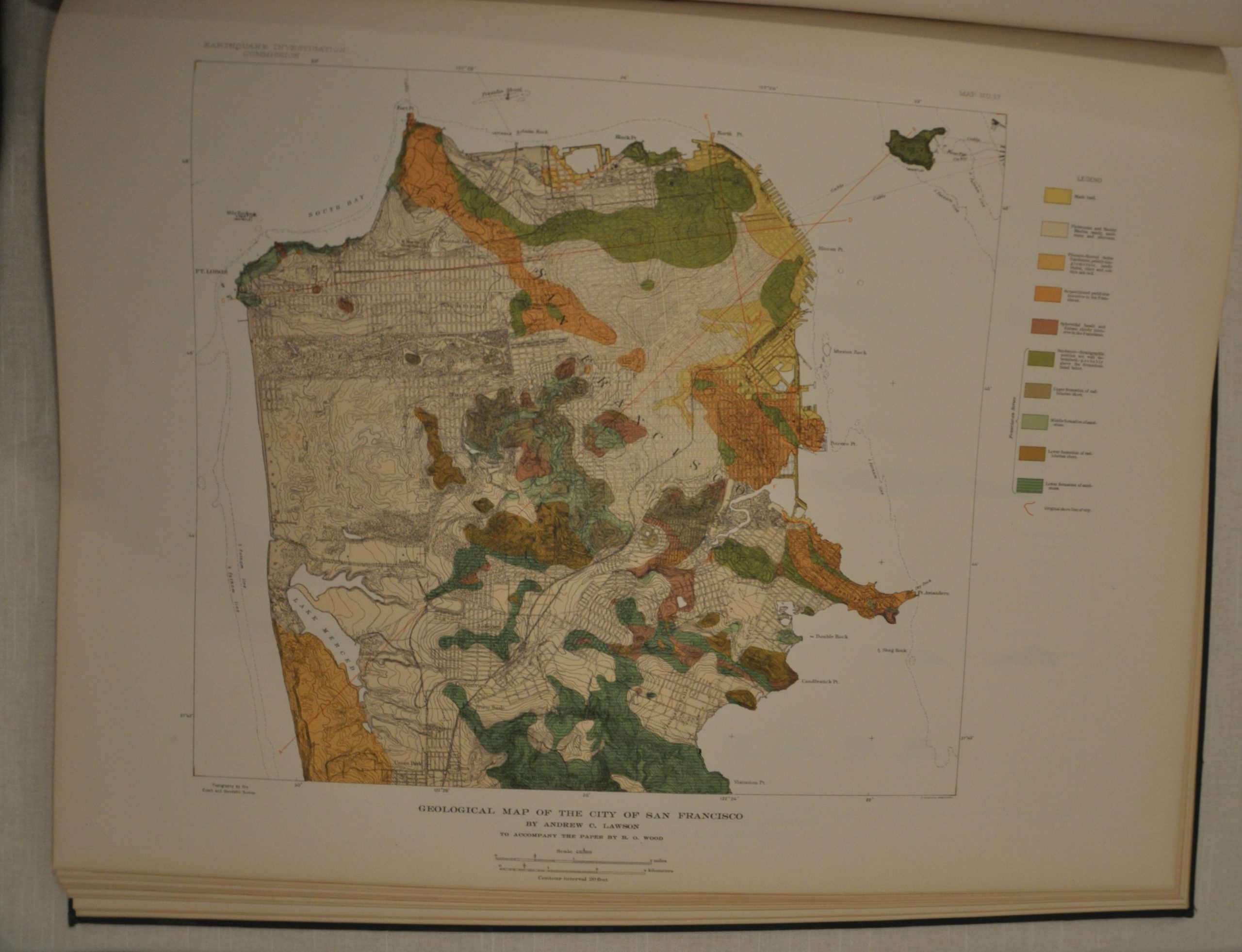
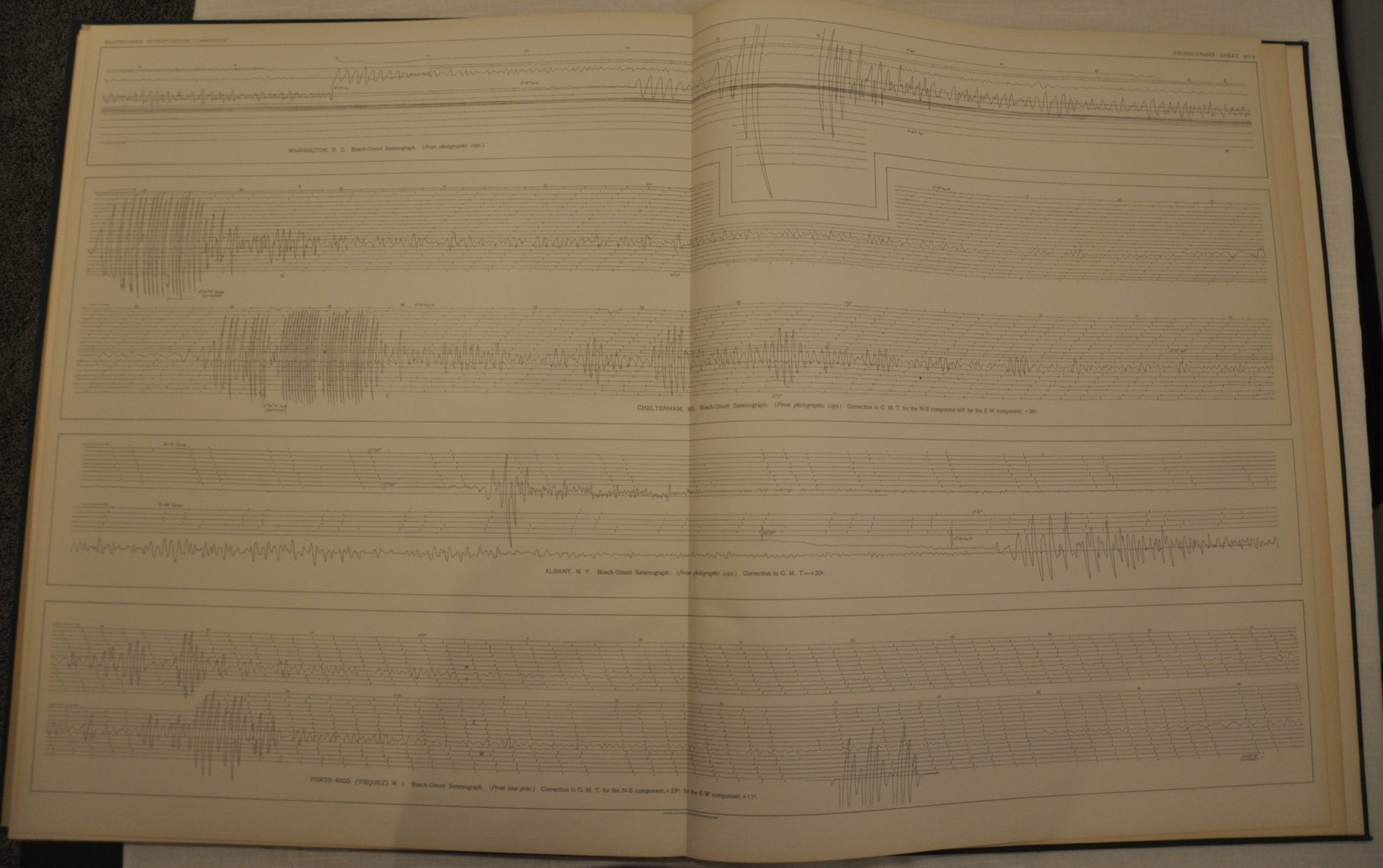
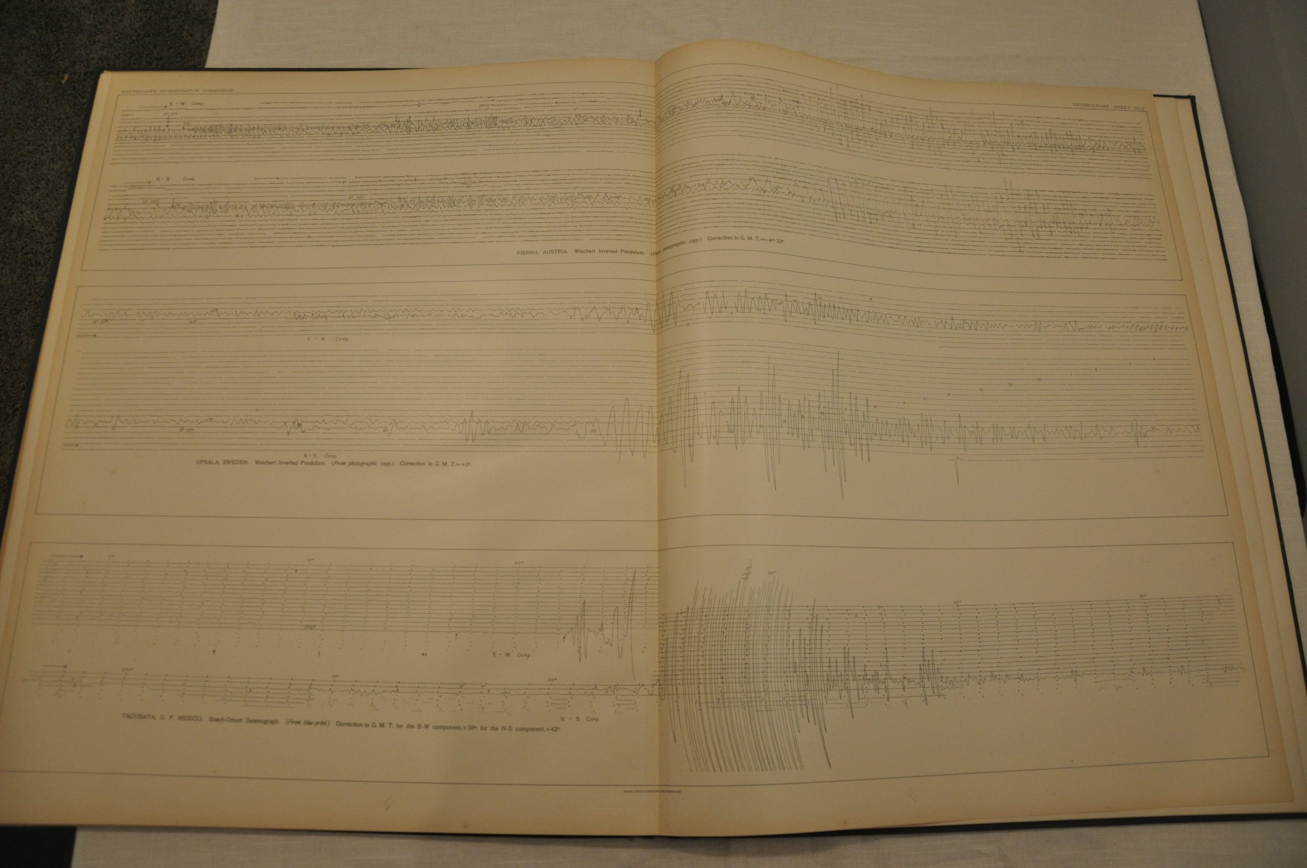
A mere three days after the tremendous earthquake and subsequent fire destroyed over 80% of San Francisco, California governor George Pardee called for a statewide commission to unify ongoing scientific research on seismology. The State Earthquake Investigation Commission was led by Professor Andrew Larson of U.C. Berkeley. It’s ultimate publication, issued in 1908 and now known as the Lawson Report, is an incredible compilation of scientific endeavors from more than 20 contributors to the field. According to the U.S.G.S., it remains “arguably the most important study of a single earthquake.” This atlas was published by the Carnegie Institution of Washington to accompany the Lawson Report, and includes a comprehensive overview of the geology and topography of the region. It includes 25 maps which show the San Andreas fault charted through California, city plans of San Francisco, and area maps of earthquake intensity. The atlas also contains 15 seismogram profiles taken from various recording devices in cities around the world – highlighting both the global and local impacts of the quake which is estimated to have reached an incredible 7.9 on the Richter scale.
Map Details
Publication Date: 1908
Author: Carnegie Institution of Washington
Sheet Width (in): 19
Sheet Height (in): 24
Condition: A-
Condition Description: The bottom of the spine is coming loose and separating from the endpaper. Ex-library stamp. Faint offsetting from the title page and minor wear on the cover are the only other defects in this otherwise pristine atlas. Includes 25 lithographed maps and 15 seismograms on strong paper, most in bold color.
$675.00