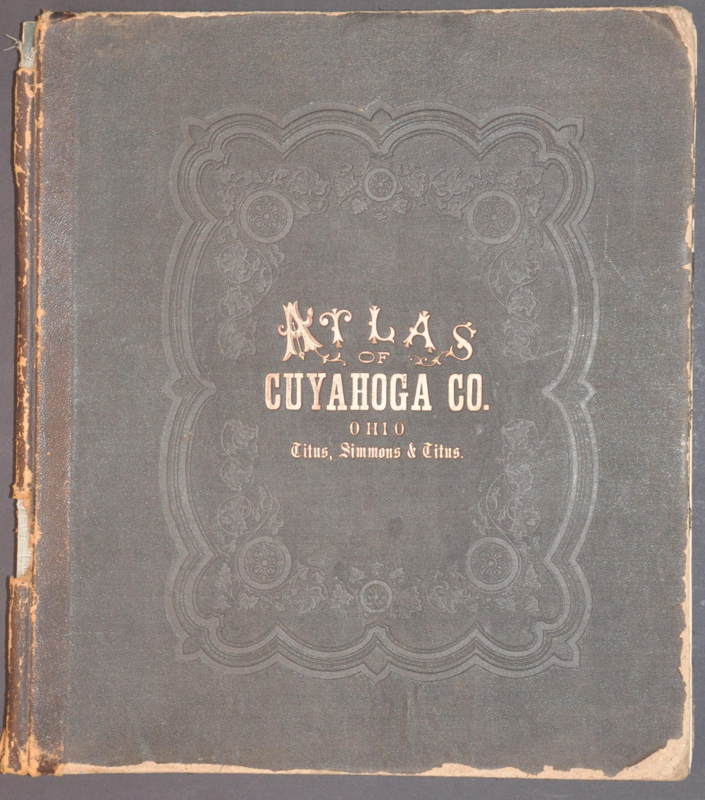
Atlas of Cuyahoga County Ohio
An incredible snapshot of Cleveland published shortly before the city’s centennial.
Out of stock


Description
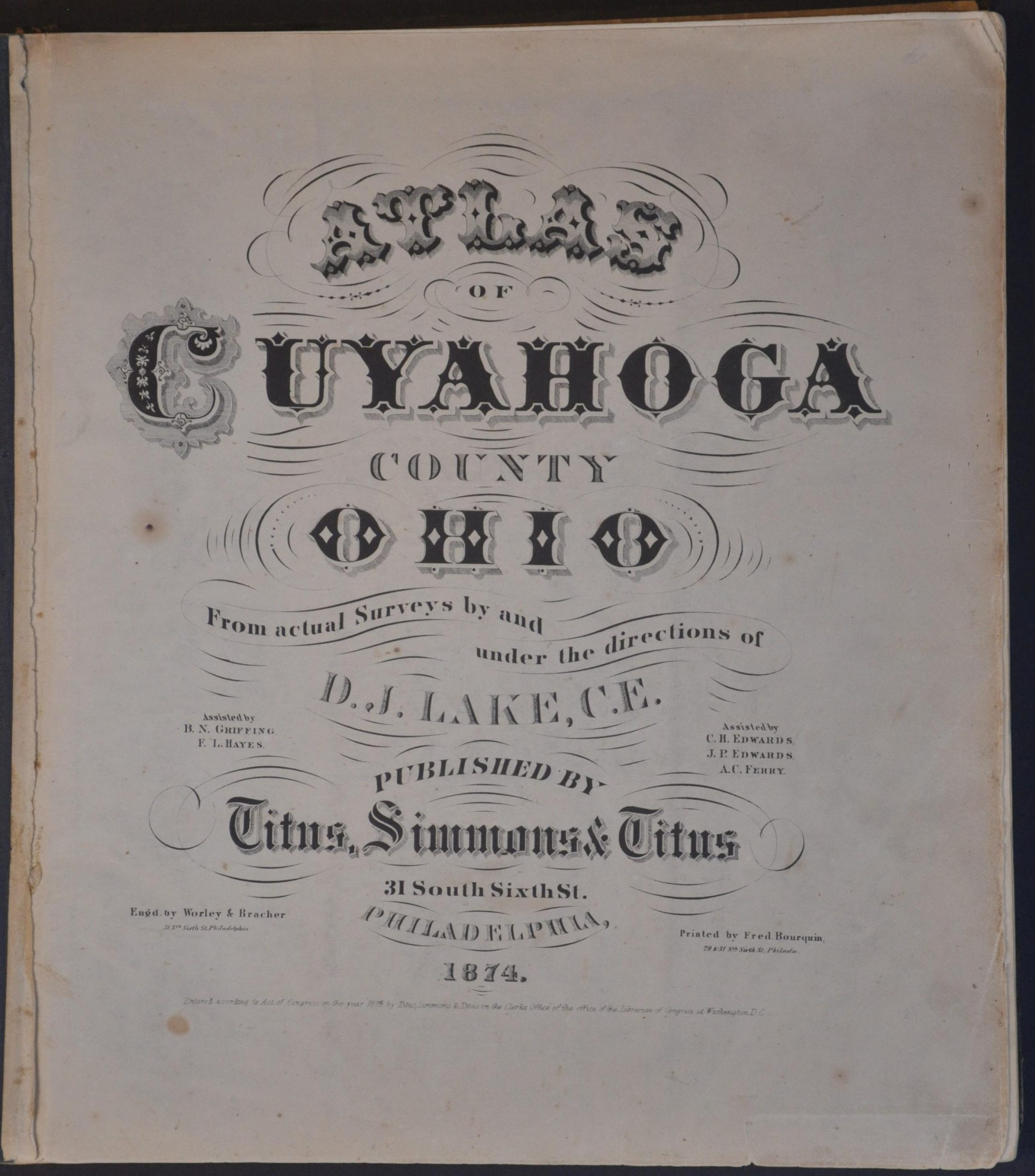
This magnificent atlas of Cuyahoga County, Ohio was published in Philadelphia in 1874 by Titus, Simmons & Titus, using maps drafted under the supervision of D.J. Lake. Its 200+ pages provide a wealth of contemporary information on Cleveland and the surrounding area at a time of tremendous industrial and population growth.
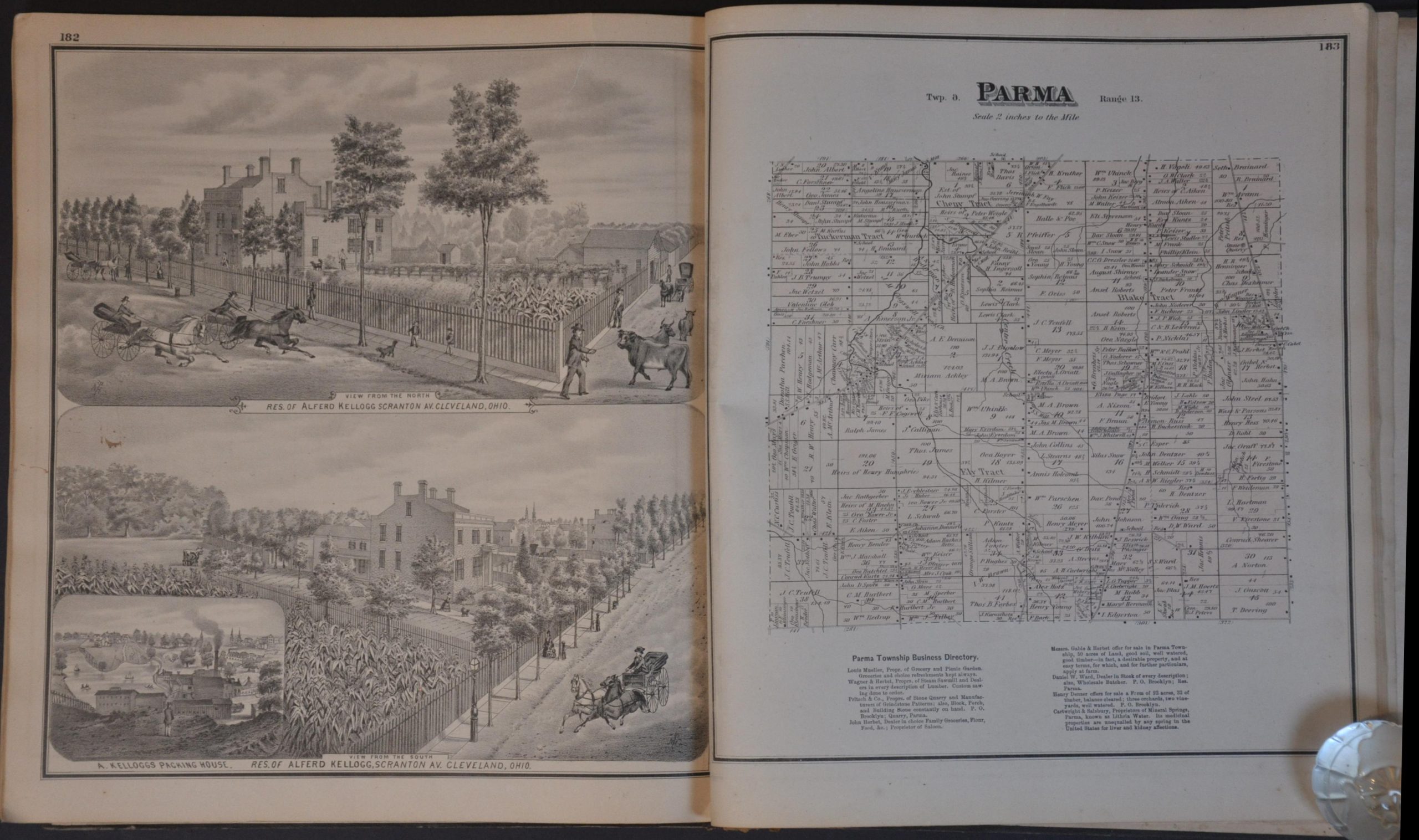
Strategically situated on the Ohio River, the city was a major transportation hub and production center for the Union Army – a status that it maintained and improved upon in the postwar years. Dozens of maps and steel plate engravings provide intimate details on the composition of Cuyahoga County, with a particular emphasis on its wealthy residents and local businesses.
This tendency was intentional, as it’s likely the atlas was published on a subscription basis in order to defray the substantial production costs – a common occurrence in 19th-century county atlases. For a set fee, subscribers could pay the publishers to include a view of their home, business, or even prized farm animals! Highlights of the atlas include:
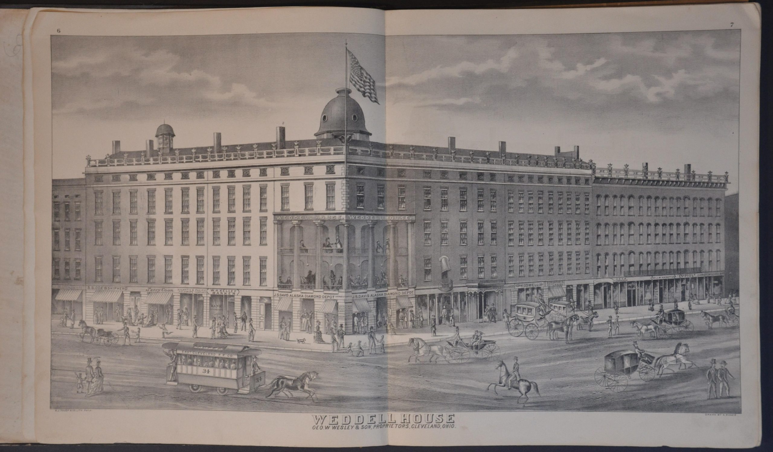
- Beautiful double-page view of the Weddell House, Cleveland’s most famous 19th-century hotel
- Large folding outline plan of Cleveland
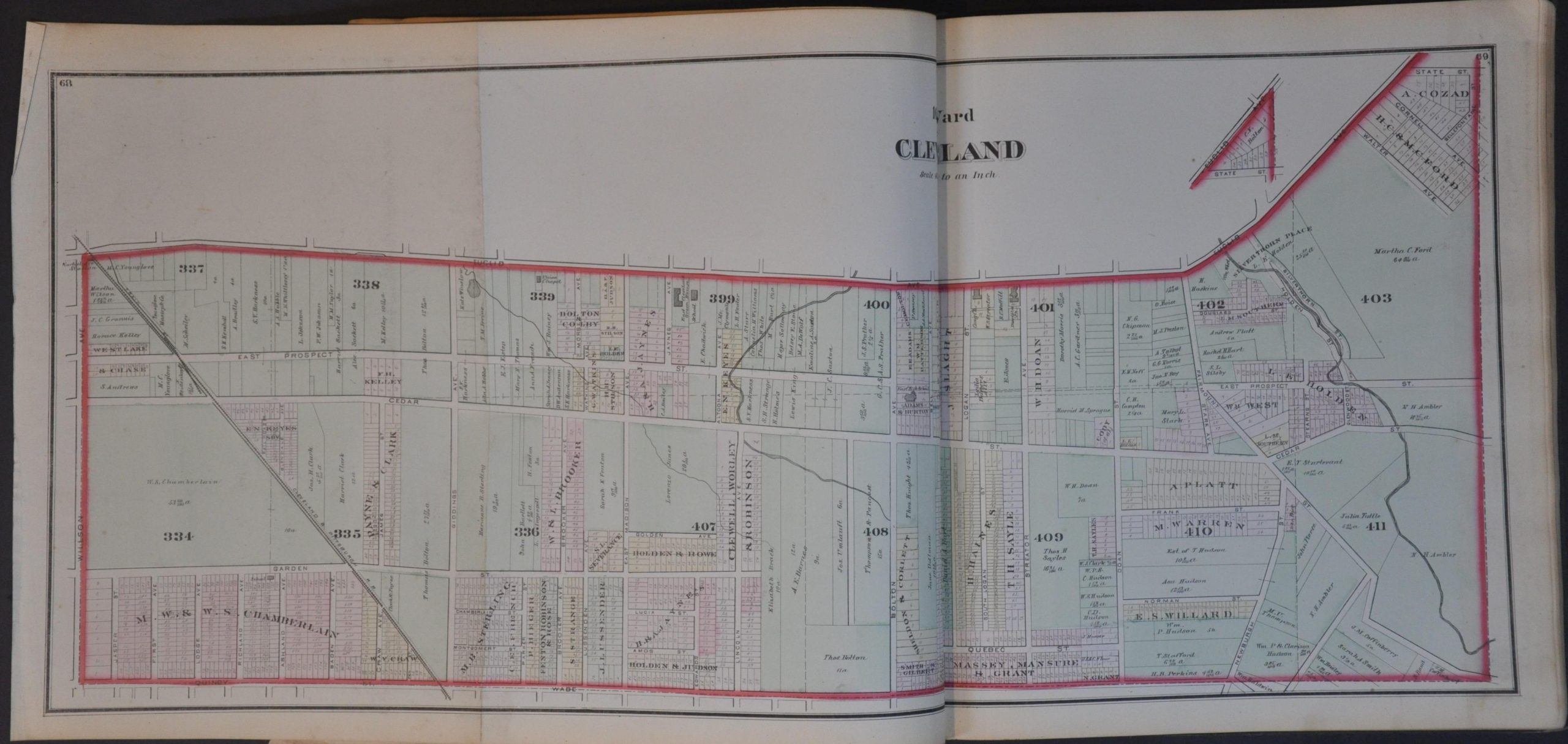
- Detailed maps of all of Cleveland’s wards, including several fold-outs
- Numerous views of prominent homes and businesses
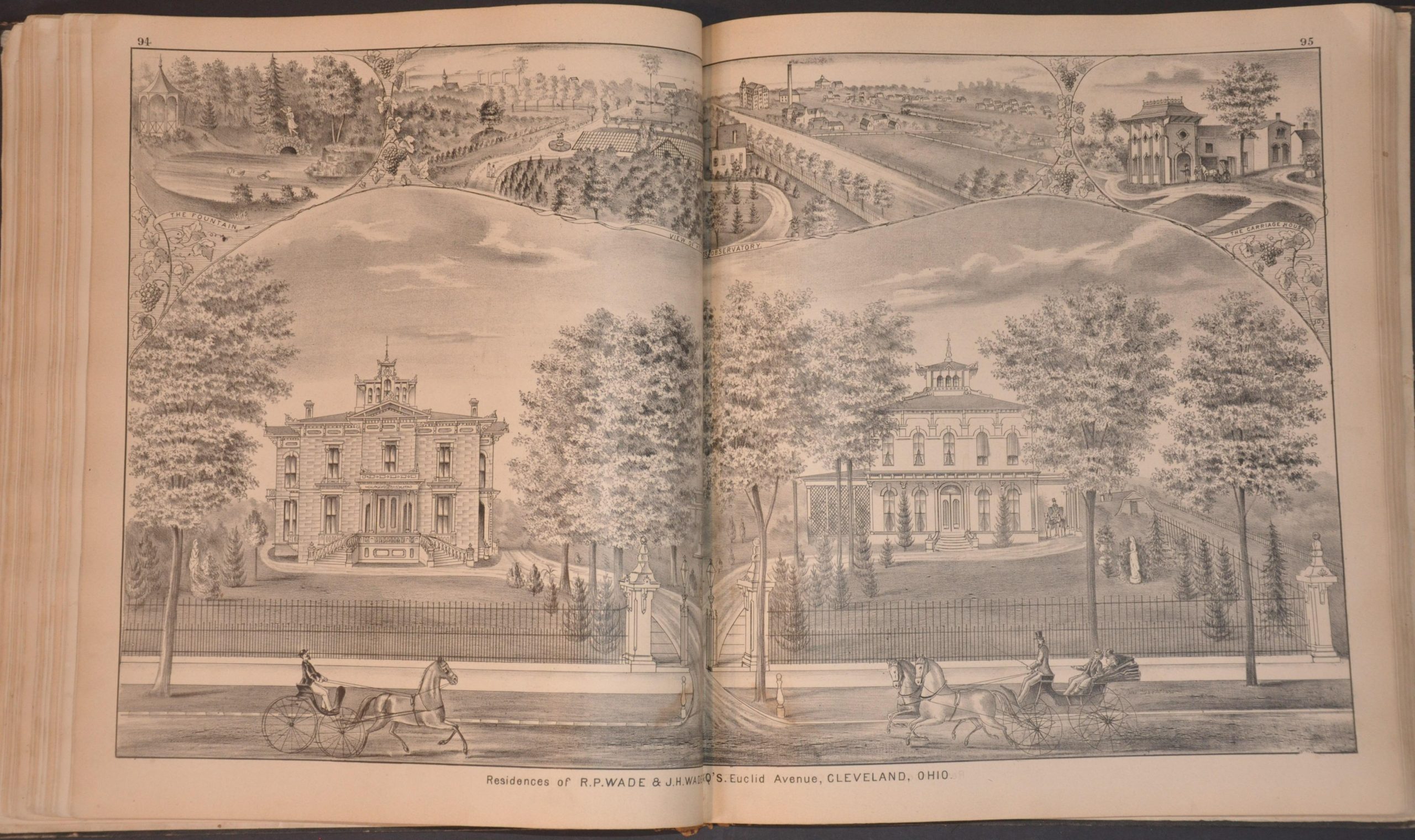
- Double-page view of the Jeptha Homer Wade (a founder of Western Union) Estate, including a greenhouse, observatory, carriage house, and lavish gardens
- Five-page Cleveland business directory listing firms ranging from Architects to Wood Carvers
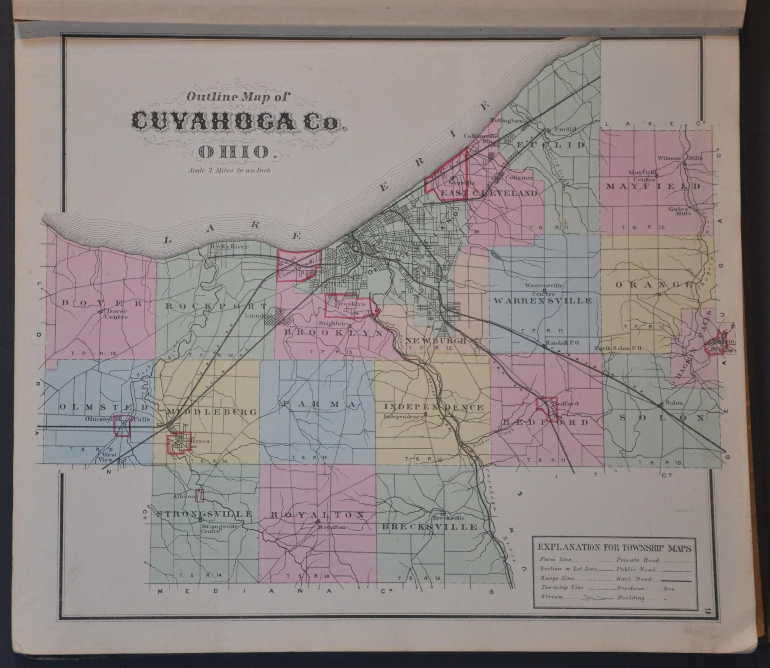
- Cadastral maps of each township, including duplicates of Orange (plate 163)
- Large folding map of Ohio with an attractive vignette of the State Capitol
- Double-page map of the United States highlighting the network of railroads across the nation
Map Details
Publication Date: 1874
Author: D.J. Lake
Sheet Width (in): 14.5
Sheet Height (in): 18.25
Condition: B+
Condition Description: 208 pp. county atlas (complete), bound in original black cloth boards with gilt embossed title. Broken spine and heavily chipped edges of the covers. Contents remain in generally good condition, with some moderate toning, fold splits, and the errant spot of foxing and dirty fingerprint. About good condition overall.
Out of stock