
Atlas for the U.S. Citizen
$65.00
Offering Americans a new perspective on the world.
1 in stock



Description
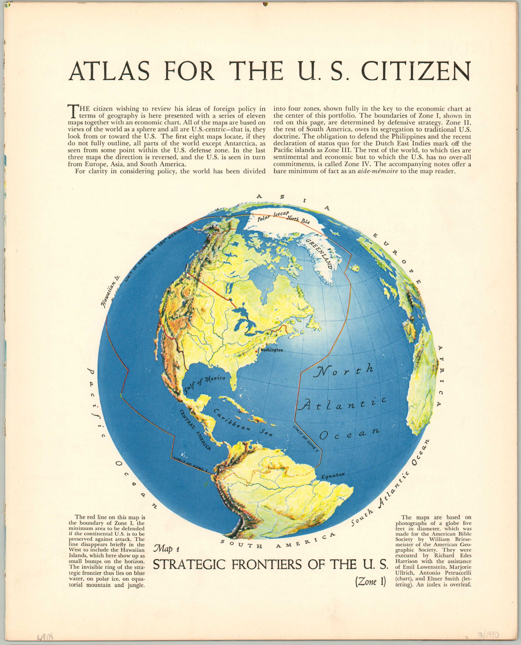
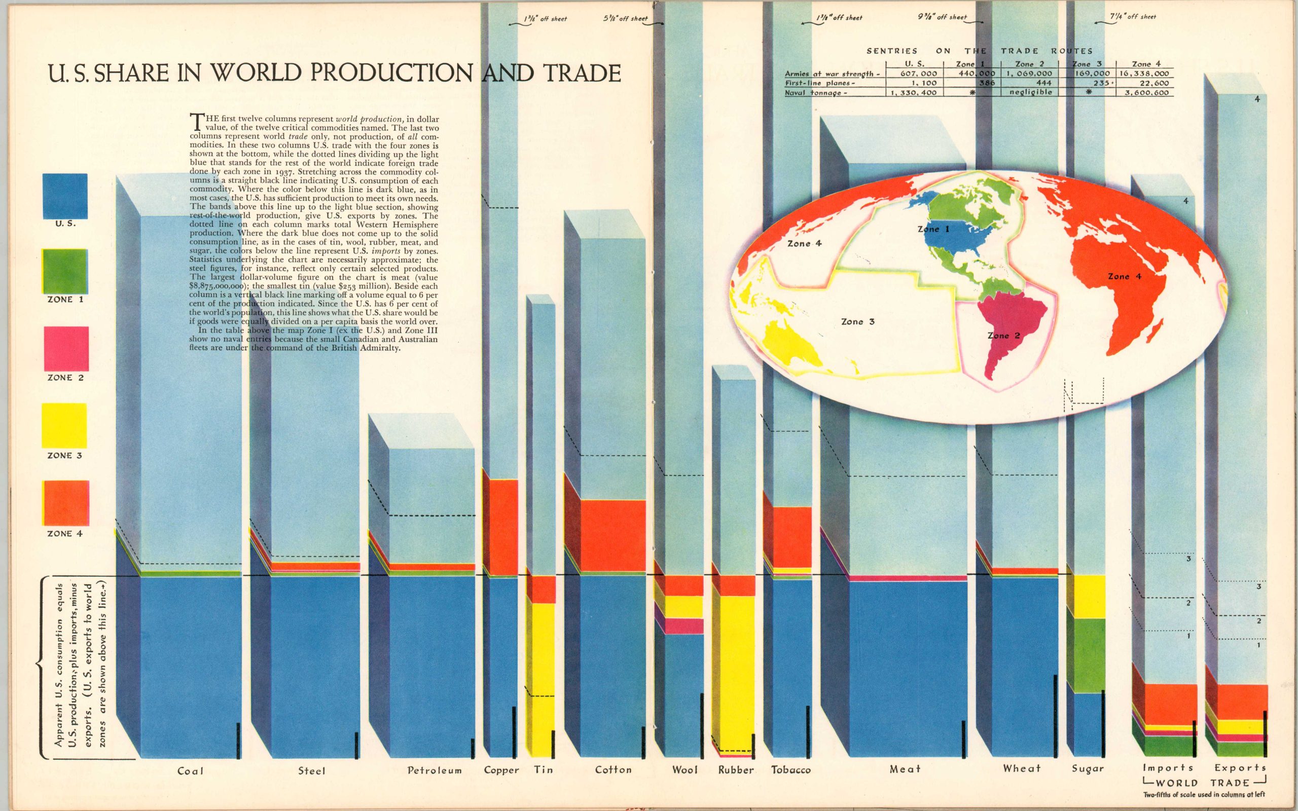
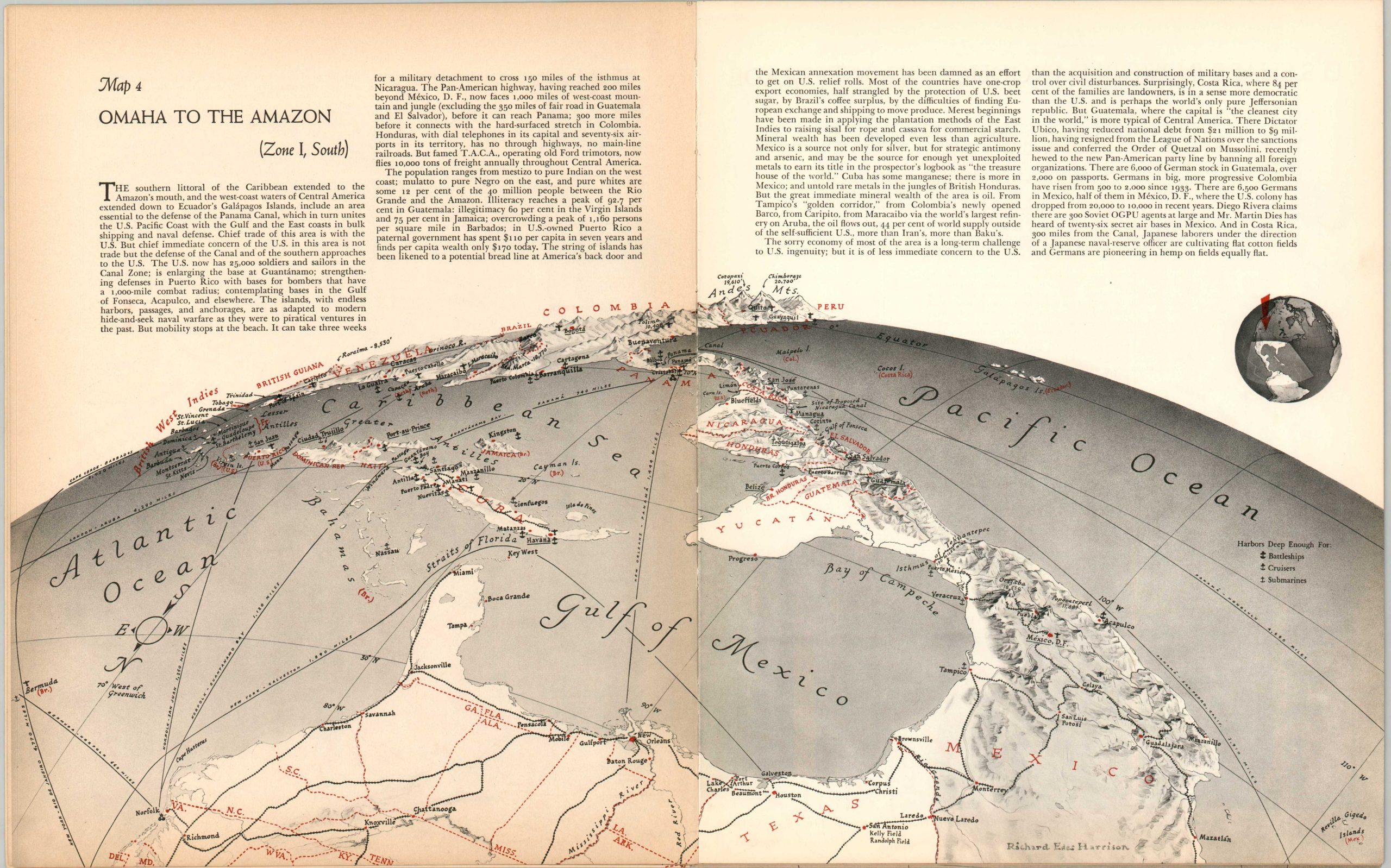
“The citizen wishing to review his ideas of foreign policy in terms of geography is here presented with a series of eleven maps together with an economic chart. All of the maps are based on views of the world as a sphere and all are U.S.-centric – that is, they look from or toward the U.S.” – Introduction.
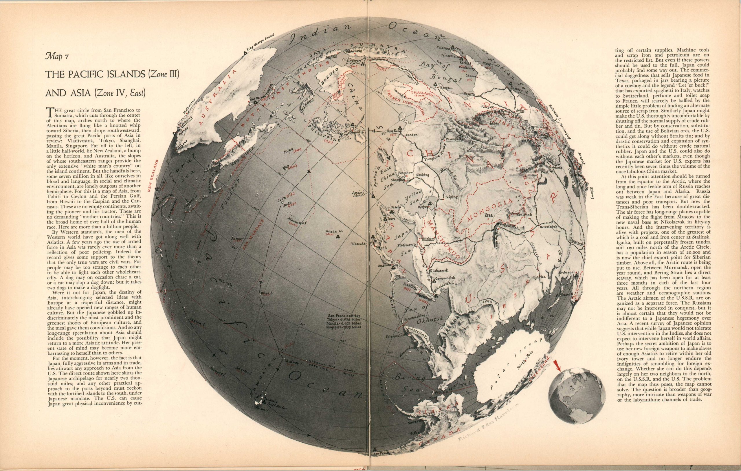
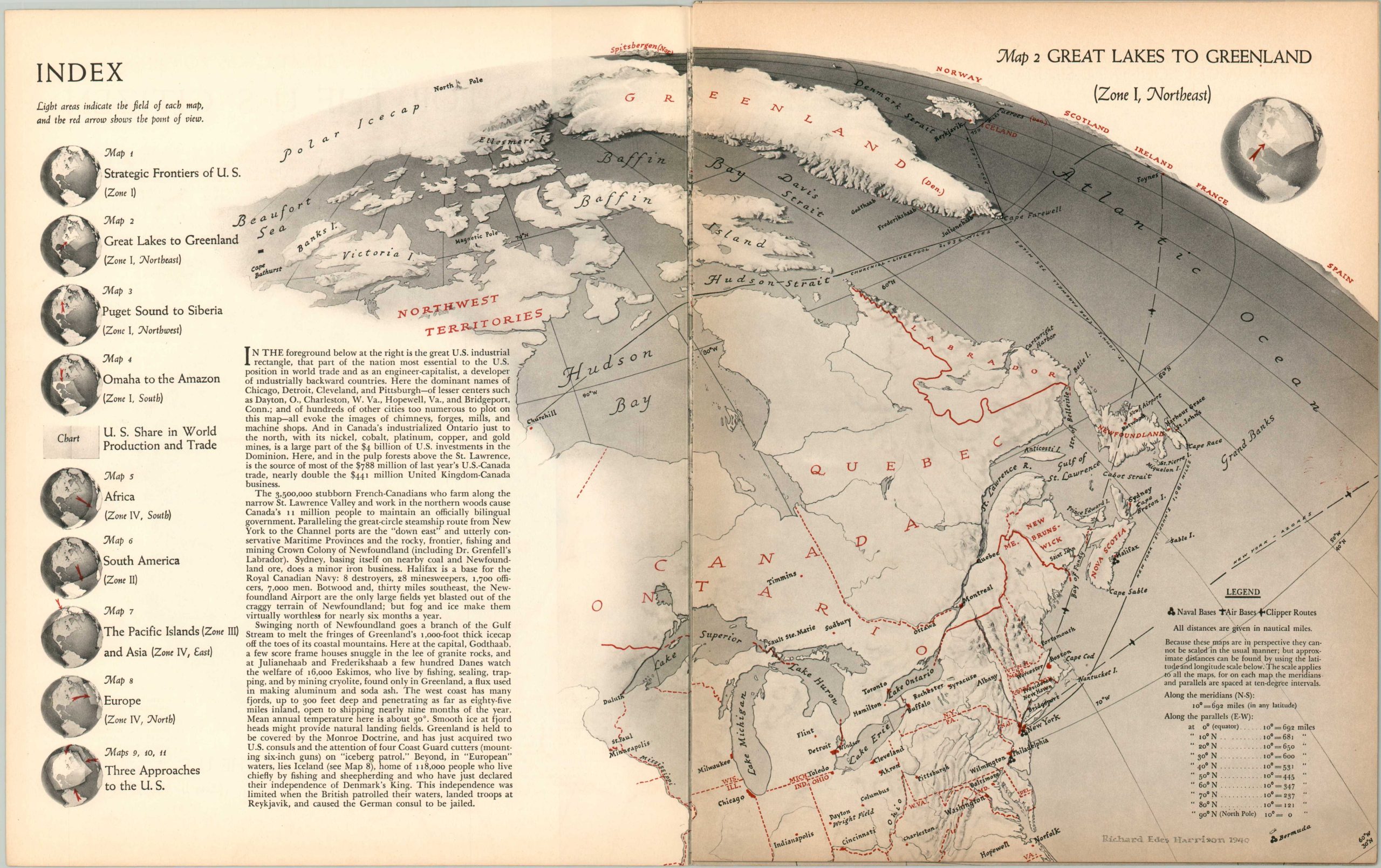
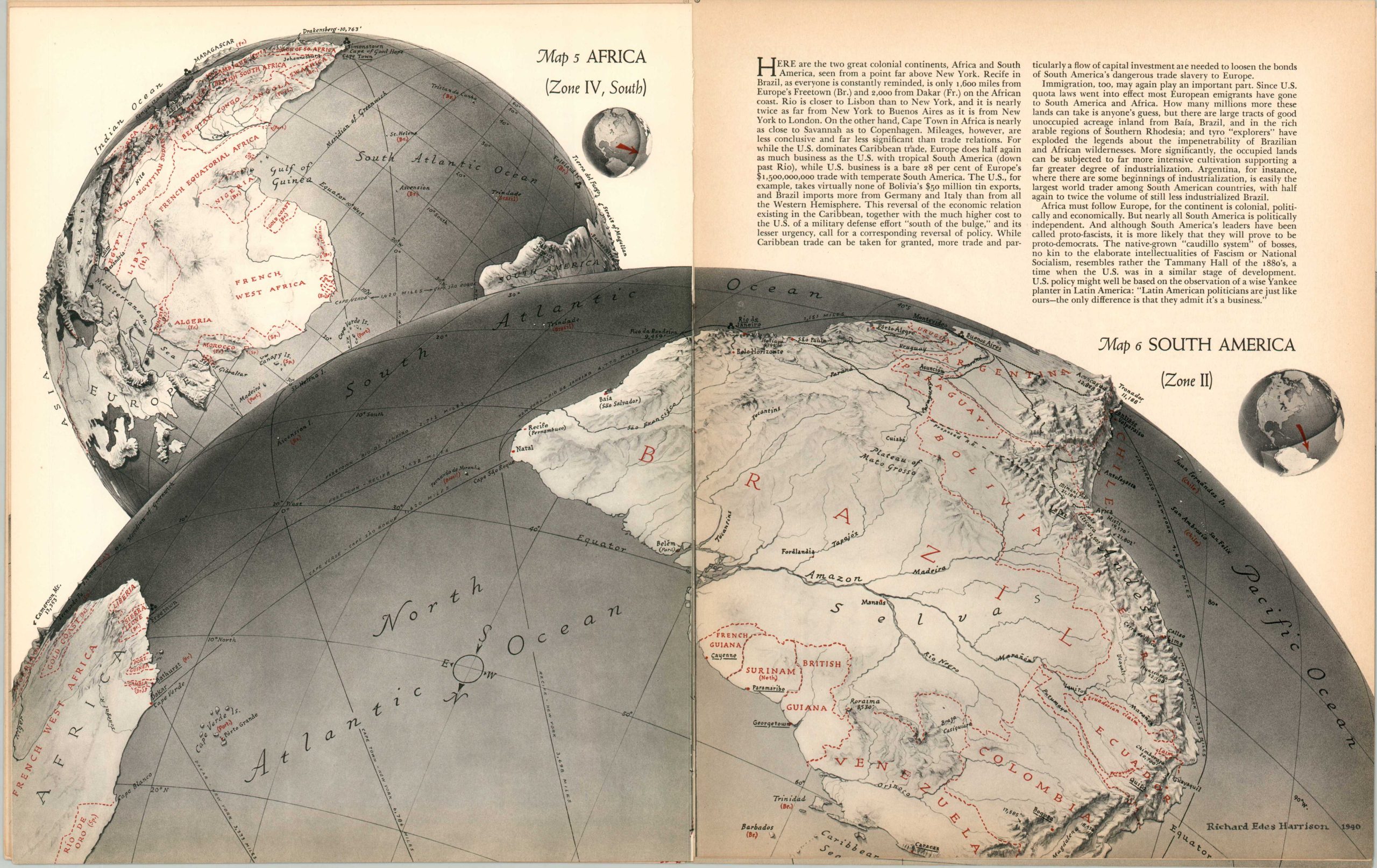
This fascinating ‘atlas’ was published in the September 1940 issue of Fortune Magazine, featuring maps designed by the talented Richard Edes Harrison. With Hitler’s recent invasion of Poland and the outbreak of war in Europe, American interest in global geography was nearing an all-time high. Each image, presented on a custom projection, presents a comprehensible pictorial overview of a specific region, emphasizing aviation routes, topography, political borders, and other strategic elements. Accompanying text offers insightful commentary on current events and the economic implications of the conflict.
Map Details
Publication Date: 1940
Author: Richard Edes Harrison
Sheet Width (in): 11.25
Sheet Height (in): 14
Condition: A
Condition Description: 15 pages extracted from a 1940 issue of Fortune Magazine, with all 11 maps and the double-page color chart. Scattered light soiling on the front page, including a small dot in the upper center. Other faint signs of age and use, including toned edges and creased corners. Good to very good condition overall.
$65.00
1 in stock