Atlantic Arena
$145.00
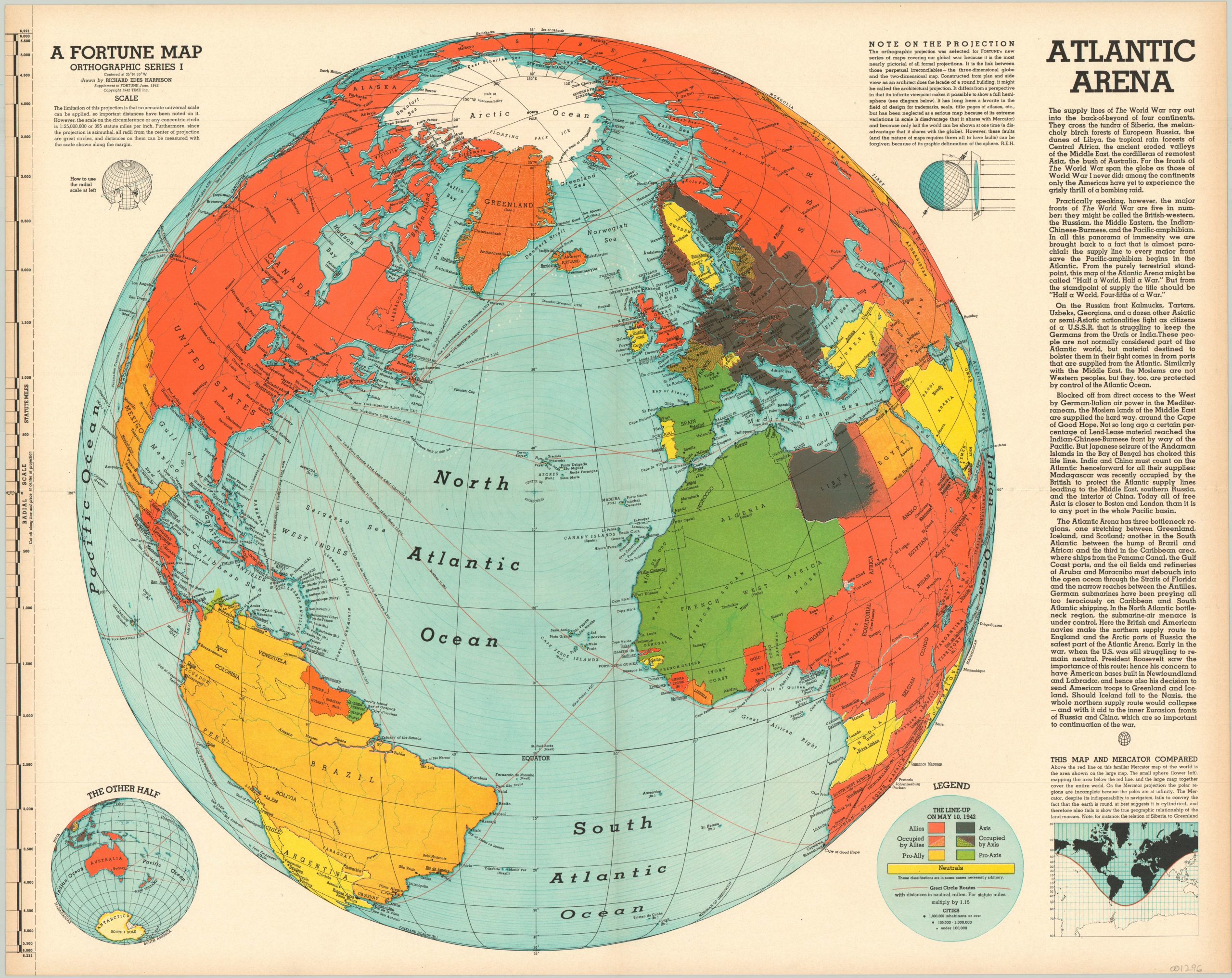
World War II map focused on the Atlantic Theater, published as a supplement to Fortune Magazine.
1 in stock
Description
Designed to influence the perception of the American public during the war, this map highlights the web of supply routes need to supply friendly forces across the Atlantic. Text along the side provides information on the geopolitical situation of the European theater, and color is used to dramatic effect to show the superiority of the Allies in landmass and the concentrated nature of Axis power in Europe and North Africa.
This is one of several wartime maps published by Fortune Magazine and designed by Richard Edes Harrison using an orthographic projection. As explained in an inset in the lower right, this projection is more suited than the Mercator Projection to show the global nature of war, as it more accurately depicts the spatial relationships between countries. A custom scale along the left side of the map can be cut out and used to measure distances between any two points.
Map Details
Publication Date: 1942
Author: Richard Edes Harrison
Sheet Width (in): 26.25
Sheet Height (in): 21.25
Condition: A
Condition Description: Originally folded into 4 panels. Some faint discoloration along the outer edge of the sheet from age, but in fine shape overall.
$145.00
1 in stock

