
Asia wie es jetziger zeit nach den fürnemesten Herrschafften abgetheilet und beschrieben
$400.00
An interesting synthesis of Classical and Early Modern geographic overview of Asia.
1 in stock
Description
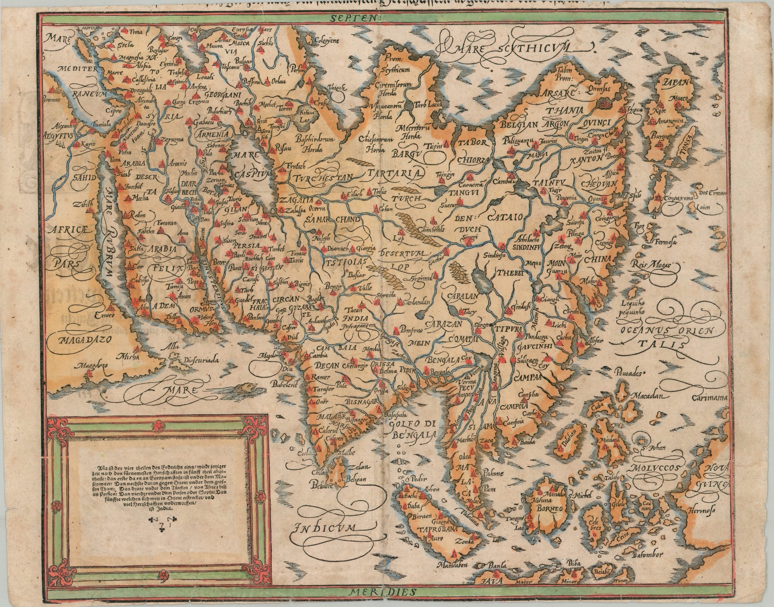
This striking “modern” map of Asia was published in Basel c. 1588 as part of Sebastian Münster’s influential Renaissance-era Cosmographia. A geographic foundation provided by the Classical Greek scholar Ptolemy has been updated with information gathered through the voyages of Portuguese explorers, Jesuit missionaries, travelers, and merchants, as well as the accumulated geographic literature of the preceding centuries. German text in the lower left offers a simple geopolitical summary, noting that Asia is divided into five parts, or generalized kingdoms.
The continent appears rather truncated to modern eyes, with a squat Arabian Peninsula and a diminutive Chinese coastline. Taprobana, a classical geographical name traditionally associated with Sri Lanka, is positioned far to the east of the Indian subcontinent, while another, unnamed island appears in its expected vicinity. Japan is situated remarkably far north, between the Siberian coast and what appears to be a fragment of the North American shoreline. The famed Spice Islands, or Moluccas, are prominently featured near the rather ambiguous landmass of New Guinea.
Throughout the woodblock image, an engaging variety of settlements, historic regions, and geographic features are identified. These include a fascinating mix of Classical and contemporary places of interest: spice-trading centers such as Calecut and Bantam appear alongside ancient Silk Road cities, Biblical sites, lands associated with the Mongol hordes, and mythical islands of the Pacific. The result is a remarkably revealing snapshot of Renaissance geographic knowledge, in which ancient authorities, medieval travel accounts, and the firsthand discoveries of the Age of Exploration coexist on a single map.
Source: National Library of Australia
Map Details
Publication Date: c. 1588
Author: Sebastian Munster/Claudius Ptolemy
Sheet Width (in): 15.75
Sheet Height (in): 12.50
Condition: B
Condition Description: Woodcut map with attractive hand color, apparently old. Trimmed margins have clipped the title block along the upper edge of the sheet. Creasing along the vertical centerfold and moderate soiling throughout. Wrinkling in the lower left. About good condition overall.
$400.00
1 in stock