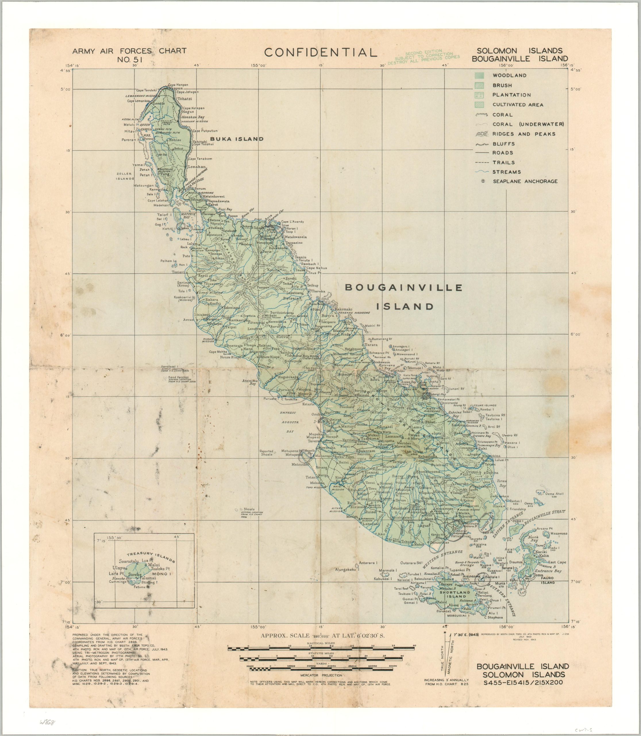
Army Air Forces Chart No 51 Solomon Islands Bougainville Island
$1,400.00
Aerial efforts during Operation Cartwheel, or the attack on Bougainville Island.
1 in stock
Description
This uncommon WWII map was compiled as a joint effort between the 4th Photo and Reconnaissance Map Group of the 13th Air Force and the 955th Engineer Topographic Company of the U.S. Army. The first edition was published in July 1943. This, the second, was printed in November of that year. Marked CONFIDENTIAL at the top of the page, the image offers a detailed overview of the strategically important area, part of the Solomon Islands and Papua New Guinea.
The physical landscape and different geographic features are generalized using color and small symbols, identified in the legend in the upper right. Various locations of interest are labeled throughout, including religious institutions, military facilities, and more. An inset in the lower left shows the Treasury Islands, the location of a different assault by the New Zealand Army codenamed Operation Goodtime.
The Japanese occupied Bougainville beginning in March 1942, constructing several airfields and strongly defended positions across the island. It was valued by Allied planners as a potential base for striking at Rabaul, though only a portion suitable for air operations was needed for a successful campaign. Landings of primarily American and Australian forces began in early November 1943, surprising the Japanese defenders. The beachhead was gradually expanded, achieving the primary objective of a functional air base by the beginning of December. Significant fighting would continue to take place in isolated pockets of resistance until the end of the war. Among the active units engaged on Bougainville was the 93rd Infantry Division, the first African American infantry unit to see combat action in the Pacific Theater during World War II.
Map Details
Publication Date: 1943
Author: 955th Engineer Topographic Company
Sheet Width (in): 17
Sheet Height (in): 20
Condition: B
Condition Description: Professionally cleaned and mounted on linen for preservation and stability. Scattered soiling of varying degrees of severity are visible in several areas. A handful of penciled annotations - mostly small circles around specific features. Soft creasing along old fold lines (now flattened). Good condition overall.
$1,400.00
1 in stock