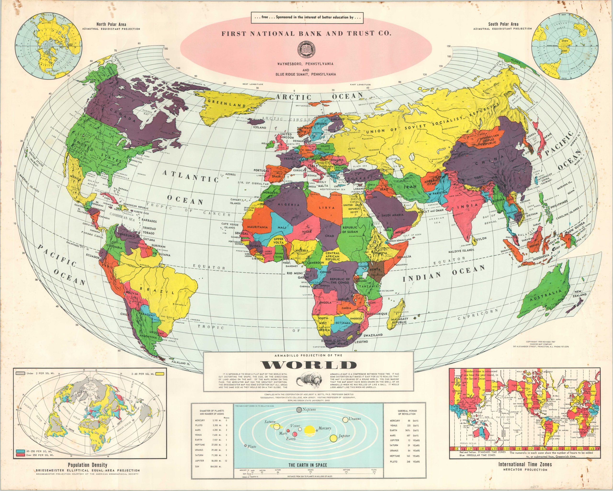
Armadillo Projection of the World
An updated interpretation of Erwin Raisz’s Armadillo projection.
Out of stock
Description
“Of the maps shown on this page, the Mercator Map has the greatest distortion. The Briesmeister Map has some distortion but all areas are the same size as they would be on a tiny globe. The Armadillo map is a compromise between the two.” – Text, lower center.
The Armadillo Projection was first coined in 1943 by Harvard cartography professor and map curator Erwin Raisz. It’s been updated here in 1967, courtesy of the Haskins Map Company and the technical expertise of Adelbert K. Botts, Professor Emeritus of Geography at Trenton State University. A vibrant global political map is accompanied by insets of the poles, international time zones, our solar system, and world population density. According to an article by Wired;
“A lot of thought went into the Armadillo map, but compared to Raisz’s other creations, it’s not all that practical. Like many other cartographers, Raisz wanted the Mercator overthrown, but he never proposed the Armadillo as a replacement. In fact, the biggest compliment he ever gave it was that it “showed more land in proportion to sea than any other world map.”
As a world map, it’s not that it’s bad, it’s just not nearly as good as others (Robinson, Winkel-Tripel, or Eckert IV come to mind) for showing the globe as a single and relatively undistorted image.”
Map Details
Publication Date: 1967
Author: Haskins Map Company
Sheet Width (in): 29
Sheet Height (in): 23.1
Condition: B+
Condition Description: Numerous spots of moderate soiling and spotting visible along the outer edges of the sheet, most evident in the corners on the right side. Lightly wrinkled from where previously rolled. About good condition overall.
Out of stock