
Arkansas
$125.00
The federal mapping of Arkansas in the mid-19th century.
1 in stock
Description
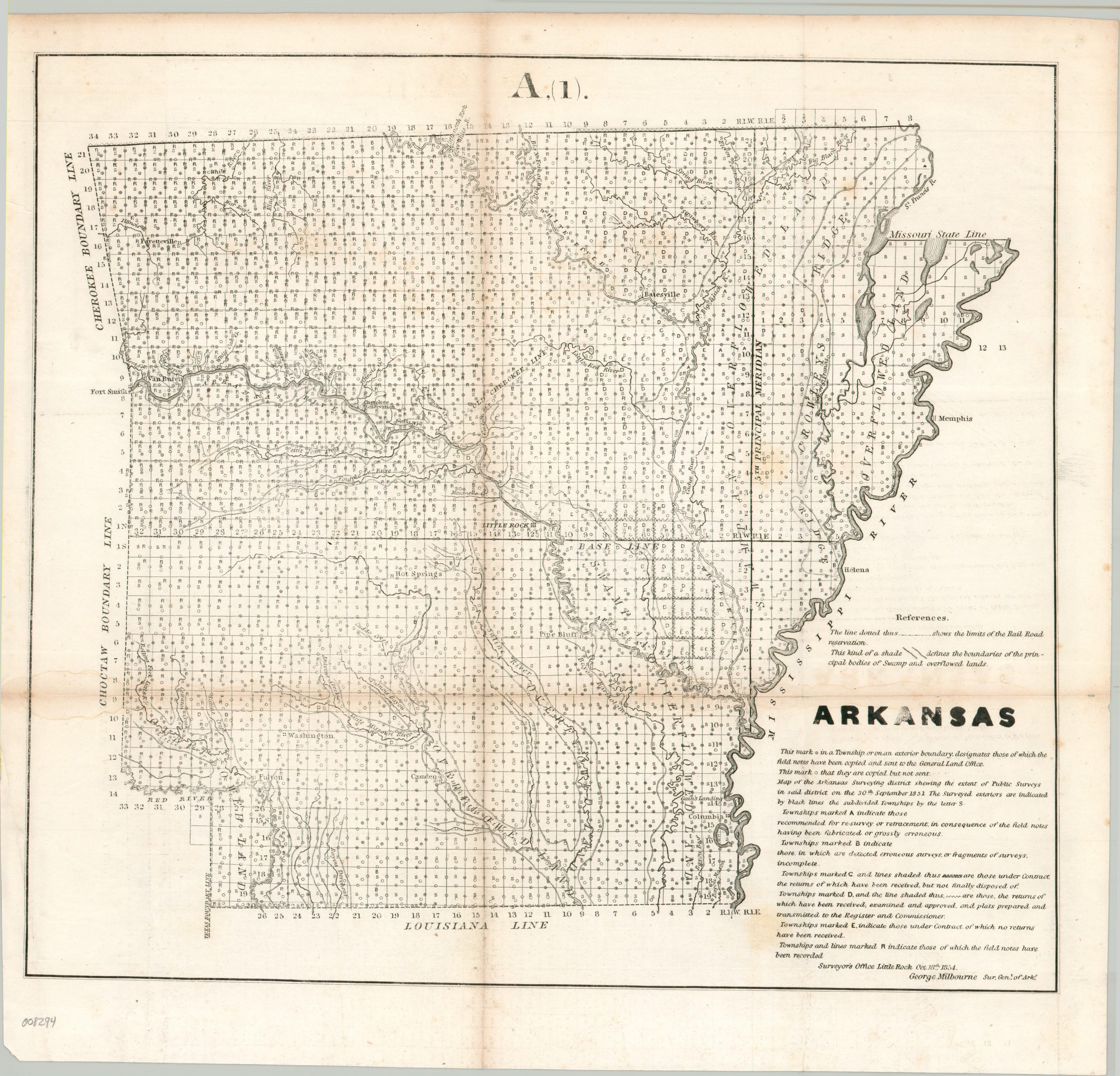
This interesting map reflects the process of government surveying across Arkansas by the mid-1850s. Significant progress had been made in measuring and platting the entire state, with an accompanying legend (lower right) outlining the meaning behind the various letters and symbols within each township. Notable settlements include Little Rock, Columbia, Hot Springs, Fayetteville, and Fort Smith (on the edge of Indian Territory). Only a handful of topographic details are provided, including the elevated region of Crowley’s Ridge and overflowed lands adjacent to rivers.
The image was approved by the Surveyor General of Arkansas, George Milbourne. Published in Washington in 1854 to accompany a Congressional Report by the General Land Office. Just a few years later (1858), the state’s first railroad tracks would be laid from West Memphis to Madison.
Map Details
Publication Date: 1854
Author: George Milbourne
Sheet Width (in): 18.25
Sheet Height (in): 17.50
Condition: B+
Condition Description: Lithographed map on a single-sided sheet. Moderate toning and creasing along original folds, with some faint damp staining visible in the lower left. Irregular left margin, where previously bound, and some faint spots from the impression (most evident in the title).
$125.00
1 in stock