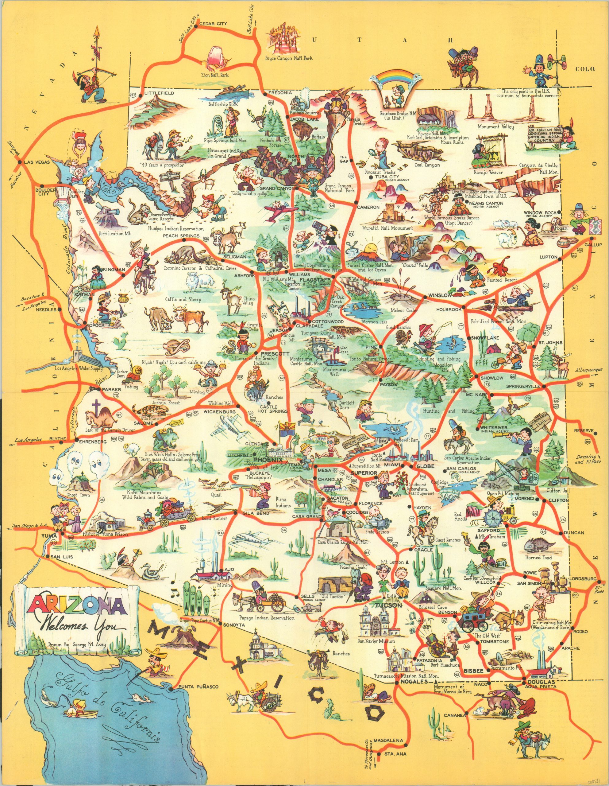
Arizona Welcomes You
$175.00
“A friendly guide for the traveler in the land of sunshine and scenic grandeur.”
1 in stock
Description
This charming WWII-era pictorial map was drawn by George Avey and published around 1940 by the Arizona Department of Highways. Dozens of illustrated vignettes highlight local residents, animals, historic sites, industrial products, natural landmarks, and other locations of interest across The Grand Canyon State. A lighthearted tone has been taken by the mapmaker to depict various features like the Painted Desert, State Prison, and Chiricahua National Monument.
Transportation routes are highlighted in red, but a caption in the upper corner warns motorists to ask about road conditions before entering Native American reservations. Details on the back offer a succinct summary of Arizona’s history and brief descriptions of some of its most popular tourist desti
Map Details
Publication Date: c. 1940
Author: George M. Avey
Sheet Width (in): 16.6
Sheet Height (in): 21.4
Condition: A-
Condition Description: Creasing along old fold lines and moderate wear along the outer edge of the sheet, including some light soiling and creased corners. Wear and old abrasions on the verso do not affect the image. Good to very good overall.
$175.00
1 in stock

