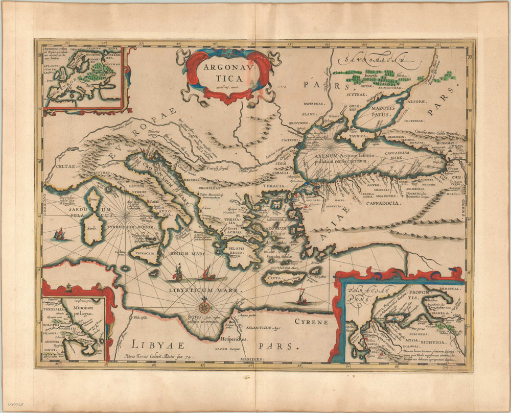
Argonautica
Hand-colored double-page engraved map of the Mediterranean Sea describing the mythical voyage of Jason and the Argonauts.
Out of stock
Description
This map, published in Janssonius’ historical atlas, was designed to accompany the story of Jason and the Argonaut’s quest for the Golden Fleece. Focusing on the Black Sea and Eastern Mediterranean, it was based off the Ortelius map of the same area (as an early owner noted in the title cartouche) and includes colored dots at locations visited by the heroes such as Lesbos, Chios, and Abydus. Three insets are present showing Thessaly (home of the Argonauts), the Hellespont (where much of the Argonauts travel took place) and Europe (showing the route of return from the Orphic Argonautica, one of many versions of the story). Other mythical locations, such as the island of Sirens and the bed of Prometheus, are also provided. A note at the bottom of the map attributes the engraving to Petrus Kaerius, who performed the work at age 74! Overall, a lovely historical map reflecting an important component of Greek literature.
Map Details
Publication Date: c. 1650
Author: Johannes Janssonius
Sheet Width (in): 23
Sheet Height (in): 18.5
Condition: A-
Condition Description: The map is in excellent condition, with minor ink offset in the title cartouche. The map has been laid into a wider margin and has a small water stain on verso that is not noticeable from the front.
Out of stock