
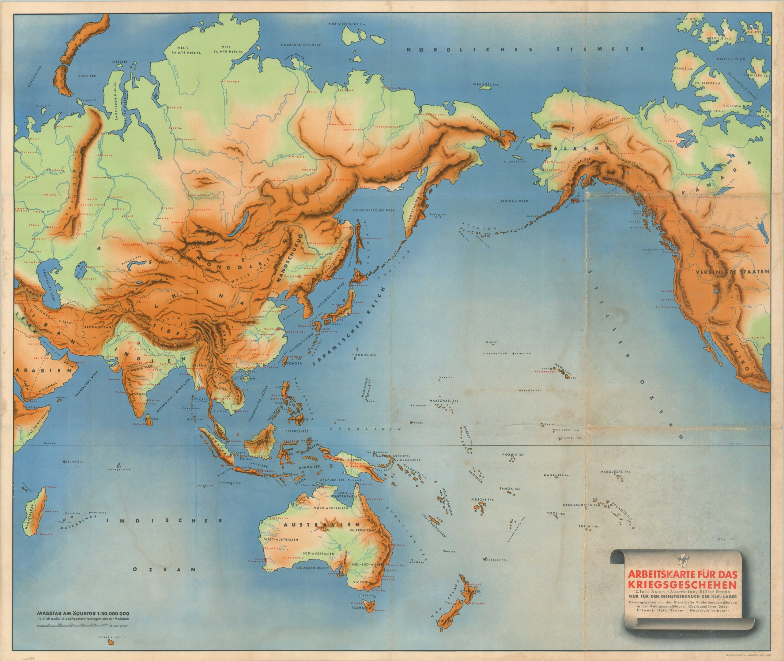
Arbeitskarte Fur das Kriegsgeschehen 2. Teil: Asien, – Australien, -Stiller Ozean
$125.00
A rudimentary map of the Pacific designed to educate the youth of the Third Reich.
1 in stock
Description
This somewhat rudimentary topographic map of Asia and the Pacific Ocean was designed by Oberbannführer Dabel and published in 1940 by the Children’s Evacuation Office of the Reich Youth Leadership. The boldly colored image was issued for use in Kinderlandverschickung (KLV), special rural facilities designed to house mothers and children in threatened urban areas of the Third Reich. The shaded relief image offers a basic overview of the Pacific theater, which was far below Europe in terms of contemporary priorities for the intended audience. Strategic locations are labeled in red.
Map Details
Publication Date: 1940
Author: Oberbannführer Dabel
Sheet Width (in): 34
Sheet Height (in): 28.5
Condition: B
Condition Description: Single-sided color printed sheet. Moderate surface soiling and offsetting visible in several areas, concentrated most heavily in the lower right quarter of the sheet. Creasing and wear along old folds and light wrinkling in the margins. About good condition overall.
$125.00
1 in stock