Annapolis, Maryland and Vicinity
Small business map of Annapolis, Maryland published in the late 1950s.
Out of stock

Description
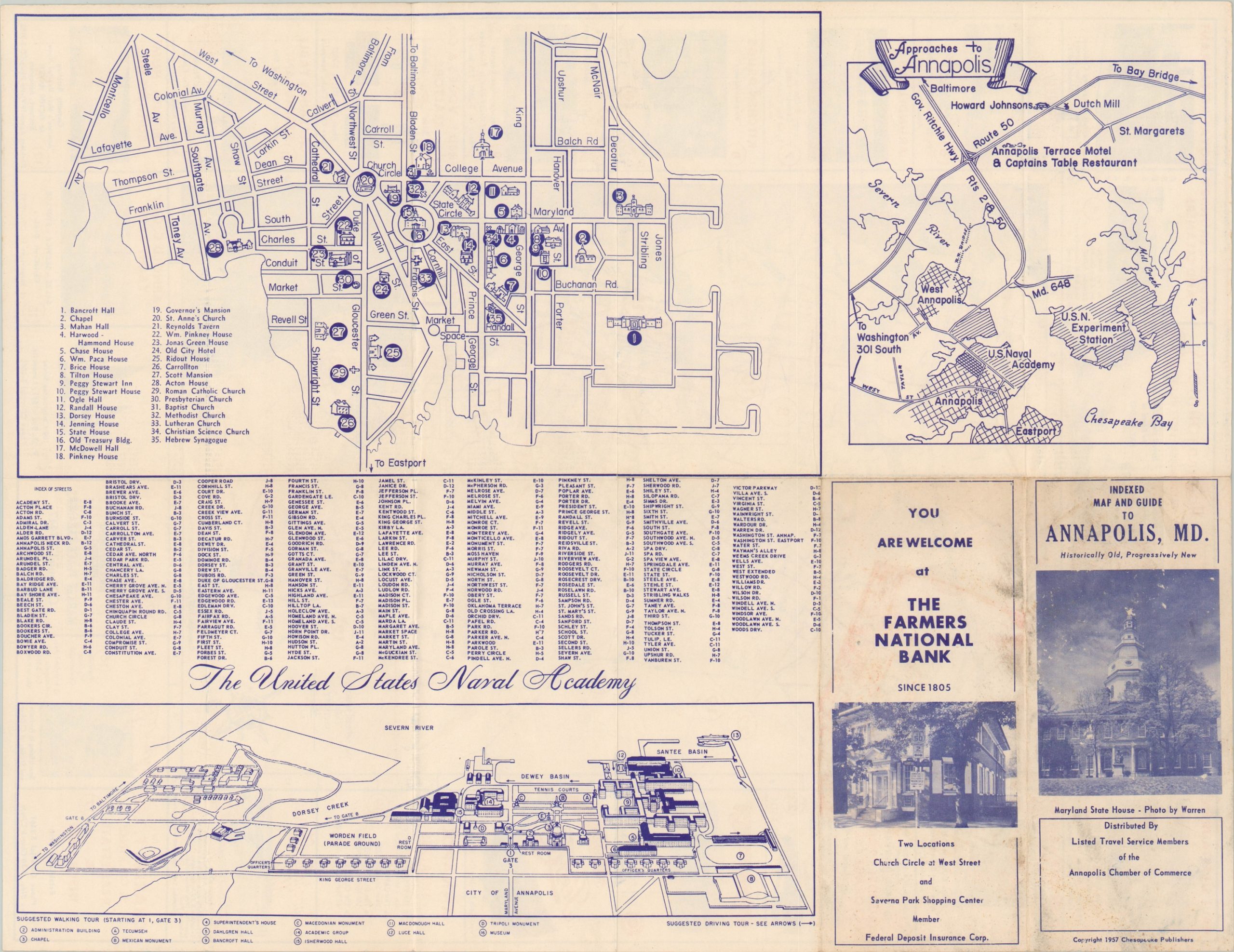
This entertaining map of Annapolis, Maryland was compiled by the local Chamber of Commerce and published by Chesapeake Publishers in 1957. A simple street plan of the city and immediate vicinity is surrounded by a border of photographic advertisements promoting local stores, hotels, restaurants, and other companies around town.
The verso presents three separate maps; one shows the primary highway approaches to Annapolis, another presents a straightforward outline of the downtown area, and a third provides a bird’s eye view of the U.S. Naval Academy.
Map Details
Publication Date: 1957
Author: Annapolis Chamber of Commerce
Sheet Width (in): 16.5
Sheet Height (in): 21.5
Condition: A-
Condition Description: Lightly creased and faint wear along originally issued fold lines. Soiling on the verso does not affect the image. Very good to near fine overall.
Out of stock