
An Illustrated Map of Chicago Youthful City of the Big Shoulders Restless – Ingenious – Wilful – Violent – Proud To Be Alive
$1,900.00
Presenting the expansive reaches of Chicago as the city prepares to host the 1933 Century of Progress.
1 in stock
Description
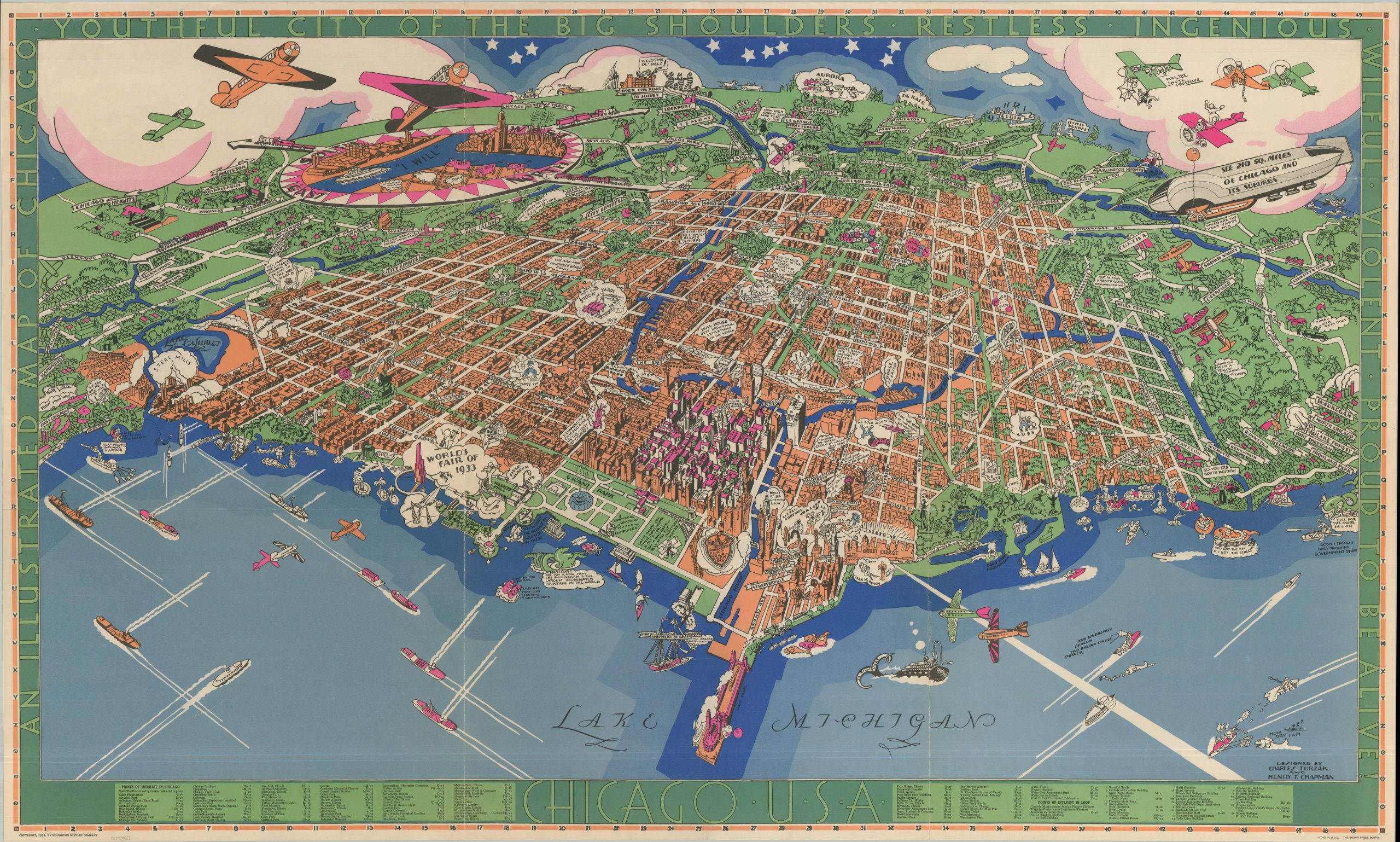
This sweeping pictorial view of Chicago, looking west from over the waters of Lake Michigan, was illustrated by Charles Turzak and Henry Chapman, both graduates of the School of the Art Institute of Chicago. The colorful, energetic design depicts the “Youthful City of the Big Shoulders” as it prepared to host the 1933 Century of Progress International Exposition. The overall composition cleverly mimics the geography of the United States, with Navy Pier serving as a surrogate Florida peninsula – almost certainly a deliberate cartographic pun by the artists.
Though issued in the depths of the Great Depression, the map’s bright hues, Art Deco motifs, and humorous vignettes project a buoyant optimism for the upcoming World’s Fair. The fairgrounds themselves are prominently featured along the lakefront south of Grant Park. Dozens of iconic landmarks, historic sites, and public spaces are comically rendered across a stylized landscape of orange urban grids and green parklands, including Soldier Field, the newly completed Merchandise Mart, the University of Chicago, Lincoln Park, and even Mrs. O’Leary’s famous cow. The surrounding region is similarly caricatured, calling out the Joliet penitentiary, the Elgin Watch Factory, and suburban commuter stops.
Scattered throughout the city are scores of tiny figures engaged in various exploits, from soapbox orators holding forth in Bughouse Square to armed bootleggers clashing with police on Lake Michigan. Notably, these vignettes also capture the overt racial and ethnic caricatures of the era, visible in the depictions of Chinatown, the Jewish Ghetto, and African American residents (including a Pullman porter).
The waters of Lake Michigan and the skies above are as active as the streets below. Passenger liners, freighters, and sailboats share the vibrant blue water with whimsical sea monsters, while airplanes, a parachutist, and a massive dirigible fill the air. Though the artists could not have known it in 1931, the German airship Graf Zeppelin would indeed make a celebrated appearance at the fairgrounds in October 1933 following a transatlantic flight.
Charles Turzak (1899-1986), a native of Streator, Illinois, graduated from the Art Institute in 1924 and earned acclaim as a painter, woodcut artist, and WPA muralist. Henry Thomas Chapman (1897-1970), born in North Dakota, also studied at the Art Institute before establishing a long career as a commercial graphic artist in Highland Park. This map represents their sole published collaboration. It was issued in Boston by the Houghton Mifflin Company in 1931 and printed by The Tudor Press.
Map Details
Publication Date: 1931
Author: Charles Turzak and Henry Chapman
Sheet Width (in): 37.75
Sheet Height (in): 22.90
Condition: A
Condition Description: Color printed map on a single-sided sheet. Minor wear along original folds, most evident in the waters of Lake Michigan along the two vertical creases. Small splits at the fold joints and one tiny tear in the margin. Very good condition overall.
$1,900.00
1 in stock