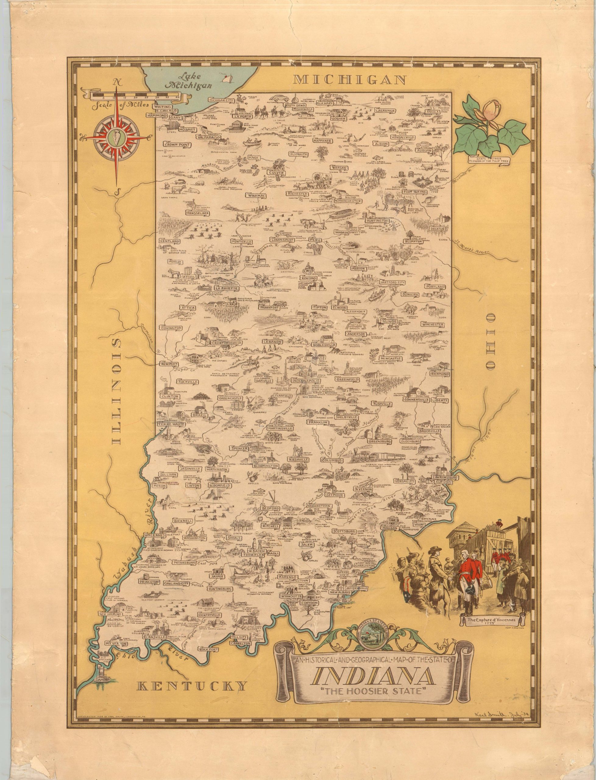
An Historical and Geographical Map of the State of Indiana “The Hoosier State”
Karl Smith’s uncommon pictorial map celebrating the Hoosier State.
Out of stock
Description
This lovely pictorial map, densely informative, presents an incredible illustrated overview of Indiana’s rich history and various physical landscapes. Dozens of carefully crafted vignettes reflect major historic events, natural landmarks, local industries, and prominent institutions statewide. George Rogers Clark’s capture of Fort Vincennes is depicted in the lower right, while the state flower, incorrectly identified as the tulip (the zinnia was adopted in 1931), is presented in the upper right.
Created and copyrighted in 1934 by Karl Smith. The map is one of several themed pictorials (generally covering Midwestern states) illustrated by Smith during the 1930s and 1940s, after being commissioned by the Speed Art Museum (then the J.B. Speed Art Museum) in Louisville, Kentucky. Most are uncommon on the market and in institutional holdings, with the Indiana map only listed in 5 institutions in WorldCat as of August 2025. OCLC# 62321894.
Map Details
Publication Date: 1934
Author: Karl Smith
Sheet Width (in): 18.75
Sheet Height (in): 25.75
Condition: B-
Condition Description: Color lithographed map mounted onto old linen. Heavy marginal wear, including pinholes, torn corners, and scattered soiling. The color has faded somewhat and there are several visible seams throughout, though the image is not obscured. A bit of surface soiling and spotting, mostly along the bottom edge. Between fair and good condition overall.
Out of stock