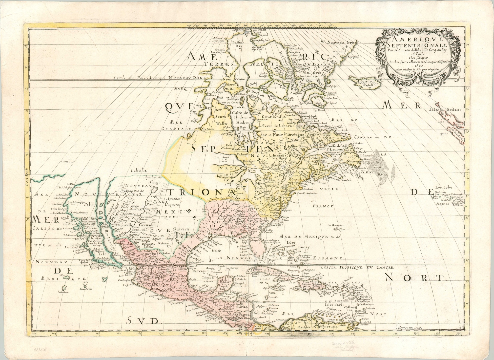
Amerique Septentrionale
Original price was: $5,000.00.$4,500.00Current price is: $4,500.00.
A foundational map of North America.
1 in stock
Description
This spectacular map of North America, created by one of the 17th century’s finest cartographers, drastically influenced popular contemporary geographic conceptions about the New World about 150 years after first discovered. The image presents the latest available information, sourced from a variety of exploration reports, ship’s logs, and personal communications spanning the globe. Its accuracy is unparalleled for the time, yet it shows some of the most recognizable cartographic myths of the day.
The map, in its uncommon second state, was published in Paris by Nicholas Sanson in 1650. A master of cartography and royal geographer to two French kings, Sanson is considered the Father of French Cartography. His careful research and commitment to conveying accurate data based on firsthand accounts, rather than historical geographic notions, set his work apart.
The depiction of the Great Lakes, each in a recognizable, albeit embryonic form, reflects Jesuit accounts of the region; while the American Southwest shows the first printed toponym for Sante Fe, located (incorrectly) on the Rio del Norte (Rio Grande). The Atlantic Seaboard and Caribbean regions each highlight the intense European rivalry for colonization and economic resources. Labeled areas show New Holland, New England, New Spain, New France, and even New Sweden in the area around what would eventually become Wilmington, Delaware. Place names reflect a variety of indigenous and western names, many of which can be traced to today.
Despite its tremendous accuracy for the period, the map also reflects a number of popular contemporary cartographic myths. The most evident is the prominent depiction of California as an island. This misconception first appeared on printed maps in the 1620s, likely reflecting earlier reports from confused Spanish explorers. It would appear on dozens of maps by influential cartographers for over a century, with the King Ferdinand VII of Spain eventually issuing a decree declaring California to be a peninsula in 1747. To the west of California can be seen Conibas, an unknown region that was said to lie between North America and Asia.
Another popular mistake appears in the Arctic Circle and is indicative of the ongoing search for the elusive Northwest Passage. Here, the fictitious Mer Glaciale can be seen accessible via a circuitous polar route through Hudson’s Bay, discovered only 40 years prior. False bays and phantom islands are also present. Finally, Cibola, one of the legendary Seven Cities of Gold, is prominently shown in the southwest. Not far away, along the West Coast, is a Lake of Gold. Both locations have roots in myths that date back decades, if not centuries, and are reflective of broader goals for material wealth and economic gain.
Map Details
Publication Date: 1650
Author: Nicholas Sanson
Sheet Width (in): 23.70
Sheet Height (in): 17.2
Condition: A-
Condition Description: A few tiny spots of worming near Baffin's Bay at the top of the sheet and some faint discoloration from the plate's impression below the Grand Banks and in the lower corners. Two small tears, confined to the margins, have been repaired on the verso with archival tape. A diagonal paper crease in the upper left is original and shows a small gap in the printed border. Veragua (lower center) is circled in what appears to be contemporary yellow. Very good overall, with old color on a bright sheet with an elaborate watermark.
Original price was: $5,000.00.$4,500.00Current price is: $4,500.00.
1 in stock

