Amerique Meridionale
$425.00
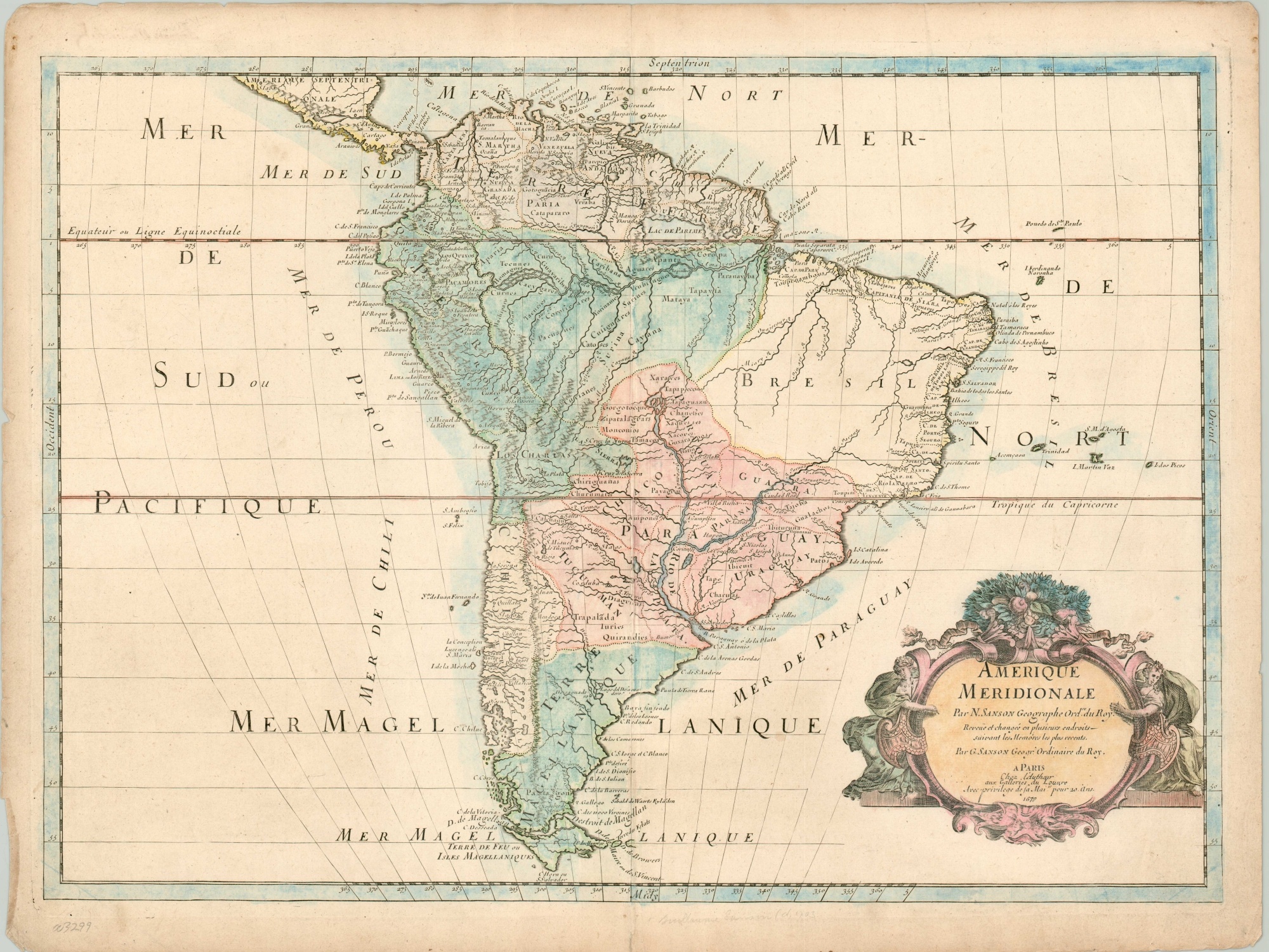
Uncommon map of South America from the Sanson family.
1 in stock
Description
This attractive map of South America presents a bulbous continental outline that retains much of the cartographic information originally presented several decades prior. It’s based on Nicholas Sanson’s important map originally issued in 1650, though this example was published by his son, Guillaume, in Paris in 1679.
Toponyms reflect a variety of indigenous, Spanish, and Portuguese, with place names like Potosi, Darien, and Cartagena indicating cornerstones in Spain’s New World empire. Topography is depicted pictorially and shows the ‘spine’ of the Andes running prominently through modern-day Chile, Argentina, and Bolivia.
Both the Rio de la Plata and Amazon are mapped throughout the interior, though their accuracy is questionable at best. A decorative rococo cartouche completes the interesting image.
Map Details
Publication Date: 1679
Author: Guillaume Sanson
Sheet Width (in): 23.30
Sheet Height (in): 17.6
Condition: B
Condition Description: Toned and worn along the outer margins, including numerous small tears, a few tiny holes, and moderate discoloration. Wash color is a bit spotty in some places and there's a bit of wear and creasing along the vertical centerfold. Remains in good condition on a strong sheet, watermarked with a fleur-de-lis.
$425.00
1 in stock